

<< Our Photo Pages >> Cologne Wharf - Ancient Mine, Quarry or other Industry in Germany in North Rhine-Westphalia
Submitted by C_Michael_Hogan on Monday, 17 December 2007 Page Views: 18228
Roman, Greek and ClassicalSite Name: Cologne Wharf Alternative Name: Colonia Claudia Ara AgrippinensiumCountry: Germany Land: North Rhine-Westphalia Type: Ancient Mine, Quarry or other Industry
Nearest Town: Cologne
Latitude: 50.937047N Longitude: 6.963208E
Condition:
| 5 | Perfect |
| 4 | Almost Perfect |
| 3 | Reasonable but with some damage |
| 2 | Ruined but still recognisable as an ancient site |
| 1 | Pretty much destroyed, possibly visible as crop marks |
| 0 | No data. |
| -1 | Completely destroyed |
| 5 | Superb |
| 4 | Good |
| 3 | Ordinary |
| 2 | Not Good |
| 1 | Awful |
| 0 | No data. |
| 5 | Can be driven to, probably with disabled access |
| 4 | Short walk on a footpath |
| 3 | Requiring a bit more of a walk |
| 2 | A long walk |
| 1 | In the middle of nowhere, a nightmare to find |
| 0 | No data. |
| 5 | co-ordinates taken by GPS or official recorded co-ordinates |
| 4 | co-ordinates scaled from a detailed map |
| 3 | co-ordinates scaled from a bad map |
| 2 | co-ordinates of the nearest village |
| 1 | co-ordinates of the nearest town |
| 0 | no data |
Internal Links:
External Links:
I have visited· I would like to visit
Harald_Platta visited on 3rd Aug 2017 - their rating: Cond: 1 Amb: 3 Access: 5
")
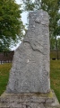
The Cologne Roman Wharf epitomizes the naval presence and legacy of Imperial Rome throughout much of the ancient world. The December 9, 2007 discovery of a two millennia old Roman barge enhances the prominence of this site relative to ancient shipping. An eight square meter flat bottom section of the oak hull with huge iron nails was found protruding from submerged mud on the banks of the Rhine. The find, likely the oldest extant boat in Central Europe, is consistent with prior archaeological data that the Cologne Wharf was the center of a vibrant regional shipping trade in the Roman Empire.
HISTORY. The Romans penetrated to the interior of many lands by river navigation, as in the case of establishing Roman ‘'Colonia Claudia Ara Agrippinensium'‘ or Cologne. Colonia originally grew up as a civilian settlement or "vicus", ancillary to a Roman naval presence centered on the wharf . (Barker, 1999), which vici were common near Roman forts along Hadrian's Wall, (Hogan, 2007) Brittania at large and other Roman colonies. Cologne like York evolved from a purely military vicus to a large medieval settlement; whereas, many vici merely dissolved after the fall of the Roman Empire. (Barker, 1999) Not far from the wharf stands an intricately built and well preserved Roman stone tower as well as ruins of the original Roman walls. The Cologne wharf was the centroid of urban development, with concentric rings spreading from that point. Such a pattern was common for a number of Roman towns including Rouen and Bordeaux; (Chesterton, 1987) however, Cologne typifies this concentric development pattern more clearly and at a larger scale than most. A well preserved aqueduct system is extant in Colonia.
There is considerable evidence from recordings in other countries that the Cologne Wharf was a veritable hub of Roman era trade. For example, Cologne merchants are cited as having permanent bases on the Thames in the earliest recorded mention of the ancient Dowgate Wharf in London. (Greatheed, 1865) Diverse goods were trafficked through the Cologne Wharf in ancient times; moreover, finds from antiquity around the Cologne Wharf reveal that manufactured goods from Whitby jet are more abundant at Colonia than any other world site. (Wacher, 1995) Whitby amber is derived from Yorkshire geological formations. Import of this black amber resulted in enormous numbers of Colonia finds of pins, beads, bracelets and other manufactured items made from Whitby jet.
THE 2007 DISCOVERY. The substantial boat found submerged in eight meters of water on the Cologne banks is a further indication of the naval freight loaded through this ancient port. University of Cologne researchers have dated the oaken hull, establishing that the tree began its growth in 142 BC, even though that doesn't establish the precise time of construction. Evidence points to the forest of origin as the highlands east of Cologne, so that it is likely that the barge was constructed at Colonia. (Roman, 2007) Researchers suggest that the total length of the flat bottomed vessel would have been about 24 meters, but the construction crew mistakenly destroyed part of the boat by concrete trough filling. The barge had a likely beam width of 3.5 meters and a capacity of 20 to 30 tons, suitable for transporting cattle, stone, firewood or construction timber.
REFERENCES
* ‘'Companion Encyclopedia of Archaeology'‘, Routledge, 1219 pages,
ISBN 0415064481
* C. Michael Hogan (2007) ‘'Hadrian's Wall'‘, the Megalithic Portal, ed. Andy Burnham
* G. K. Chesterton (1987) ‘'The collected works of G.K. Chesterton'‘, Ignatius Press ISBN 089870244
* Samuel Greatheed, Daniel Parken, Theophilus Williams, Josiah Conder, Thomas Price, William Hendry Stowell, Jonathan Edwards Ryland, Edwin Paxton Hood (1865) ‘'The Eclectic Review'‘
* John Wacher (1995) ‘' The Towns of Roman Britain'‘, Routledge ISBN 071347319
* ‘'Roman barge under Cologne to reveal shipping history'‘ (Dec. 9, 2007) EARTHtimes.org
The above is original research of C. Michael Hogan prepared for the Megalithic Portal.
You may be viewing yesterday's version of this page. To see the most up to date information please register for a free account.
")
")
Do not use the above information on other web sites or publications without permission of the contributor.
Nearby Images from Flickr


The above images may not be of the site on this page, but were taken nearby. They are loaded from Flickr so please click on them for image credits.
Click here to see more info for this site
Nearby sites
Click here to view sites on an interactive map of the areaKey: Red: member's photo, Blue: 3rd party photo, Yellow: other image, Green: no photo - please go there and take one, Grey: site destroyed
Download sites to:
KML (Google Earth)
GPX (GPS waypoints)
CSV (Garmin/Navman)
CSV (Excel)
To unlock full downloads you need to sign up as a Contributory Member. Otherwise downloads are limited to 50 sites.
Turn off the page maps and other distractions
Nearby sites listing. In the following links * = Image available
451m SW 217° Oppidum Ubiorum* Ancient Village or Settlement
491m NW 322° Römisch-Germanisches Museum Köln* Museum
5.9km WSW 253° Lindenthal* Ancient Village or Settlement
8.2km ENE 69° Huegelgraeberfeld Koeln-Dellbrueck* Barrow Cemetery
9.7km E 101° Grabhügel Rather Mauspfad* Round Barrow(s)
9.8km NE 42° Huegelgraeberfeld Duennwalder Wald Sued* Barrow Cemetery
10.0km NE 40° Huegelgraeberfeld Duennwalder Wald Nord* Barrow Cemetery
10.1km E 100° Huegelgraeberfeld Koenigsforst NW* Barrow Cemetery
12.4km ESE 105° Huegelgraeberfeld Koenigsforst SO* Barrow Cemetery
12.5km NNE 24° Gezelinquelle* Holy Well or Sacred Spring
13.8km NNE 24° Huegelgraeberfeld Buergerbusch* Barrow Cemetery
14.4km NNE 23° Teufelsstein vom Bürgerbusch* Natural Stone / Erratic / Other Natural Feature
15.2km ENE 76° Erdenburg* Hillfort
17.3km E 92° Ringwall Luederich* Hillfort
17.5km NW 317° Grabhügelgruppe Chorbusch Barrow Cemetery
17.8km N 11° Huegelgraeberfeld Vorster Busch* Barrow Cemetery
17.9km SW 217° Summstein Lechenich Modern Stone Circle etc
19.6km SE 125° Ringwall Gueldenberg* Hillfort
20.0km NE 40° Rippelmarken im Eifgenbachtal* Natural Stone / Erratic / Other Natural Feature
22.6km SE 125° Grabhügelgruppe Lohmarer Wald* Barrow Cemetery
24.2km SSE 156° Mithraeum Bonn* Ancient Temple
24.5km SSE 158° LVR-Rheinisches LandesMuseum Bonn* Museum
24.6km SSE 157° Stein des Ursicinus* Ancient Cross
24.6km SSE 157° Matronenheiligtum Bonn* Ancient Temple
24.6km SSE 156° Ägyptisches Museum Bonn* Museum
View more nearby sites and additional images


 We would like to know more about this location. Please feel free to add a brief description and any relevant information in your own language.
 Wir möchten mehr über diese Stätte erfahren. Bitte zögern Sie nicht, eine kurze Beschreibung und relevante Informationen in Deutsch hinzuzufügen.
 Nous aimerions en savoir encore un peu sur les lieux. S'il vous plaît n'hesitez pas à ajouter une courte description et tous les renseignements pertinents dans votre propre langue.
 Quisieramos informarnos un poco más de las lugares. No dude en añadir una breve descripción y otros datos relevantes en su propio idioma.