


<< Our Photo Pages >> Gluecksburg Huegelgrab 3 - Round Barrow(s) in Germany in Schleswig-Holstein, Hamburg
Submitted by holger_rix on Sunday, 09 December 2007 Page Views: 2102
Neolithic and Bronze AgeSite Name: Gluecksburg Huegelgrab 3Country: Germany Land: Schleswig-Holstein, Hamburg Type: Round Barrow(s)
Nearest Town: Flensburg Nearest Village: Gluecksburg
Latitude: 54.838969N Longitude: 9.563331E
Condition:
| 5 | Perfect |
| 4 | Almost Perfect |
| 3 | Reasonable but with some damage |
| 2 | Ruined but still recognisable as an ancient site |
| 1 | Pretty much destroyed, possibly visible as crop marks |
| 0 | No data. |
| -1 | Completely destroyed |
| 5 | Superb |
| 4 | Good |
| 3 | Ordinary |
| 2 | Not Good |
| 1 | Awful |
| 0 | No data. |
| 5 | Can be driven to, probably with disabled access |
| 4 | Short walk on a footpath |
| 3 | Requiring a bit more of a walk |
| 2 | A long walk |
| 1 | In the middle of nowhere, a nightmare to find |
| 0 | No data. |
| 5 | co-ordinates taken by GPS or official recorded co-ordinates |
| 4 | co-ordinates scaled from a detailed map |
| 3 | co-ordinates scaled from a bad map |
| 2 | co-ordinates of the nearest village |
| 1 | co-ordinates of the nearest town |
| 0 | no data |
Internal Links:
External Links:
I have visited· I would like to visit
johnstone visited on 29th Aug 2023 - their rating: Cond: 1 Amb: 3 Access: 4
")
Part of the 'Dolmenpfad', this is #9 of the track.
You may be viewing yesterday's version of this page. To see the most up to date information please register for a free account.
")
")
Do not use the above information on other web sites or publications without permission of the contributor.
Nearby Images from Flickr
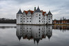
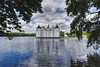
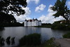


The above images may not be of the site on this page, but were taken nearby. They are loaded from Flickr so please click on them for image credits.
Click here to see more info for this site
Nearby sites
Click here to view sites on an interactive map of the areaKey: Red: member's photo, Blue: 3rd party photo, Yellow: other image, Green: no photo - please go there and take one, Grey: site destroyed
Download sites to:
KML (Google Earth)
GPX (GPS waypoints)
CSV (Garmin/Navman)
CSV (Excel)
To unlock full downloads you need to sign up as a Contributory Member. Otherwise downloads are limited to 50 sites.
Turn off the page maps and other distractions
Nearby sites listing. In the following links * = Image available
69m WNW 292° Gluecksburg Findling* Natural Stone / Erratic / Other Natural Feature
144m NE 51° Gluecksburg Huegelgrab 2* Round Barrow(s)
381m ENE 64° Gluecksburg Dolmen 3* Burial Chamber or Dolmen
529m ENE 68° Gluecksburg Huegelgrab 1* Round Barrow(s)
554m N 350° Gluecksburg Langbett 1* Long Barrow
762m NW 305° Gluecksburg Langbett 2* Long Barrow
794m NNW 345° Gluecksburg Steingrab 3* Burial Chamber or Dolmen
855m N 349° Gluecksburg Steingrab 2* Burial Chamber or Dolmen
1.1km NNW 339° Gluecksburg Dolmen 2* Burial Chamber or Dolmen
1.1km WNW 284° Gluecksburg Dolmenpfad* Museum
1.1km NW 322° Gluecksburg Dolmen 1* Burial Chamber or Dolmen
1.6km ESE 102° Bockholm Huenenbett Long Barrow
2.0km W 267° Gluecksburg Steingrab 1* Burial Chamber or Dolmen
2.7km WSW 238° Gluecksburg Steingrab 4* Burial Chamber or Dolmen
4.1km ESE 113° Siegum Langbett* Long Barrow
5.0km NW 306° Sønderhav Langdysse* Long Barrow
5.0km NW 305° Sønderhav Rundhøj* Round Barrow(s)
5.1km NW 308° Hønsnap Skov Afd. 686 Langdysse* Long Barrow
5.2km NW 307° Hønsnap Skov Afd. 710 Langdysse* Long Barrow
5.2km NW 321° Rønshoved Skov Afd. 730 Langdysse* Long Barrow
5.3km NW 304° Hønsnap Skov Afd. 680 Langdysse Long Barrow
5.3km SSE 146° Ringsberg Steingrab* Burial Chamber or Dolmen
5.3km NW 307° Hønsnap Skov Afd. 687 Langdysse* Long Barrow
5.4km SW 223° Wees Steingrab* Burial Chamber or Dolmen
5.5km WNW 298° Hønsnap Skov Afd. 697 Runddysse* Burial Chamber or Dolmen
View more nearby sites and additional images


 We would like to know more about this location. Please feel free to add a brief description and any relevant information in your own language.
 Wir möchten mehr über diese Stätte erfahren. Bitte zögern Sie nicht, eine kurze Beschreibung und relevante Informationen in Deutsch hinzuzufügen.
 Nous aimerions en savoir encore un peu sur les lieux. S'il vous plaît n'hesitez pas à ajouter une courte description et tous les renseignements pertinents dans votre propre langue.
 Quisieramos informarnos un poco más de las lugares. No dude en añadir una breve descripción y otros datos relevantes en su propio idioma.