


<< Our Photo Pages >> Kampen Huenenbett - Long Barrow in Germany in Schleswig-Holstein, Hamburg
Submitted by holger_rix on Monday, 30 July 2007 Page Views: 3973
Neolithic and Bronze AgeSite Name: Kampen Huenenbett Alternative Name: Sprockhoff 2Country: Germany Land: Schleswig-Holstein, Hamburg Type: Long Barrow
Nearest Town: Westerland Nearest Village: Kampen
Latitude: 54.963380N Longitude: 8.341930E
Condition:
| 5 | Perfect |
| 4 | Almost Perfect |
| 3 | Reasonable but with some damage |
| 2 | Ruined but still recognisable as an ancient site |
| 1 | Pretty much destroyed, possibly visible as crop marks |
| 0 | No data. |
| -1 | Completely destroyed |
| 5 | Superb |
| 4 | Good |
| 3 | Ordinary |
| 2 | Not Good |
| 1 | Awful |
| 0 | No data. |
| 5 | Can be driven to, probably with disabled access |
| 4 | Short walk on a footpath |
| 3 | Requiring a bit more of a walk |
| 2 | A long walk |
| 1 | In the middle of nowhere, a nightmare to find |
| 0 | No data. |
| 5 | co-ordinates taken by GPS or official recorded co-ordinates |
| 4 | co-ordinates scaled from a detailed map |
| 3 | co-ordinates scaled from a bad map |
| 2 | co-ordinates of the nearest village |
| 1 | co-ordinates of the nearest town |
| 0 | no data |
Internal Links:
External Links:
")
Note: Now lies under the road from Kampen to List.
You may be viewing yesterday's version of this page. To see the most up to date information please register for a free account.
")
")
Do not use the above information on other web sites or publications without permission of the contributor.
Nearby Images from Flickr
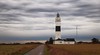
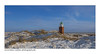
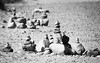
The above images may not be of the site on this page, but were taken nearby. They are loaded from Flickr so please click on them for image credits.
Click here to see more info for this site
Nearby sites
Click here to view sites on an interactive map of the areaKey: Red: member's photo, Blue: 3rd party photo, Yellow: other image, Green: no photo - please go there and take one, Grey: site destroyed
Download sites to:
KML (Google Earth)
GPX (GPS waypoints)
CSV (Garmin/Navman)
CSV (Excel)
To unlock full downloads you need to sign up as a Contributory Member. Otherwise downloads are limited to 50 sites.
Turn off the page maps and other distractions
Nearby sites listing. In the following links * = Image available
537m WSW 254° Kampener Findling* Natural Stone / Erratic / Other Natural Feature
568m SW 218° Kampen Steingrab 3* Burial Chamber or Dolmen
983m SSW 198° Kampen Ganggrab* Passage Grave
2.7km SSW 198° Denghoog Sylt* Passage Grave
5.5km S 169° Gallighoog Round Barrow(s)
6.1km S 171° Boikenhoog Round Barrow(s)
7.3km S 169° Winjshoog Round Barrow(s)
7.5km S 191° Tinnumburg Hillfort
7.9km SSE 165° Steinkiste von Tinnum* Cist
7.9km SSE 165° Sylter Heimatmuseum* Museum
7.9km S 174° Klöwenhoog Round Barrow(s)
8.1km S 176° Taidishoog Round Barrow(s)
8.4km SSE 162° Tipkenhoog* Round Barrow(s)
8.5km SSE 162° Harhoog Keitum* Burial Chamber or Dolmen
8.8km SSW 202° Westerland Langbett 2 Long Barrow
8.8km SSW 202° Westerland Langbett 1* Long Barrow
11.1km S 170° Archsum Steingrab 2* Long Barrow
11.1km S 170° Archsum Steingrab 1* Long Barrow
11.1km S 170° Archsum Merelmerskhoog* Passage Grave
12.1km SSE 168° Archsum Kolkingehoog* Passage Grave
13.1km SSE 150° Morsum Osterende Steingrab* Burial Chamber or Dolmen
27.8km S 173° Utersum Steingrab* Burial Chamber or Dolmen
28.5km S 171° Utersum Ganggrab* Passage Grave
28.7km S 170° Suederende Steingrab Passage Grave
31.2km ENE 63° Abterp Langdysse 1* Long Barrow
View more nearby sites and additional images


 We would like to know more about this location. Please feel free to add a brief description and any relevant information in your own language.
 Wir möchten mehr über diese Stätte erfahren. Bitte zögern Sie nicht, eine kurze Beschreibung und relevante Informationen in Deutsch hinzuzufügen.
 Nous aimerions en savoir encore un peu sur les lieux. S'il vous plaît n'hesitez pas à ajouter une courte description et tous les renseignements pertinents dans votre propre langue.
 Quisieramos informarnos un poco más de las lugares. No dude en añadir una breve descripción y otros datos relevantes en su propio idioma.