<< Our Photo Pages >> Metherall Settlement - Ancient Village or Settlement in England in Devon

Submitted by AngieLake on Thursday, 20 October 2016  Page Views: 20507

Multi-periodSite Name: Metherall Settlement Alternative Name: Fernworthy Reservoir settlement
Country: England County: Devon Type: Ancient Village or Settlement
Nearest Town: Chagford
Map Ref: SX66838401
Latitude: 50.640521N  Longitude: 3.884688W
Condition:
5Perfect
4Almost Perfect
3Reasonable but with some damage
2Ruined but still recognisable as an ancient site
1Pretty much destroyed, possibly visible as crop marks
0No data.
-1Completely destroyed
3 Ambience:
5Superb
4Good
3Ordinary
2Not Good
1Awful
0No data.
3 Access:
5Can be driven to, probably with disabled access
4Short walk on a footpath
3Requiring a bit more of a walk
2A long walk
1In the middle of nowhere, a nightmare to find
0No data.
4 Accuracy:
5co-ordinates taken by GPS or official recorded co-ordinates
4co-ordinates scaled from a detailed map
3co-ordinates scaled from a bad map
2co-ordinates of the nearest village
1co-ordinates of the nearest town
0no data
5

Internal Links:
External Links:

I have visited· I would like to visit

Catrinm visited on 16th Jul 2022 - their rating: Cond: 3 Amb: 4 Access: 4 Could see the submerged hut circles as reservoir is low.Very well preserved large stones

SandyG visited on 16th Oct 2018 - their rating: Cond: 3 Amb: 4 Access: 4

AngieLake have visited here

Average ratings for this site from all visit loggers: Condition: 3 Ambience: 4 Access: 4

Metherall Settlement
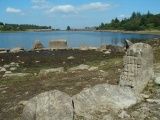
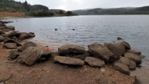
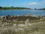
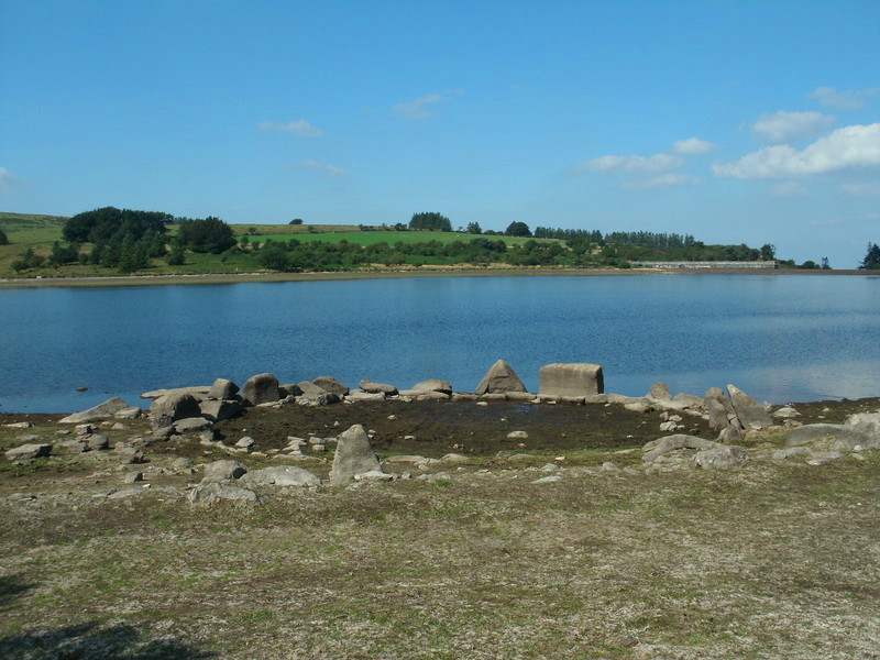
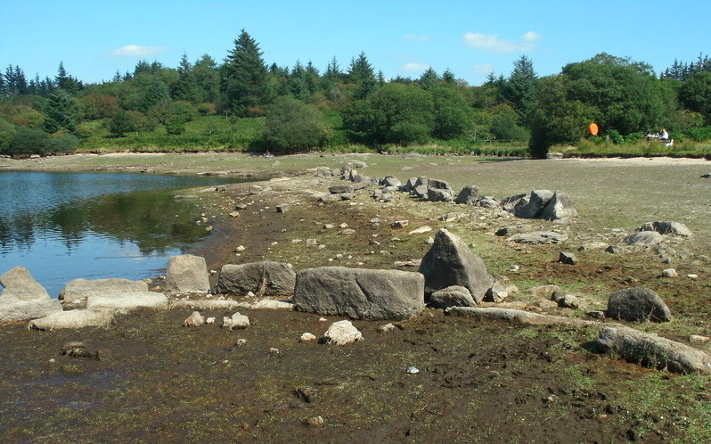
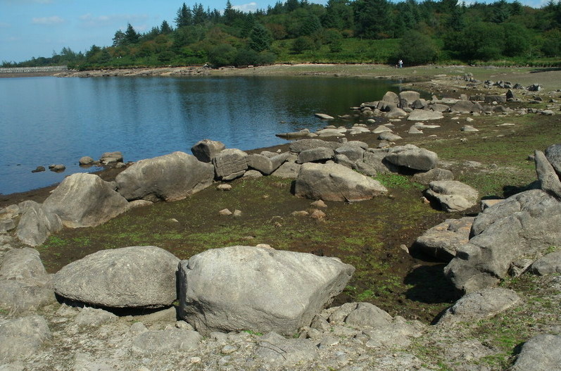
Metherall Settlement submitted by cazzyjane : Hut Circle exposed as the water in the Fernworthy Reservoir is exceptionally low (October 2016). (Vote or comment on this photo)
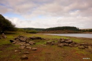
This is an ancient settlement near to the Fernworthy Reservoir on Dartmoor, in Devon. Eight fairly large hut circles and many other pound walls make up the settlement, with half of the huts now normally flooded by the Fernworthy Reservoir.

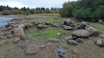
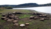
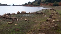
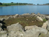
Four hut circles are only exposed after long dry periods, such as the very hot and dry July we experienced this year (2006). I also remember seeing them in 1988/89(?) when we also had a very dry summer. This visit was on 12th August 2006, and rather a dull afternoon, weatherwise. They still look quite impressive though.

Before the reservoir was constructed, excavations were carried out by Worth in 1934-36.

Update November 2019: This settlement is featured on the Prehistoric Dartmoor Walks (PDW) website - see their entry for the Metherall Settlement.

This site is also recorded as Pastscape Monument No. 443845, and as MDV6624 (Hut circle 450 metres north-west of Metherall, Fernworthy Reservoir) on the Devon and Dartmoor HER.

Note: Hut Circle exposed as the water in the Fernworthy Reservoir is exceptionally low (Photo: CazzyJane, October 2016)
You may be viewing yesterday's version of this page. To see the most up to date information please register for a free account.
Metherall Settlement
Metherall Settlement submitted by SandyG : Roundhouse 5. View from east. (Vote or comment on this photo)

Metherall Settlement
Metherall Settlement submitted by SandyG : Length of prehistoric walling. View from west (Scale 1m). (Vote or comment on this photo)

Metherall Settlement
Metherall Settlement submitted by Bladup : Metherall Settlement Hut 5. (Vote or comment on this photo)

Metherall Settlement
Metherall Settlement submitted by Bladup : Metherall Settlement, Looking over Hut 5 at the ancient field wall. (Vote or comment on this photo)

Metherall Settlement
Metherall Settlement submitted by Bladup : Metherall Settlement Hut 4 and in the background on the right is hut 5. (Vote or comment on this photo)

Metherall Settlement
Metherall Settlement submitted by Bladup : Metherall Settlement, The strange patterned stone with hut 5 behind. (5 comments)

Metherall Settlement
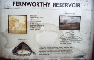
Metherall Settlement submitted by AngieLake : This was the notice board above Hut 2, beside the track. It shows 18th century Fernworthy farmhouse, abandoned in the 1930s when the reservoir was built. 'Fernworthy' is a name of Anglo Saxon origin. 'Worthy' means an enclosed homestead. On the right is Thornworthy Tor. "Tors are outcrops of granite rock crowning the Dartmoor ridges. Granite is made up of Quartz, Mica and Felspar crystals."... (1 comment)

Metherall Settlement
Metherall Settlement submitted by Postman : Just off picture to the right is a couple of prancing pony foals, living and loving life to the extreme, like we should be.

Metherall Settlement
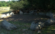
Metherall Settlement submitted by Postman : It's perfect circularity is a wonder to behold, and it's a nice place to sit for a while.

Metherall Settlement
Metherall Settlement submitted by Postman : Later in the morning of the Autumn equinox.

Metherall Settlement
Metherall Settlement submitted by Postman : Due to high water levels in the reservoir this is the only hut circle I could find (in fairness it was the only one I was looking for) I felt cheated, do the people of Devon really need all this water?

Metherall Settlement
Metherall Settlement submitted by SandyG : Roundhouse 4. View from west.

Metherall Settlement
Metherall Settlement submitted by SandyG : Roundhouse 6. View from west (Scale 1m).

Metherall Settlement
Metherall Settlement submitted by SandyG : Roundhouse 4. View from south.

Metherall Settlement
Metherall Settlement submitted by SandyG : Roundhouse 3. View from north east (Scale 1m).

Metherall Settlement
Metherall Settlement submitted by SandyG : Roundhouse 3. View from south west (Scale 1m).

Metherall Settlement
Metherall Settlement submitted by SandyG : Roundhouse 4. View from east.

Metherall Settlement
Metherall Settlement submitted by SandyG : Roundhouse 5. View from west. (5 comments)

Metherall Settlement
Metherall Settlement submitted by cazzyjane : Cist exposed for the first time for many years after being submerged in the water at Fernworthy reservoir. (October 2016) (3 comments)

Metherall Settlement
Metherall Settlement submitted by cazzyjane : Hut circle exposed as the water in the Fernworthy Reservoir is exceptionally low (October 2016).

Metherall Settlement
Metherall Settlement submitted by AngieLake : A photo showing an archaeological excavation of one of the hut circles at 'Metherel' in August 1934, prior to flooding by the new Fernworthy reservoir. R. Hansford Worth, in homburg hat on right, leans over to look at the progress. S. Taylor Collection. Taken from 'A Dartmoor Century, 1883-1983, One hundred years or the Dartmoor Preservation Association.' [Their copyright.]

Metherall Settlement
Metherall Settlement submitted by Bladup : Metherall Settlement Hut 5.

Metherall Settlement
Metherall Settlement submitted by Bladup : Metherall Settlement hut 6

Metherall Settlement
Metherall Settlement submitted by Bladup : Metherall Settlement hut 4.

These are just the first 25 photos of Metherall Settlement. If you log in with a free user account you will be able to see our entire collection.

Do not use the above information on other web sites or publications without permission of the contributor.
Click here to see more info for this site

Nearby sites

Click here to view sites on an interactive OS map

Key: Red: member's photo, Blue: 3rd party photo, Yellow: other image, Green: no photo - please go there and take one, Grey: site destroyed

Download sites to:
KML (Google Earth)
GPX (GPS waypoints)
CSV (Garmin/Navman)
CSV (Excel)

To unlock full downloads you need to sign up as a Contributory Member. Otherwise downloads are limited to 50 sites.


Turn off the page maps and other distractions

Nearby sites listing. In the following links * = Image available
 337m NNW 343° Thornworthy Cairn* Cairn (SX6674284335)
 389m SE 130° The Heath Stone* Standing Stone (Menhir) (SX6712083750)
 450m SW 219° East Lowton settlement* Ancient Village or Settlement (SX6653783668)
 807m SW 219° Lowton Brook West Settlement* Ancient Village or Settlement (SX663834)
 859m ENE 62° Yardworthy* Stone Row / Alignment (SX6760184393)
 1.1km N 350° Thornworthy Down Stone Row / Alignment (SX66688505)
 1.3km W 271° Fernworthy Cairn E* Cairn (SX65568407)
 1.3km W 269° Fernworthy Cairn 4* Cairn (SX65518403)
 1.3km WNW 283° Fernworthy Cairn N* Cairn (SX65548433)
 1.3km WNW 283° Fernworthy stone row N* Multiple Stone Rows / Avenue (SX6553884336)
 1.3km W 271° Fernworthy stone row SE* Stone Row / Alignment (SX65498407)
 1.3km W 272° Fernworthy Cairn SE* Cairn (SX65498409)
 1.3km W 272° Fernworthy* Multiple Stone Rows / Avenue (SX65488410)
 1.3km W 273° Fernworthy circle* Stone Circle (SX65488411)
 1.4km W 273° Fernworthy stone row SW* Multiple Stone Rows / Avenue (SX6547984105)
 1.4km W 272° Fernworthy Cairn SW* Cairn (SX65478410)
 1.4km SSE 147° Chagford Common Cairn* Cairn (SX6757182800)
 1.6km SSW 207° Assycombe Hill* Cairn (SX66108264)
 1.6km SSE 160° Hurston Ridge Settlement* Ancient Village or Settlement (SX67338253)
 1.6km SSE 161° Hurston Ridge* Multiple Stone Rows / Avenue (SX67308251)
 1.6km SSW 207° Assycombe* Multiple Stone Rows / Avenue (SX66058260)
 1.6km NNW 328° Shovel Down row 7* Multiple Stone Rows / Avenue (SX660854)
 1.6km NNW 332° Thornworthy Corner North Cist (SX66118546)
 1.7km NNW 330° Three Boys* Standing Stone (Menhir) (SX66038548)
 1.8km NNW 331° Shovel Down row 6* Multiple Stone Rows / Avenue (SX660856)
View more nearby sites and additional images

<< Gräberfeld Traisental

Hentor 1 >>

Please add your thoughts on this site

Prehistoric Settlements

Prehistoric Settlements

Sponsors

Auto-Translation (Google)

Translate from English into:

"Metherall Settlement" | Login/Create an Account | 16 News and Comments
  
Go back to top of page    Comments are owned by the poster. We aren't responsible for their content.
How are the water levels in Fernworthy Reservoir at the moment? by Andy B on Monday, 18 July 2022
(User Info | Send a Message)
How are the water levels in Fernworthy Reservoir at the moment?
[ Reply to This ]

Re: Metherall Settlement by davep on Friday, 21 October 2016
(User Info | Send a Message)
Comments I wrote on Facebook on 15/10/16:

Popped up to Fernworthy reservoir today. Interesting to see the old bridge, the clapper bridge and a collection of hut circles revealed by the very low water levels. I managed to mess up with my camera - the battery was dead so I was unable to take any photos.

A number of people have reported a cist being revealed and I took a look. I did get an accurate GPS location - SX 66184 83891. It had been raining heavily and it was slippery and a bit boggy which made it almost impossible to walk around it. However, I got a close enough look. Although I do a website on Dartmoor prehistoric archaeology I'm not an archaeologist (just interested!) - however I'm totally certain now that it is not a cist. One side of this structure (as can be seen in some of the photos on various facebook groups) is in fact a bit of a heap of slabs with the cross slabs resting on top. This is quite unlike any cists in the way it is constructed. I think it is medieval or post-medieval and most probably the well in the NMR and HER listings.

On both the NMR and HER - there is a mention of a well at SX661838 called the Pixy Well. Whether there is any structure associated with it - it is not stated. See:

Pastscape Monument 443851

and

HER Monument MDV6652

Finally - it was stunning up there today despite the rain.
[ Reply to This ]

Re: Stone Circle uncovered as reservoir is drained by Andy B on Tuesday, 27 October 2009
(User Info | Send a Message)
Good find Angie. New page created:
http://www.megalithic.co.uk/article.php?sid=24205

There's a free book from our online shop for the first person to get us an exclusive photo of this site
[ Reply to This ]

Re: Stone Circle uncovered as reservoir is drained by AngieLake on Tuesday, 27 October 2009
(User Info | Send a Message)
The so-called Devon Atlantis is not at Fernworthy but Tottiford Reservoir!
I googled for more info and found this link:
[Headlines]
"Sat, October 24, 2009, at 11:56 am
‘Atlantis and Mini-Stonehenge’ found on Dartmoor"
on
http://standingstones.tv/
[Quote]
"Archaeologists have discovered the remains of a prehistoric city, buried beneath a reservoir in southern England. The ‘mini-Atlantis’ was unearthed after water levels were lowered at the old Tottiford Reservoir, near Moretonhampstead - and comes complete with a Stonehenge-esque ceremonial site.

Archaeologists observing the city are justifiably astonished at its existence.

Jane Marchand, of Dartmoor National Park Authority, describes the find and its Avebury-like credentials: “It’s a proper ceremonial site - we’ve also got ten burial cairns there. It was probably a real community centre. There are a lot of earlier recordings in this area of polished stone axes and so on - and I’ve always wondered why they were there. This place could have been the focus for all that activity.

“Most of the stones we found would have been put in place around 4,000 years ago but some of the flint is much earlier,” Marchand adds, “going right back to the Mesolithic period around 7,000 to 8,000 years ago.”

The idea of a British Atlantis may be romantic, but it’s far from original. The medieval East Anglian town of Dunwich has long been lauded as the UK’s answer to Plato’s famous lost city, having lurched into the North Sea some 700 years ago."
[Unquote]

It's not far from Newton Abbot, so I'll try and get up there soon and take some photos.

Meanwhile, here's another link to the story in our local evening paper:
http://www.thisissouthdevon.co.uk/news/Reservoir-s-running-low-s-worry/article-1418780-detail/article.html
(I missed this because I was away in Lancashire.)
and:
http://www.geograph.org.uk/photo/153365/

The first and last links have a photo.

[ Reply to This ]

Re: Stone Circle uncovered as reservoir is drained by MikeAitch on Monday, 26 October 2009
(User Info | Send a Message)
Nice article Angie, i've never been here but looks a really lovely site, hope to pay a visit next time i head east accross the tamar!
[ Reply to This ]
    Re: Stone Circle uncovered as reservoir is drained by AngieLake on Tuesday, 27 October 2009
    (User Info | Send a Message)
    Thanks Mike. I only set up the site page, by the way. It was Andy who brought it all up to date the other day by adding the article about the Devon Atlantis. (I was away on holiday and knew nothing about it.)
    I'm trying to find out more by emailing Dartmoor National Park Authority archaeologist, Jane Marchand, but haven't had a reply yet.
    Still... when exposed by drought, like it was in 2006, it's a very interesting area. JackME came to visit and was very impressed.
    [Btw: I was shocked by the state of my later photos, but it was a duff film on my old camera. These days I've got digi, and it's much more reliable. Plus, when posting those, my computer was playing up and I couldn't get the correct size for the photos format!]
    [ Reply to This ]
      Re: Stone Circle uncovered as reservoir is drained by AngieLake on Tuesday, 27 October 2009
      (User Info | Send a Message)
      I meant to add that I'm not even sure it is Fernworthy Reservoir that has been drained, so don't go making a special trip!
      [ Reply to This ]
      Re: Stone Circle uncovered as reservoir is drained by MikeAitch on Wednesday, 28 October 2009
      (User Info | Send a Message)
      thanks angie, will keep in mind, hopefully combine visit in future with other sites up that way, think my four legged companion will definately enjoy it!
      [ Reply to This ]

Stone Circle uncovered as reservoir is drained by Andy B on Thursday, 22 October 2009
(User Info | Send a Message)
Details are sketchy at the moment but this has been reported in the Metro.

'Atlantis' is discovered in Devon

An ancient British inland Atlantis dating back millennia has been discovered on a remote moor.

The remains - including a mini-Stonehenge - were found when an old reservoir was drained in Dartmoor, Devon.

The find includes remains of ancient walled buildings, burial mounds and a stone circle 27m (89ft) across.

'Most of the stones we found would have been put in place around 4,000 years ago but some of the flint is much earlier, going right back to the Mesolithic period around 7,000 to 8,000 years ago,' said Dartmoor National park authority archaeologist Jane Marchand.

Source: Metro
http://www.metro.co.uk/news/article.html?Atlantis_is_discovered_in_Devon&in_article_id=755717&in_page_id=34
[ Reply to This ]

Re: Metherall Settlement by AngieLake on Thursday, 24 August 2006
(User Info | Send a Message)
I've made an error with the grid ref for this, mainly because the edge of the forest is shown to the west of the public car park on the OS map, and I assumed I was already well inside the plantation when visiting this site. Now it should be changed to read: SX668840, much closer to Metherall* on the map too. I'm also now guided by the position of the public loos, which I mis-interpreted when map-reading last night!
(NB: *I didn't name the photos for this 'Metherall' settlement, nor did I enter the first paragraph, or first line of 2nd one, on this page, so hadn't seen the fourth hut circle. I have seen other large hut circles in the forest, so assume these are the ones that are also classified as part of this settlement.)
[ Reply to This ]
    Re: Metherall Settlement by kelpie on Thursday, 24 August 2006
    (User Info | Send a Message)
    Map ref changed
    [ Reply to This ]
    Re: Metherall Settlement by TheCaptain on Thursday, 24 August 2006
    (User Info | Send a Message)
    Angie. I changed the name to Metherall settlement to match up with Worth and Butler, and did a few quick words of introduction. Hope thats allright with you, and I havn't put anything you dont want to be credited for. Forgot to check your grid ref though !
    [ Reply to This ]
      Re: Metherall Settlement by AngieLake on Thursday, 24 August 2006
      (User Info | Send a Message)
      Hi Martyn
      It's ok, especially now that I know you did it, but I only wanted to make it clear *I* didn't, as I'd captioned every photo (of 11 posted!) with info about 3 hut circles, not 4 here, so it would be rather confusing to anyone reading those details next to a photo posted by me, and it being a new site, etc. They'd think, " 'ello! Wos goin' on?!" Ha!ha! [For foreign readers, this phrase is pinched from Eastenders, a British TV soap!] I'm going to look this site up in Butlers soon, so I can pretend I wrote that first paragraph too!
      (Anyway - "Metherall Settlement" is a lot easier to type than what I'd posted : "Fernworthy Reservoir Submerged Hut Circle Group"!!!!!)
      [ Reply to This ]
        Re: Metherall Settlement by TheCaptain on Friday, 25 August 2006
        (User Info | Send a Message)
        Please do write a better description of the whole site for us, and we'll replace or add to what we have here. It was late when I added my words before adding the site to the portal, and they are not exactly the best !
        [ Reply to This ]
        Re: Metherall Settlement by AngieLake on Saturday, 26 August 2006
        (User Info | Send a Message)
        Jeremy Butler in his 'Atlas of Dartmoor Antiquities, Vol 2 - The North' tells us that the site of Metherall Farm was occupied at least as far back as the Bronze Age, with perhaps a continuity broken only by comparatively short intervals, down to the present. Some of the field walls have been rebuilt on the earliest foundations either as bank and ditch, or later drystone walling. The lower fields alongside the South Teign river are now submerged by the reservoir, but the prehistoric settlement covered a large area extending uphill from the river bank to the lines of orthostats, one of them including the Heath Stone, beyond the present enclosures south of the road.
        Eight large huts, all with diameters over 7.5m, survive within the fields, some probably re-used as farm buildings at various periods and two of them certainly by the tinners as workshops or stores in the sixteenth century. Four huts are now submerged close to the edge of the reservoir, though these periodically reappear when the water level falls in summer. Despite some nineteenth century damage to their walls by stone workers, most of them are in excellent condition and give a good idea how spacious such dwellings could be. They were much admired by the early Dartmoor writers and the settlement was one of the first on the Moor to receive a detailed description.

        (In this section is a plan showing the positions of the eight huts, each one numbered for reference. The ones in my photos of 12 August 06 are Numbers.4, 5 and 6. Number 4 is the one second closest to the water, Number 5 is the one in the water, and Number 6 is the one 'most high-and-dry'. The other one that I didn't photograph that is usually submerged is No.3, and may be glimpsed in the photo of Hut 5, looking towards a more north-eastern direction. I'll copy the plan and post it later.)

        Butler goes on to describe how R H Worth excavated Huts 1-5 in 1934-6 prior to the flooding of the reservoir. Huts 2, 3 and 4 seemed to be the best: a flint spear-head and a hammer or whetstone, Bronze Age pottery shards and a scatter of charcoal, pot-boilers, etc., were found, though less remained in Hut 1, where the floor was more disturbed.

        Worth concluded that the exceptionally large circle [No.] 5 (10.1m) was the remains of a cairn with all the small stones removed, though in appearance it is not dissimilar to the huts. He found that the wall-stones on the inside were set more evenly than normal and were shorter than those forming the outer face, and that there was an inner ring of small slabs. The wall on the south edge where the entrance to a hut would be expected was too badly damaged to determine the matter. The only probably contemporary finds were some flint chips and four quartz crystals, but none of the usual household waste such as pottery or charcoal. Beneath the rubble floor another exceptional feature was a large flat slab covering a shallow depression in the subsoil containing charcoal, which Worth interpreted as an interment pit.

        Hut 6 (7.4m) is also submerged but, like [No.] 7 (8.4m) and [No.] 8 (8.6m) within the fields uphill, has not been excavated. Huts 3 and 4 were later re-used by tinners, evidence of their occupation overlaying the Bronze Age finds.

        [ Reply to This ]

Your Name: Anonymous [ Register Now ]
Subject:


Add your comment or contribution to this page. Spam or offensive posts are deleted immediately, don't even bother

<<< What is five plus one as a number? (Please type the answer to this question in the little box on the left)
You can also embed videos and other things. For Youtube please copy and paste the 'embed code'.
For Google Street View please include Street View in the text.
Create a web link like this: <a href="https://www.megalithic.co.uk">This is a link</a>  

Allowed HTML is:
<p> <b> <i> <a> <img> <em> <br> <strong> <blockquote> <tt> <li> <ol> <ul> <object> <param> <embed> <iframe>

We would like to know more about this location. Please feel free to add a brief description and any relevant information in your own language.
Wir möchten mehr über diese Stätte erfahren. Bitte zögern Sie nicht, eine kurze Beschreibung und relevante Informationen in Deutsch hinzuzufügen.
Nous aimerions en savoir encore un peu sur les lieux. S'il vous plaît n'hesitez pas à ajouter une courte description et tous les renseignements pertinents dans votre propre langue.
Quisieramos informarnos un poco más de las lugares. No dude en añadir una breve descripción y otros datos relevantes en su propio idioma.