
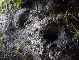

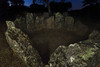
<< Our Photo Pages >> Gran Encina Dolmen - Burial Chamber or Dolmen in Spain in Extremadura
Submitted by theCaptain on Monday, 06 March 2006 Page Views: 2680
Neolithic and Bronze AgeSite Name: Gran Encina Dolmen Alternative Name: La Encina, Dehesa de Montehermoso 11Country: Spain Region: Extremadura Type: Burial Chamber or Dolmen
Nearest Town: Caceres Nearest Village: Montehermoso
Latitude: 40.085780N Longitude: 6.37474W
Condition:
| 5 | Perfect |
| 4 | Almost Perfect |
| 3 | Reasonable but with some damage |
| 2 | Ruined but still recognisable as an ancient site |
| 1 | Pretty much destroyed, possibly visible as crop marks |
| 0 | No data. |
| -1 | Completely destroyed |
| 5 | Superb |
| 4 | Good |
| 3 | Ordinary |
| 2 | Not Good |
| 1 | Awful |
| 0 | No data. |
| 5 | Can be driven to, probably with disabled access |
| 4 | Short walk on a footpath |
| 3 | Requiring a bit more of a walk |
| 2 | A long walk |
| 1 | In the middle of nowhere, a nightmare to find |
| 0 | No data. |
| 5 | co-ordinates taken by GPS or official recorded co-ordinates |
| 4 | co-ordinates scaled from a detailed map |
| 3 | co-ordinates scaled from a bad map |
| 2 | co-ordinates of the nearest village |
| 1 | co-ordinates of the nearest town |
| 0 | no data |
Be the first person to rate this site - see the 'Contribute!' box in the right hand menu.
Internal Links:
External Links:
I have visited· I would like to visit
DrewParsons would like to visit
")
For more details visit Megalitos.es.
You may be viewing yesterday's version of this page. To see the most up to date information please register for a free account.
")
")
Do not use the above information on other web sites or publications without permission of the contributor.
Nearby Images from Flickr
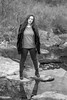

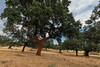
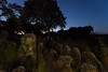
The above images may not be of the site on this page, but were taken nearby. They are loaded from Flickr so please click on them for image credits.
Click here to see more info for this site
Nearby sites
Click here to view sites on an interactive map of the areaKey: Red: member's photo, Blue: 3rd party photo, Yellow: other image, Green: no photo - please go there and take one, Grey: site destroyed
Download sites to:
KML (Google Earth)
GPX (GPS waypoints)
CSV (Garmin/Navman)
CSV (Excel)
To unlock full downloads you need to sign up as a Contributory Member. Otherwise downloads are limited to 50 sites.
Turn off the page maps and other distractions
Nearby sites listing. In the following links * = Image available
526m SSW 198° El Tremedal Dolmen* Burial Chamber or Dolmen
597m WSW 241° Gran Dolmen* Burial Chamber or Dolmen
3.5km E 94° Las Colmenas Burial Chamber or Dolmen
14.0km ESE 106° El Terinuelo Burial Chamber or Dolmen
14.8km SE 144° Menhires de la Cerca Standing Stones
16.4km NNW 332° La Majadilla Burial Chamber or Dolmen
16.5km NNW 332° Prado del Castano Burial Chamber or Dolmen
16.5km NNW 332° Arroyo de Canillas Burial Chamber or Dolmen
16.6km NNW 332° Chanquero 1 Burial Chamber or Dolmen
16.6km NNW 332° Chanquero 2 Burial Chamber or Dolmen
16.6km NNW 332° Dehesa 1 Burial Chamber or Dolmen
16.7km NNW 332° Dehesa 2 Burial Chamber or Dolmen
17.7km SW 230° Las Corras Burial Chamber or Dolmen
18.5km NW 325° El Maton Burial Chamber or Dolmen
20.6km NE 38° El Collado Burial Chamber or Dolmen
23.1km N 9° Pedro Munoz Burial Chamber or Dolmen
23.8km N 2° Navaconcejo Burial Chamber or Dolmen
24.1km N 8° Penas Tajadas Burial Chamber or Dolmen
24.1km ESE 104° Dehesa de Valcorchero Castro or Chafurdão
25.0km ENE 69° Ciudad Romana de Cáparra Ancient Village or Settlement
25.0km ENE 69° Cáparra* Ancient Village or Settlement
26.9km NNE 17° El Madronal Burial Chamber or Dolmen
30.1km N 357° Castillo Petroglifos Erias Rock Art
30.3km S 171° Arroyo del Rayo Burial Chamber or Dolmen
31.6km SSW 196° Portezuelo Burial Chamber or Dolmen
View more nearby sites and additional images


 We would like to know more about this location. Please feel free to add a brief description and any relevant information in your own language.
 Wir möchten mehr über diese Stätte erfahren. Bitte zögern Sie nicht, eine kurze Beschreibung und relevante Informationen in Deutsch hinzuzufügen.
 Nous aimerions en savoir encore un peu sur les lieux. S'il vous plaît n'hesitez pas à ajouter une courte description et tous les renseignements pertinents dans votre propre langue.
 Quisieramos informarnos un poco más de las lugares. No dude en añadir una breve descripción y otros datos relevantes en su propio idioma.