<< Our Photo Pages >> Buchlyvie Broch - Broch or Nuraghe in Scotland in Stirling
Submitted by cosmic on Sunday, 15 January 2006 Page Views: 14099
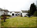
Iron Age and Later PrehistorySite Name: Buchlyvie Broch Alternative Name: Fairy Knowe; Mains of BucklyvieCountry: Scotland County: Stirling Type: Broch or Nuraghe
Nearest Town: Stirling
Map Ref: NS5856494259
Latitude: 56.120056N Longitude: 4.276573W
Condition:
| 5 | Perfect |
| 4 | Almost Perfect |
| 3 | Reasonable but with some damage |
| 2 | Ruined but still recognisable as an ancient site |
| 1 | Pretty much destroyed, possibly visible as crop marks |
| 0 | No data. |
| -1 | Completely destroyed |
| 5 | Superb |
| 4 | Good |
| 3 | Ordinary |
| 2 | Not Good |
| 1 | Awful |
| 0 | No data. |
| 5 | Can be driven to, probably with disabled access |
| 4 | Short walk on a footpath |
| 3 | Requiring a bit more of a walk |
| 2 | A long walk |
| 1 | In the middle of nowhere, a nightmare to find |
| 0 | No data. |
| 5 | co-ordinates taken by GPS or official recorded co-ordinates |
| 4 | co-ordinates scaled from a detailed map |
| 3 | co-ordinates scaled from a bad map |
| 2 | co-ordinates of the nearest village |
| 1 | co-ordinates of the nearest town |
| 0 | no data |
Internal Links:
External Links:
I have visited· I would like to visit
SolarMegalith visited on 9th Aug 2017 - their rating: Cond: 2 Amb: 3 Access: 4
")
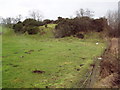
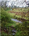
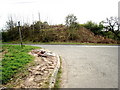
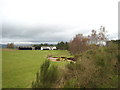
This was considered to be a natural mound until excavated in 1976-7. It stands just South of A811 Kippen to Buchlyvie road.
The excavation found a broch of diameter 19m with walls over 5 metres thick. Roman finds suggest a date of 1st-2nd Century AD.
For more information see Canmore ID 44651 which has extensive notes of an excavation in 2007, together with radiocarbon dating and a list of finds. They add that this may well have been in use in the Iron Age.
You may be viewing yesterday's version of this page. To see the most up to date information please register for a free account.
")
")
")
")
Do not use the above information on other web sites or publications without permission of the contributor.
Nearby Images from Geograph Britain and Ireland:
©2009(licence)
©2015(licence)
©2007(licence)
©2007(licence)
©2007(licence)
The above images may not be of the site on this page, they are loaded from Geograph.
Please Submit an Image of this site or go out and take one for us!
Click here to see more info for this site
Nearby sites
Key: Red: member's photo, Blue: 3rd party photo, Yellow: other image, Green: no photo - please go there and take one, Grey: site destroyed
Download sites to:
KML (Google Earth)
GPX (GPS waypoints)
CSV (Garmin/Navman)
CSV (Excel)
To unlock full downloads you need to sign up as a Contributory Member. Otherwise downloads are limited to 50 sites.
Turn off the page maps and other distractions
Nearby sites listing. In the following links * = Image available
3.1km SSE 160° Carlin Stone (Balfron) Marker Stone (NS5955391277)
3.2km SSE 151° Wife with the Bratty Plaid (Balfron) Standing Stone (Menhir) (NS6002791383)
5.7km NNW 336° The Peace Stone* Rock Art (NS56419954)
6.8km N 355° Lake of Menteith Crannogs* Crannog (NN5821901097)
6.9km SSE 159° Knockraich (Fintry)* Standing Stone (Menhir) (NS60898774)
7.2km NNW 337° Ballochraggan 1 Rock Art (NN5590001005)
7.5km NNE 26° The Ruskie Stane* Modern Stone Circle etc (NN6203800912)
7.7km NNW 339° Ballochraggan 5 Rock Art (NN5604401549)
7.8km NNW 340° Ballochraggan 12 Rock Art (NN5610601711)
7.8km NNW 340° Mask Stone (Port of Menteith) Rock Art (NN5610701712)
7.9km NNW 340° Nether Glenny Rock Art* Rock Art (NN56140179)
7.9km NNW 343° Nether Glenny Cairn* Cairn (NN56460192)
8.0km NNW 343° Nether Glenny (02) Cairn (NN56440202)
8.1km NNW 341° Nether Glenny (28) Rock Art (NN56190197)
8.1km NNW 343° Nether Glenny (35) Rock Art (NN5642502099)
8.3km NNW 343° Nether Glenny (42) Rock Art (NN56430229)
8.7km NNW 347° Upper Glenny* Rock Art (NN56880277)
10.5km S 191° Earl’s Seat Cairn* Cairn (NS562840)
10.7km E 89° Leckie Broch* Broch or Nuraghe (NS6925494002)
10.7km E 90° Leckie 1* Rock Art (NS6925993985)
10.7km E 90° Leckie 2* Rock Art (NS69269399)
11.2km ENE 67° Craighead Cairn* Cairn (NS69039822)
11.7km SE 126° Todholes (Fintry Hills) Cairn (NS67748702)
11.7km ENE 69° Coldoch Broch* Broch or Nuraghe (NS6963998128)
12.5km NNE 31° Wester Torrie Stone Circle (NN65340480)
View more nearby sites and additional images


 We would like to know more about this location. Please feel free to add a brief description and any relevant information in your own language.
 Wir möchten mehr über diese Stätte erfahren. Bitte zögern Sie nicht, eine kurze Beschreibung und relevante Informationen in Deutsch hinzuzufügen.
 Nous aimerions en savoir encore un peu sur les lieux. S'il vous plaît n'hesitez pas à ajouter une courte description et tous les renseignements pertinents dans votre propre langue.
 Quisieramos informarnos un poco más de las lugares. No dude en añadir una breve descripción y otros datos relevantes en su propio idioma.