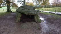
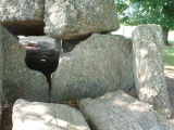
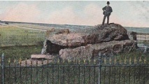
<< Our Photo Pages >> Wéris Dolmen - Burial Chamber or Dolmen in Belgium in Luxembourg
Submitted by AlexHunger on Thursday, 06 October 2005 Page Views: 11639
Neolithic and Bronze AgeSite Name: Wéris Dolmen Alternative Name: Wéris I; Allee Couverte Norde; Dolmen de NordCountry: Belgium Province: Luxembourg Type: Burial Chamber or Dolmen
Nearest Town: Barvaux Nearest Village: Wéris
Latitude: 50.333400N Longitude: 5.522670E
Condition:
| 5 | Perfect |
| 4 | Almost Perfect |
| 3 | Reasonable but with some damage |
| 2 | Ruined but still recognisable as an ancient site |
| 1 | Pretty much destroyed, possibly visible as crop marks |
| 0 | No data. |
| -1 | Completely destroyed |
| 5 | Superb |
| 4 | Good |
| 3 | Ordinary |
| 2 | Not Good |
| 1 | Awful |
| 0 | No data. |
| 5 | Can be driven to, probably with disabled access |
| 4 | Short walk on a footpath |
| 3 | Requiring a bit more of a walk |
| 2 | A long walk |
| 1 | In the middle of nowhere, a nightmare to find |
| 0 | No data. |
| 5 | co-ordinates taken by GPS or official recorded co-ordinates |
| 4 | co-ordinates scaled from a detailed map |
| 3 | co-ordinates scaled from a bad map |
| 2 | co-ordinates of the nearest village |
| 1 | co-ordinates of the nearest town |
| 0 | no data |
Internal Links:
External Links:
I have visited· I would like to visit
KieKa J_W_R patrickbrown would like to visit
CharcoalBurner89 visited on 6th Nov 2023 - their rating: Cond: 4 Amb: 4 Access: 4 There is a parking lot nearby. Easy to access and wonderfully preserved.
iseemore visited on 16th Sep 2018 - their rating: Cond: 4 Amb: 5 Access: 5
johnstone visited on 28th Jun 1998 - their rating: Cond: 4 Amb: 4 Access: 5
ShamrockStone have visited here
Average ratings for this site from all visit loggers: Condition: 4 Ambience: 4.33 Access: 4.67
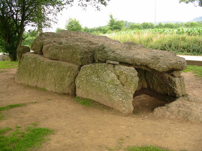
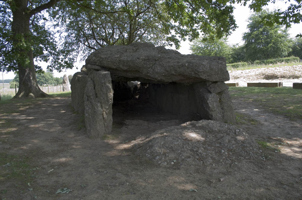
Excavations found flints, stone arrows, pottery fragments and human remains.
Information about this burial chamber is also included on The Journal of Antiquities webpage for the Dolmen De Weris, Wallonia, Belgium, which gives directions for finding this easily missed burial chamber, includes a photograph, a description and details of other dolmens in the area.
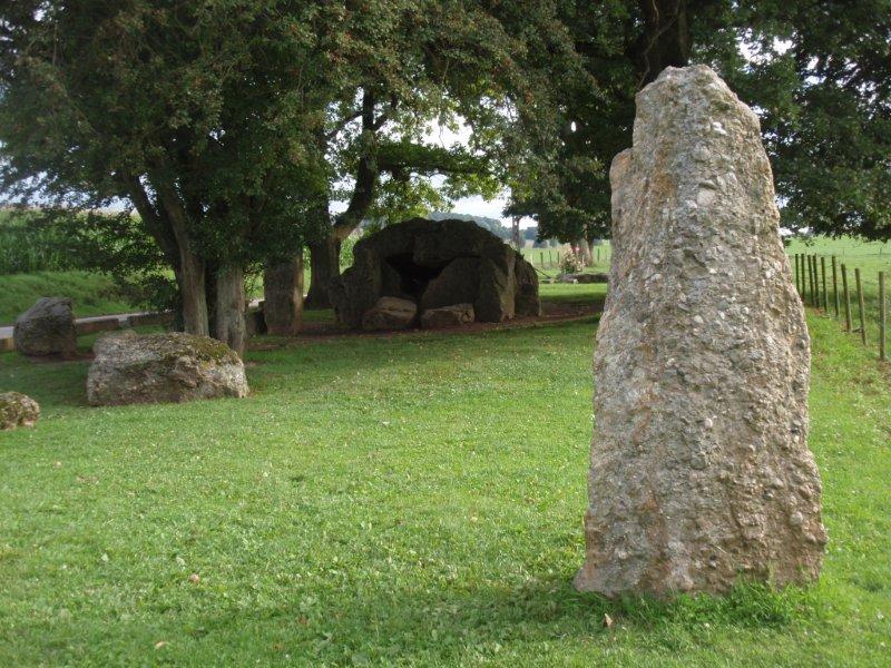
The Journal adds: "At the south side of the dolmen are two stone rows or an avenue of 30 menhirs that form an alignment with this – the northern dolmen – and with a curious stone to the north-east called ‘the Stone of the Ancients’ or ‘White Stone’ that is often referred to as a standing stone but, in fact, it is a naturally-formed stone some 3 metres high that leans at a 45 degree angle and stands on a hillside. At the bottom of the hill another stone ‘the Devil’s Stone’ or ‘Devil’s Bed’ is a flatish stone that is 0.6 metres high by 2.45 metres long". Wikipedia has a basic entry which gives a few more details of the dolmens, plus the Museum of Megaliths in the village of Wéris.
You may be viewing yesterday's version of this page. To see the most up to date information please register for a free account.






Do not use the above information on other web sites or publications without permission of the contributor.
Click here to see more info for this site
Nearby sites
Click here to view sites on an interactive map of the areaKey: Red: member's photo, Blue: 3rd party photo, Yellow: other image, Green: no photo - please go there and take one, Grey: site destroyed
Download sites to:
KML (Google Earth)
GPX (GPS waypoints)
CSV (Garmin/Navman)
CSV (Excel)
To unlock full downloads you need to sign up as a Contributory Member. Otherwise downloads are limited to 50 sites.
Turn off the page maps and other distractions
Nearby sites listing. In the following links * = Image available
25m SW 220° Menhirs du Champ de la Longue Pierre* Standing Stone (Menhir)
399m WNW 283° Bois du Vesin Menhir* Standing Stones
750m NNE 31° Menhir de Morville* Standing Stone (Menhir)
920m SSW 206° Alignement de Danthine* Stone Row / Alignment
997m SE 140° Pierre du Carrefour des Sorcières* Natural Stone / Erratic / Other Natural Feature
1.0km SE 139° Cercle Historique* Museum
1.1km SSW 208° Menhir Danthine* Standing Stone (Menhir)
1.5km E 91° Pierre Haina* Rock Outcrop
1.5km E 83° Lit du Diable* Rock Outcrop
1.5km SSW 207° Oppagne Menhirs* Standing Stones
1.5km SSW 208° Oppagne Dolmen* Burial Chamber or Dolmen
1.8km S 177° Pas-Bayard* Rock Outcrop
2.0km SSW 209° Menhirs d'Oppagne* Standing Stones
3.7km NNE 28° Menhir de Heyd* Standing Stone (Menhir)
6.0km NNE 31° Ozo Menhir* Standing Stone (Menhir)
11.1km E 89° Chêne-al-Pierre Rock Outcrop
13.6km S 182° Source Miraculeuse de Saint Thibaut Holy Well or Sacred Spring
15.9km NNW 336° Grosse Pierre d'Ellemelle* Standing Stone (Menhir)
18.0km SW 227° Pierre de Pîrîre* Modern Stone Circle etc
18.0km NNW 341° Borne seigneurale de Houchenée* Marker Stone
18.5km SW 225° Pierre Saint-Hubert* Marker Stone
20.8km WNW 302° Othée Tumulus* Barrow Cemetery
21.6km SW 224° Bois des Lus* Modern Stone Circle etc
22.4km N 0° Fine Pierre de Plainevaux* Rock Outcrop
23.7km SSE 149° Monument Europalia Portugal* Modern Stone Circle etc
View more nearby sites and additional images


 We would like to know more about this location. Please feel free to add a brief description and any relevant information in your own language.
 Wir möchten mehr über diese Stätte erfahren. Bitte zögern Sie nicht, eine kurze Beschreibung und relevante Informationen in Deutsch hinzuzufügen.
 Nous aimerions en savoir encore un peu sur les lieux. S'il vous plaît n'hesitez pas à ajouter une courte description et tous les renseignements pertinents dans votre propre langue.
 Quisieramos informarnos un poco más de las lugares. No dude en añadir una breve descripción y otros datos relevantes en su propio idioma.