

<< Text Pages >> Donore Mystery Mound - Artificial Mound in Ireland (Republic of) in Co. Meath
Submitted by Andy B on Saturday, 17 September 2005 Page Views: 5489
Multi-periodSite Name: Donore Mystery MoundCountry: Ireland (Republic of) County: Co. Meath Type: Artificial Mound
Nearest Town: Drogheda Nearest Village: Donore
Map Ref: O0334573550
Latitude: 53.701583N Longitude: 6.435944W
Condition:
| 5 | Perfect |
| 4 | Almost Perfect |
| 3 | Reasonable but with some damage |
| 2 | Ruined but still recognisable as an ancient site |
| 1 | Pretty much destroyed, possibly visible as crop marks |
| 0 | No data. |
| -1 | Completely destroyed |
| 5 | Superb |
| 4 | Good |
| 3 | Ordinary |
| 2 | Not Good |
| 1 | Awful |
| 0 | No data. |
| 5 | Can be driven to, probably with disabled access |
| 4 | Short walk on a footpath |
| 3 | Requiring a bit more of a walk |
| 2 | A long walk |
| 1 | In the middle of nowhere, a nightmare to find |
| 0 | No data. |
| 5 | co-ordinates taken by GPS or official recorded co-ordinates |
| 4 | co-ordinates scaled from a detailed map |
| 3 | co-ordinates scaled from a bad map |
| 2 | co-ordinates of the nearest village |
| 1 | co-ordinates of the nearest town |
| 0 | no data |
Be the first person to rate this site - see the 'Contribute!' box in the right hand menu.
Internal Links:
External Links:
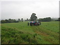
Anthony Murphy of Mythical Ireland writes "There's a huge round mound-shaped hillock in the Boyne Valley which is not marked on any map but which at least one archaeologist thinks is a probable passage-tomb structure", so this would be similar to Newgrange.
"This site is is actually Very Obvious while at the same time
Very Subtle. The sidhe folk are playing tricks. It can be seen
clearly if one knows from where to see it.
Not a kerbstone to be seen, however. Perhaps it's a megalithic
passage-tomb. Perhaps it's an innocent hillock. I'd be glad to show
anyone who's interested.
But only on the condition that no-one try to excavate it! ;-)"
It is on private property, so access is not possible without arrangement.
More at Irish Stones.
You may be viewing yesterday's version of this page. To see the most up to date information please register for a free account.
Do not use the above information on other web sites or publications without permission of the contributor.
Nearby Images from Geograph Britain and Ireland:
©2007(licence)
©2018(licence)

©2010(licence)
©2010(licence)
©2010(licence)
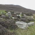
The above images may not be of the site on this page, they are loaded from Geograph.
Please Submit an Image of this site or go out and take one for us!
Click here to see more info for this site
Nearby sites
Click here to view sites on an interactive map of the areaKey: Red: member's photo, Blue: 3rd party photo, Yellow: other image, Green: no photo - please go there and take one, Grey: site destroyed
Download sites to:
KML (Google Earth)
GPX (GPS waypoints)
CSV (Garmin/Navman)
CSV (Excel)
To unlock full downloads you need to sign up as a Contributory Member. Otherwise downloads are limited to 50 sites.
Turn off the page maps and other distractions
Nearby sites listing. In the following links * = Image available
483m NNW 326° Dowth Hall* Passage Grave
652m N 6° Dowth Henge* Henge (O034742)
996m WNW 284° Dowth Passage Grave* Passage Grave (O02377377)
2.0km WSW 240° Newgrange Standing Stones* Standing Stones
2.4km NNW 334° Townleyhall Passage Tomb* Passage Grave (O0222075723)
2.5km WSW 242° Newgrange Barrow ME019-049001* Chambered Tomb (SB0500930882)
2.7km WSW 254° Newgrange* Passage Grave (O00747272)
2.8km WSW 253° Newgrange Stone Circle* Stone Circle (O007727)
2.9km NE 50° Oldbridge Logboat, River Boyne Not Known (by us)
3.2km WSW 244° Recently Discovered Prehistoric Cropmark near Newgrange* Misc. Earthwork
3.6km W 269° Knowth Timber Circle* Timber Circle (N997734)
3.6km W 269° Knowth* Passage Grave (N99697342)
5.8km E 79° Millmount* Artificial Mound
7.4km WNW 283° Hill of Slane* Artificial Mound
8.5km N 8° Muiredach's Cross (Monasterboice)* Ancient Cross (O044820)
10.3km NNW 345° Tinure* Rock Art (O005835)
10.9km NW 309° Grangegeeth Sculptured Stone
12.0km ENE 69° Baltray* Standing Stones
12.5km SE 143° Greenanstown Stone Circle (O110637)
12.6km SSE 148° Micknanstown* Passage Grave
13.7km SSE 148° Fourknocks* Passage Grave (O10856202)
15.4km SW 219° Rath Lugh* Promontory Fort / Cliff Castle (N939613)
15.5km SW 221° Lismullin Henge Henge (N93426156)
16.0km S 186° Kilbrew Henge
16.2km ESE 117° Knocknagin* Passage Grave
View more nearby sites and additional images


 We would like to know more about this location. Please feel free to add a brief description and any relevant information in your own language.
 Wir möchten mehr über diese Stätte erfahren. Bitte zögern Sie nicht, eine kurze Beschreibung und relevante Informationen in Deutsch hinzuzufügen.
 Nous aimerions en savoir encore un peu sur les lieux. S'il vous plaît n'hesitez pas à ajouter une courte description et tous les renseignements pertinents dans votre propre langue.
 Quisieramos informarnos un poco más de las lugares. No dude en añadir una breve descripción y otros datos relevantes en su propio idioma.