

<< Our Photo Pages >> Leith Hall - Class I Pictish Symbol Stone in Scotland in Aberdeenshire
Submitted by cosmic on Monday, 27 June 2005 Page Views: 7053
Early Medieval (Dark Age)Site Name: Leith HallCountry: Scotland County: Aberdeenshire Type: Class I Pictish Symbol Stone
Nearest Town: Inverurie Nearest Village: Kennethmont
Map Ref: NJ540300
Latitude: 57.358147N Longitude: 2.766221W
Condition:
| 5 | Perfect |
| 4 | Almost Perfect |
| 3 | Reasonable but with some damage |
| 2 | Ruined but still recognisable as an ancient site |
| 1 | Pretty much destroyed, possibly visible as crop marks |
| 0 | No data. |
| -1 | Completely destroyed |
| 5 | Superb |
| 4 | Good |
| 3 | Ordinary |
| 2 | Not Good |
| 1 | Awful |
| 0 | No data. |
| 5 | Can be driven to, probably with disabled access |
| 4 | Short walk on a footpath |
| 3 | Requiring a bit more of a walk |
| 2 | A long walk |
| 1 | In the middle of nowhere, a nightmare to find |
| 0 | No data. |
| 5 | co-ordinates taken by GPS or official recorded co-ordinates |
| 4 | co-ordinates scaled from a detailed map |
| 3 | co-ordinates scaled from a bad map |
| 2 | co-ordinates of the nearest village |
| 1 | co-ordinates of the nearest town |
| 0 | no data |
Internal Links:
External Links:
")
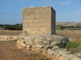
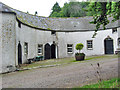
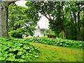
Two Pictish Stones were donated to the National Trust in 1945 to be kept at their Leith Hall property. (It is really a fortified house).
The first one, the Wolf Stone, came from Newbigging Leslie - about five miles away.
The second, the Percylieu, was found at Hillhead of Clatt which is only a couple of miles away.
Both are displayed in a shelter along with various other stones - querns, grindstones etc.
You may be viewing yesterday's version of this page. To see the most up to date information please register for a free account.
")
")
")
")
Do not use the above information on other web sites or publications without permission of the contributor.
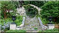
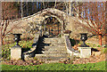
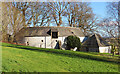
Nearby Images from Geograph Britain and Ireland:
©2021(licence)
©2024(licence)
©2024(licence)
©2008(licence)
©2019(licence)
The above images may not be of the site on this page, they are loaded from Geograph.
Please Submit an Image of this site or go out and take one for us!
Click here to see more info for this site
Nearby sites
Key: Red: member's photo, Blue: 3rd party photo, Yellow: other image, Green: no photo - please go there and take one, Grey: site destroyed
Download sites to:
KML (Google Earth)
GPX (GPS waypoints)
CSV (Garmin/Navman)
CSV (Excel)
To unlock full downloads you need to sign up as a Contributory Member. Otherwise downloads are limited to 50 sites.
Turn off the page maps and other distractions
Nearby sites listing. In the following links * = Image available
22m SSW 206° Newbigging Leslie Class I Pictish Symbol Stone (NJ53992998)
759m WNW 293° Candy* Stone Circle (NJ533303)
2.4km SSE 148° Ardlair (Circle)* Stone Circle (NJ55272794)
2.6km SE 145° Ardlair (Pictish Stone)* Class I Pictish Symbol Stone (NJ55472784)
2.7km E 83° Wardhouse Ancient Village or Settlement (NJ567303)
3.1km SSE 162° The Sunken Kirk, Seggieden Stone Circle (NJ54912708)
3.2km SSW 199° Clatt Bankhead Stone Circle (NJ529270)
3.2km SSW 199° Bankhead of Clatt Multiple Stone Rows / Avenue (NJ529270)
3.7km SSW 198° Hillhead of Clatt Multiple Stone Rows / Avenue (NJ528265)
3.7km SSW 198° Clatt Hillhead Stone Circle (NJ528265)
4.0km S 181° Clatt 2* Class I Pictish Symbol Stone (NJ53892600)
4.1km SSE 165° Tofthill, Clatt Stone Circle (NJ5526)
4.2km SW 225° Corrstone Wood* Stone Circle (NJ510271)
4.3km WSW 238° Mill o'Noth* Standing Stones (NJ5034727801)
5.1km SW 235° Rhynie 2* Class I Pictish Symbol Stone (NJ49802715)
5.1km SW 234° Rhynie 4* Class I Pictish Symbol Stone (NJ49822700)
5.3km SW 229° Rhynie 6* Class I Pictish Symbol Stone (NJ49972659)
5.6km SW 229° Rhynie Man* Class I Pictish Symbol Stone (NJ49762636)
5.6km SW 229° Craw Stane* Class I Pictish Symbol Stone (NJ4974926345)
5.6km W 262° Tap o'Noth* Hillfort (NJ484293)
5.7km SW 228° Rhynie 8* Class I Pictish Symbol Stone (NJ497262)
5.9km E 90° Candle Hill* Stone Circle (NJ59912997)
5.9km S 175° Clatt 1* Class I Pictish Symbol Stone (NJ54422408)
6.2km SE 140° Johnston, The Ringing Stone* Standing Stone (Menhir) (NJ57902517)
6.2km ESE 101° Stonehead* Stone Circle (NJ601287)
View more nearby sites and additional images


 We would like to know more about this location. Please feel free to add a brief description and any relevant information in your own language.
 Wir möchten mehr über diese Stätte erfahren. Bitte zögern Sie nicht, eine kurze Beschreibung und relevante Informationen in Deutsch hinzuzufügen.
 Nous aimerions en savoir encore un peu sur les lieux. S'il vous plaît n'hesitez pas à ajouter une courte description et tous les renseignements pertinents dans votre propre langue.
 Quisieramos informarnos un poco más de las lugares. No dude en añadir una breve descripción y otros datos relevantes en su propio idioma.