 with our Megalithic Portal iPhone app")

<< Our Photo Pages >> Hill of Menmuir - Rock Art in Scotland in Angus
Submitted by tiompan on Sunday, 09 January 2005 Page Views: 6471
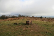
Rock ArtSite Name: Hill of MenmuirCountry: Scotland County: Angus Type: Rock Art
Nearest Village: Menmuir
Map Ref: NO52096489
Latitude: 56.773114N Longitude: 2.785508W
Condition:
| 5 | Perfect |
| 4 | Almost Perfect |
| 3 | Reasonable but with some damage |
| 2 | Ruined but still recognisable as an ancient site |
| 1 | Pretty much destroyed, possibly visible as crop marks |
| 0 | No data. |
| -1 | Completely destroyed |
| 5 | Superb |
| 4 | Good |
| 3 | Ordinary |
| 2 | Not Good |
| 1 | Awful |
| 0 | No data. |
| 5 | Can be driven to, probably with disabled access |
| 4 | Short walk on a footpath |
| 3 | Requiring a bit more of a walk |
| 2 | A long walk |
| 1 | In the middle of nowhere, a nightmare to find |
| 0 | No data. |
| 5 | co-ordinates taken by GPS or official recorded co-ordinates |
| 4 | co-ordinates scaled from a detailed map |
| 3 | co-ordinates scaled from a bad map |
| 2 | co-ordinates of the nearest village |
| 1 | co-ordinates of the nearest town |
| 0 | no data |
Internal Links:
External Links:
")
You may be viewing yesterday's version of this page. To see the most up to date information please register for a free account.
Do not use the above information on other web sites or publications without permission of the contributor.
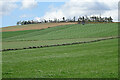
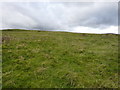
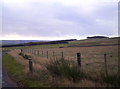
Nearby Images from Geograph Britain and Ireland:
©2022(licence)
©2011(licence)
©2005(licence)
©2006(licence)
©2007(licence)
The above images may not be of the site on this page, they are loaded from Geograph.
Please Submit an Image of this site or go out and take one for us!
Click here to see more info for this site
Nearby sites
Key: Red: member's photo, Blue: 3rd party photo, Yellow: other image, Green: no photo - please go there and take one, Grey: site destroyed
Download sites to:
KML (Google Earth)
GPX (GPS waypoints)
CSV (Garmin/Navman)
CSV (Excel)
To unlock full downloads you need to sign up as a Contributory Member. Otherwise downloads are limited to 50 sites.
Turn off the page maps and other distractions
Nearby sites listing. In the following links * = Image available
1.4km ESE 110° Menmuir Pictish Cross Slab Class III Pictish Cross Slab (NO534644)
2.9km ENE 66° White Caterthun* Stone Fort or Dun (NO5474766057)
4.0km ENE 60° Brown Caterthun* Stone Fort or Dun (NO5555366871)
4.8km NNE 24° Newbigging Ring Cairn (NO541693)
4.9km SW 229° Ghaist Stone (Fern) Standing Stone (Menhir) (NO48326173)
5.7km SE 134° Killievair* Standing Stone (Menhir) (NO562609)
7.6km SE 131° Pictavia* Museum (NO578599)
7.8km ESE 123° Dubton Farm Iron Age settlement and Souterrain Souterrain (Fogou, Earth House) (NO58616062)
8.7km E 84° Stracathro B Cursus Cursus (NO60746576)
8.7km E 85° Stracathro A Cursus Cursus (NO608655)
8.7km ESE 123° Aldbar* Class III Pictish Cross Slab (NO594601)
8.8km SE 131° St Ouret's Well (Brechin) Holy Well or Sacred Spring (NO58695904)
8.9km ESE 122° Brechin Cathedral* Sculptured Stone (NO596601)
8.9km E 83° Stracathro B Cursus Cursus (NO60986584)
8.9km E 84° Stracathro A Cursus Cursus (NO610657)
9.0km S 178° Aberlemno* Standing Stones (NO52245586)
9.4km WSW 240° Easter Memus Standing Stone (Menhir) (NO439603)
9.4km S 188° Finavon* Vitrified Fort (NO506556)
9.6km NE 43° Dalbog Stone Circle (NO587719)
10.2km SE 141° St Murdoch's Well (Brechin) Holy Well or Sacred Spring (NO58405682)
10.4km ESE 109° Easter Pitforthie Stone Circle (NO619614)
10.5km S 188° Carsegownie Cairn* Cairn (NO50565449)
11.2km S 179° Doo'cot Woods (Turin Hill) Rock Art (NO5224953716)
11.2km S 179° West Mains 1 & 2 (Turin Hill) Rock Art (NO52145369)
11.3km E 82° Capo, Aberdeenshire* Long Barrow (NO633664)
View more nearby sites and additional images


 We would like to know more about this location. Please feel free to add a brief description and any relevant information in your own language.
 Wir möchten mehr über diese Stätte erfahren. Bitte zögern Sie nicht, eine kurze Beschreibung und relevante Informationen in Deutsch hinzuzufügen.
 Nous aimerions en savoir encore un peu sur les lieux. S'il vous plaît n'hesitez pas à ajouter une courte description et tous les renseignements pertinents dans votre propre langue.
 Quisieramos informarnos un poco más de las lugares. No dude en añadir una breve descripción y otros datos relevantes en su propio idioma.