<< Our Photo Pages >> St Peter's Well (West Mersea) - Holy Well or Sacred Spring in England in Essex
Submitted by Thorgrim on Monday, 09 August 2004 Page Views: 10584
Springs and Holy WellsSite Name: St Peter's Well (West Mersea)Country: England County: Essex Type: Holy Well or Sacred Spring
Nearest Town: Colchester Nearest Village: West Mersea
Map Ref: TM006124
Latitude: 51.774311N Longitude: 0.906250E
Condition:
| 5 | Perfect |
| 4 | Almost Perfect |
| 3 | Reasonable but with some damage |
| 2 | Ruined but still recognisable as an ancient site |
| 1 | Pretty much destroyed, possibly visible as crop marks |
| 0 | No data. |
| -1 | Completely destroyed |
| 5 | Superb |
| 4 | Good |
| 3 | Ordinary |
| 2 | Not Good |
| 1 | Awful |
| 0 | No data. |
| 5 | Can be driven to, probably with disabled access |
| 4 | Short walk on a footpath |
| 3 | Requiring a bit more of a walk |
| 2 | A long walk |
| 1 | In the middle of nowhere, a nightmare to find |
| 0 | No data. |
| 5 | co-ordinates taken by GPS or official recorded co-ordinates |
| 4 | co-ordinates scaled from a detailed map |
| 3 | co-ordinates scaled from a bad map |
| 2 | co-ordinates of the nearest village |
| 1 | co-ordinates of the nearest town |
| 0 | no data |
Internal Links:
External Links:
 (PID:7709)")
Now restored, but covered with timber. A bronze plate was added in 2000 giving information. Accessible via a board walk path from the Coast Road.
You may be viewing yesterday's version of this page. To see the most up to date information please register for a free account.
 (PID:7708)")
Do not use the above information on other web sites or publications without permission of the contributor.
Nearby Images from Geograph Britain and Ireland:
©2019(licence)
©2008(licence)
©2017(licence)
©2017(licence)
©2014(licence)
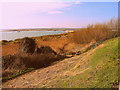
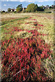
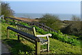
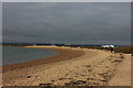
The above images may not be of the site on this page, they are loaded from Geograph.
Please Submit an Image of this site or go out and take one for us!
Click here to see more info for this site
Nearby sites
Key: Red: member's photo, Blue: 3rd party photo, Yellow: other image, Green: no photo - please go there and take one, Grey: site destroyed
Download sites to:
KML (Google Earth)
GPX (GPS waypoints)
CSV (Garmin/Navman)
CSV (Excel)
To unlock full downloads you need to sign up as a Contributory Member. Otherwise downloads are limited to 50 sites.
Turn off the page maps and other distractions
Nearby sites listing. In the following links * = Image available
2.9km NNE 33° West Mersea* Artificial Mound (TM021149)
5.0km SSE 152° Othona Roman Fort* Early Christian Sculptured Stone (TM031081)
5.3km WNW 295° Wigborough Henge* Henge (TL957144)
6.1km WNW 293° Mill Mound Artificial Mound (TL9487914575)
8.6km NNW 334° Gryme's Dyke Ancient Village or Settlement (TL965200)
9.5km N 357° Berechurch Dyke Misc. Earthwork
9.6km NE 38° Alresford Hill Cairn (TM06282022)
9.8km N 3° Tamworth Mound Misc. Earthwork (TM0065922209)
10.3km NNW 338° Heath Farm Dyke Ancient Village or Settlement (TL964218)
11.0km NNW 342° Gosbecks Archaeological Park* Ancient Village or Settlement (TL968227)
11.3km NNW 336° Stanway Gravel Pit Ancient Village or Settlement (TL956225)
11.4km NW 319° Birch Long Barrow (TL927207)
11.8km ENE 71° St. Osyth's Well (St. Osyth) Holy Well or Sacred Spring (TM11651670)
11.9km N 10° Annan Road Bronze Age Barrow Cemetery* Barrow Cemetery (TM0215024164)
12.3km N 358° St John's Green (Colchester) Cairn (TL99642468)
12.4km ENE 67° Flag Inn (St Osyth) Cairn (TM11771777)
12.4km WNW 300° Tiptree Moud Round Barrow(s) (TL896182)
12.5km N 9° Greenstead Stones* Natural Stone / Erratic / Other Natural Feature (TM021248)
12.7km NNW 348° Lexden Tumulus* Artificial Mound (TL9753724712)
12.9km NNW 344° Triple Dyke Ancient Village or Settlement (TL965246)
12.9km N 359° Colchester Castle Museum* Museum (TL998253)
13.2km N 354° Sheepden Dyke Ancient Village or Settlement (TL987255)
14.0km NE 47° Great Bentley Henge (TM104224)
14.0km WNW 298° Inworth Cursus Cursus (TL8794718454)
14.8km NW 323° Marks Tey Puddingstone* Natural Stone / Erratic / Other Natural Feature (TL911238)
View more nearby sites and additional images


 We would like to know more about this location. Please feel free to add a brief description and any relevant information in your own language.
 Wir möchten mehr über diese Stätte erfahren. Bitte zögern Sie nicht, eine kurze Beschreibung und relevante Informationen in Deutsch hinzuzufügen.
 Nous aimerions en savoir encore un peu sur les lieux. S'il vous plaît n'hesitez pas à ajouter une courte description et tous les renseignements pertinents dans votre propre langue.
 Quisieramos informarnos un poco más de las lugares. No dude en añadir una breve descripción y otros datos relevantes en su propio idioma.