<< Our Photo Pages >> Cherrapunji - Standing Stones in India
Submitted by Andy B on Monday, 09 January 2012 Page Views: 5632
Neolithic and Bronze AgeSite Name: CherrapunjiCountry: India
NOTE: This site is 11.925 km away from the location you searched for.
Type: Standing Stones
Nearest Town: Mawsynram Nearest Village: Cherrapunji
Latitude: 25.300000N Longitude: 91.700000E
Condition:
| 5 | Perfect |
| 4 | Almost Perfect |
| 3 | Reasonable but with some damage |
| 2 | Ruined but still recognisable as an ancient site |
| 1 | Pretty much destroyed, possibly visible as crop marks |
| 0 | No data. |
| -1 | Completely destroyed |
| 5 | Superb |
| 4 | Good |
| 3 | Ordinary |
| 2 | Not Good |
| 1 | Awful |
| 0 | No data. |
| 5 | Can be driven to, probably with disabled access |
| 4 | Short walk on a footpath |
| 3 | Requiring a bit more of a walk |
| 2 | A long walk |
| 1 | In the middle of nowhere, a nightmare to find |
| 0 | No data. |
| 5 | co-ordinates taken by GPS or official recorded co-ordinates |
| 4 | co-ordinates scaled from a detailed map |
| 3 | co-ordinates scaled from a bad map |
| 2 | co-ordinates of the nearest village |
| 1 | co-ordinates of the nearest town |
| 0 | no data |
Internal Links:
External Links:
")
You may be viewing yesterday's version of this page. To see the most up to date information please register for a free account.
Do not use the above information on other web sites or publications without permission of the contributor.
Nearby Images from Flickr
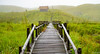
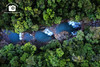
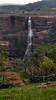


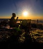
The above images may not be of the site on this page, but were taken nearby. They are loaded from Flickr so please click on them for image credits.
Click here to see more info for this site
Nearby sites
Click here to view sites on an interactive map of the areaKey: Red: member's photo, Blue: 3rd party photo, Yellow: other image, Green: no photo - please go there and take one, Grey: site destroyed
Download sites to:
KML (Google Earth)
GPX (GPS waypoints)
CSV (Garmin/Navman)
CSV (Excel)
To unlock full downloads you need to sign up as a Contributory Member. Otherwise downloads are limited to 50 sites.
Turn off the page maps and other distractions
Nearby sites listing. In the following links * = Image available
16.7km NNE 18° Mawphlang Sacred Forest* Standing Stones
152.5km NE 40° Mahadeoshal Ancient Village or Settlement
182.7km SSW 213° Wari-Bateswar Ancient Village or Settlement
236.8km N 357° Gom Kora Bhutan Natural Stone / Erratic / Other Natural Feature
240.3km W 261° Mahasthangarh Ancient Village or Settlement
270.5km NNW 340° Bumthang cup-marked Stone Rock Art
271.6km NNW 340° Dorje Dolmen Thamshing* Burial Chamber or Dolmen
327.7km NW 317° The National Museum of Bhutan* Museum
332.1km NW 316° Kyichu Lhakhang Ancient Temple
337.0km NW 317° Taktsang Monastery, Bhutan* Ancient Temple
354.4km ENE 59° Charaideo Maidams Barrow Cemetery
413.4km N 360° Tibetan Kings´Tombs Artificial Mound
453.7km NNW 333° Palcho Monastery* Ancient Temple
487.3km N 354° Jokhang* Ancient Temple
488.0km N 353° Potala Palace Museum* Museum
490.7km N 353° Drepung stone* Rock Art
548.3km WNW 294° Haleshi Mahadeva Cave or Rock Shelter
561.1km SE 144° Bagan temple area* Ancient Temple
561.3km SE 144° Bagan Archaeological Museum* Museum
605.5km SE 143° Popa Taungkalat Monastery* Ancient Temple
606.8km WSW 258° Dhekia Pathar* Burial Chamber or Dolmen
614.4km N 353° Nam-Tso rocks* Natural Stone / Erratic / Other Natural Feature
629.6km W 270° Nalanda University excavated site* Ancient Temple
631.1km WSW 249° Chokahatu* Barrow Cemetery
650.0km WSW 258° Rola.* Standing Stones
View more nearby sites and additional images


 We would like to know more about this location. Please feel free to add a brief description and any relevant information in your own language.
 Wir möchten mehr über diese Stätte erfahren. Bitte zögern Sie nicht, eine kurze Beschreibung und relevante Informationen in Deutsch hinzuzufügen.
 Nous aimerions en savoir encore un peu sur les lieux. S'il vous plaît n'hesitez pas à ajouter une courte description et tous les renseignements pertinents dans votre propre langue.
 Quisieramos informarnos un poco más de las lugares. No dude en añadir una breve descripción y otros datos relevantes en su propio idioma.