 with our Megalithic Portal iPhone app")

<< Our Photo Pages >> Hemmelmark Steingrab (9) - Long Barrow in Germany in Schleswig-Holstein, Hamburg
Submitted by krautrock on Thursday, 14 May 2009 Page Views: 2996
Neolithic and Bronze AgeSite Name: Hemmelmark Steingrab (9) Alternative Name: Sprockhoff 88, Grab 9, Splieth 7Country: Germany
NOTE: This site is 2.335 km away from the location you searched for.
Land: Schleswig-Holstein, Hamburg Type: Long Barrow
Nearest Town: Eckernfoerde Nearest Village: Hemmelmark
Latitude: 54.495130N Longitude: 9.868507E
Condition:
| 5 | Perfect |
| 4 | Almost Perfect |
| 3 | Reasonable but with some damage |
| 2 | Ruined but still recognisable as an ancient site |
| 1 | Pretty much destroyed, possibly visible as crop marks |
| 0 | No data. |
| -1 | Completely destroyed |
| 5 | Superb |
| 4 | Good |
| 3 | Ordinary |
| 2 | Not Good |
| 1 | Awful |
| 0 | No data. |
| 5 | Can be driven to, probably with disabled access |
| 4 | Short walk on a footpath |
| 3 | Requiring a bit more of a walk |
| 2 | A long walk |
| 1 | In the middle of nowhere, a nightmare to find |
| 0 | No data. |
| 5 | co-ordinates taken by GPS or official recorded co-ordinates |
| 4 | co-ordinates scaled from a detailed map |
| 3 | co-ordinates scaled from a bad map |
| 2 | co-ordinates of the nearest village |
| 1 | co-ordinates of the nearest town |
| 0 | no data |
Internal Links:
External Links:
 (PID:47326)")
Chamber 9 is situated with 2 Long Barrows in a small wood not far from the Prince Heinrich Mausoleum.
Source:
Ernst Sprockhoff: Atlas der Megalithgraeber Deutschlands, Teil 1, Schleswig-Holstein
Information dated back to 1933.
You may be viewing yesterday's version of this page. To see the most up to date information please register for a free account.
 (PID:181264)")
 (PID:47327)")
 (PID:47323)")
Do not use the above information on other web sites or publications without permission of the contributor.
Nearby Images from Flickr
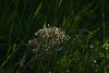
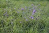
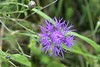
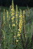
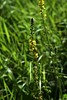
The above images may not be of the site on this page, but were taken nearby. They are loaded from Flickr so please click on them for image credits.
Click here to see more info for this site
Nearby sites
Click here to view sites on an interactive map of the areaKey: Red: member's photo, Blue: 3rd party photo, Yellow: other image, Green: no photo - please go there and take one, Grey: site destroyed
Download sites to:
KML (Google Earth)
GPX (GPS waypoints)
CSV (Garmin/Navman)
CSV (Excel)
To unlock full downloads you need to sign up as a Contributory Member. Otherwise downloads are limited to 50 sites.
Turn off the page maps and other distractions
Nearby sites listing. In the following links * = Image available
67m ENE 77° Hemmelmark Steingrab (10)* Long Barrow
115m SE 125° Hemmelmark Steingrab (14)* Chambered Tomb
121m E 81° Hemmelmark Steingrab (9b)* Burial Chamber or Dolmen
158m E 81° Hemmelmark Steingrab (11)* Long Barrow
470m E 96° Hemmelmark Steingrab (8)* Burial Chamber or Dolmen
762m ENE 75° Hemmelmark Steingrab (7)* Burial Chamber or Dolmen
800m SSW 196° Hemmelmark Steingrab (12)* Burial Chamber or Dolmen
993m S 175° Hemmelmark Steingrab (13)* Burial Chamber or Dolmen
1.0km ENE 72° Hemmelmark Steingrab (4)* Burial Chamber or Dolmen
1.0km ENE 75° Hemmelmark Steingrab (6)* Burial Chamber or Dolmen
1.1km ENE 72° Hemmelmark Steingrab (5)* Burial Chamber or Dolmen
1.3km ENE 71° Hemmelmark Steingrab (2)* Burial Chamber or Dolmen
1.3km ENE 69° Hemmelmark Steingrab (1)* Long Barrow
3.8km ENE 72° Karlsminde Langbett* Long Barrow
4.7km NNE 23° Loose Dolmen* Burial Chamber or Dolmen
5.1km WNW 286° Gammelby-Eichthal Steingrab* Burial Chamber or Dolmen
5.9km SSE 167° Altenhof Langbett 5* Long Barrow
5.9km SSE 159° Noer-Lindhoeft Dolmen* Burial Chamber or Dolmen
5.9km SSE 162° Schalenstein Schnellmarker Holz* Sculptured Stone
6.0km NNW 339° Hoerst Steingrab* Burial Chamber or Dolmen
6.0km SSE 165° Altenhof Langbett 4* Long Barrow
6.1km SSE 162° Altenhof Langbett 1* Long Barrow
6.1km SSE 161° Altenhof Langbett 3* Long Barrow
6.1km SSE 162° Altenhof Langbett 2* Long Barrow
6.3km WNW 286° Kosel Ganggrab Passage Grave
View more nearby sites and additional images


 We would like to know more about this location. Please feel free to add a brief description and any relevant information in your own language.
 Wir möchten mehr über diese Stätte erfahren. Bitte zögern Sie nicht, eine kurze Beschreibung und relevante Informationen in Deutsch hinzuzufügen.
 Nous aimerions en savoir encore un peu sur les lieux. S'il vous plaît n'hesitez pas à ajouter une courte description et tous les renseignements pertinents dans votre propre langue.
 Quisieramos informarnos un poco más de las lugares. No dude en añadir una breve descripción y otros datos relevantes en su propio idioma.