<< Other Photo Pages >> Summstein Grünbrücke - Modern Stone Circle etc in Germany in Bavaria
Submitted by Harald_Platta on Thursday, 07 December 2017 Page Views: 989
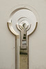
Modern SitesSite Name: Summstein GrünbrückeCountry: Germany Land: Bavaria Type: Modern Stone Circle etc
Nearest Town: Aschaffenburg
Latitude: 49.977856N Longitude: 9.160183E
Condition:
| 5 | Perfect |
| 4 | Almost Perfect |
| 3 | Reasonable but with some damage |
| 2 | Ruined but still recognisable as an ancient site |
| 1 | Pretty much destroyed, possibly visible as crop marks |
| 0 | No data. |
| -1 | Completely destroyed |
| 5 | Superb |
| 4 | Good |
| 3 | Ordinary |
| 2 | Not Good |
| 1 | Awful |
| 0 | No data. |
| 5 | Can be driven to, probably with disabled access |
| 4 | Short walk on a footpath |
| 3 | Requiring a bit more of a walk |
| 2 | A long walk |
| 1 | In the middle of nowhere, a nightmare to find |
| 0 | No data. |
| 5 | co-ordinates taken by GPS or official recorded co-ordinates |
| 4 | co-ordinates scaled from a detailed map |
| 3 | co-ordinates scaled from a bad map |
| 2 | co-ordinates of the nearest village |
| 1 | co-ordinates of the nearest town |
| 0 | no data |
Be the first person to rate this site - see the 'Contribute!' box in the right hand menu.
Internal Links:
External Links:
")
Further information and literature on Summsteine in general: MP page Großer Summstein.
Reference:
[01] Rokec, M.: Summstein auf der Grünbrücke.
You may be viewing yesterday's version of this page. To see the most up to date information please register for a free account.
Do not use the above information on other web sites or publications without permission of the contributor.
Nearby Images from Flickr

The above images may not be of the site on this page, but were taken nearby. They are loaded from Flickr so please click on them for image credits.
Click here to see more info for this site
Nearby sites
Click here to view sites on an interactive map of the areaKey: Red: member's photo, Blue: 3rd party photo, Yellow: other image, Green: no photo - please go there and take one, Grey: site destroyed
Download sites to:
KML (Google Earth)
GPX (GPS waypoints)
CSV (Garmin/Navman)
CSV (Excel)
To unlock full downloads you need to sign up as a Contributory Member. Otherwise downloads are limited to 50 sites.
Turn off the page maps and other distractions
Nearby sites listing. In the following links * = Image available
18.5km WSW 242° Stein Klein-Umstadt Standing Stone (Menhir)
22.9km N 356° Pfortenstein* Standing Stone (Menhir)
31.2km SW 226° Wersau Menhir* Standing Stone (Menhir)
33.1km WSW 249° Darmstadt Steinkreis* Stone Circle
33.5km NW 319° Schöneck-Kilianstädten* Ancient Village or Settlement
34.7km WNW 286° Alter Hegwald Barrow Cemetery
34.8km WNW 287° Rainheeg Grabhügelgruppe Barrow Cemetery
36.3km WNW 287° Heidenstock Grabhügelgruppe Barrow Cemetery
37.3km WNW 293° Frankfurt Archaelogisches Museum* Museum
37.3km WNW 293° Frankfurt Museum für Vor-und Frühgeschichte Museum
37.6km WNW 289° Eichlehen Grabhügelgruppe Barrow Cemetery
37.8km WSW 252° Hinkelstein Darmstadt Natural Stone / Erratic / Other Natural Feature
38.0km NNW 344° Glauberg Fürstengrabhügel* Round Barrow(s)
38.1km NNW 343° Keltenwelt am Glauberg* Museum
38.3km NNW 344° Glauberg Siedlung* Hillfort
38.8km WNW 288° Summstein Niederrad* Modern Stone Circle etc
39.1km NNW 343° Glauberg Museum* Museum
41.0km WSW 240° Summstein Mühltal Modern Stone Circle etc
44.2km SSE 151° Hardheim Grabhügelgruppe* Round Barrow(s)
44.4km NW 324° Friedberg Siedlung Ancient Village or Settlement
44.4km SSW 214° Summstein Hammelbach Modern Stone Circle etc
45.4km S 171° Buttenthalhöhle Cave or Rock Shelter
46.8km SSE 151° Erfatal-Hardheim Museum Museum
46.9km WSW 236° Alsbach Hinkelstein* Standing Stone (Menhir)
47.9km WNW 295° Summstein Eschborn Modern Stone Circle etc
View more nearby sites and additional images

")
 We would like to know more about this location. Please feel free to add a brief description and any relevant information in your own language.
 Wir möchten mehr über diese Stätte erfahren. Bitte zögern Sie nicht, eine kurze Beschreibung und relevante Informationen in Deutsch hinzuzufügen.
 Nous aimerions en savoir encore un peu sur les lieux. S'il vous plaît n'hesitez pas à ajouter une courte description et tous les renseignements pertinents dans votre propre langue.
 Quisieramos informarnos un poco más de las lugares. No dude en añadir una breve descripción y otros datos relevantes en su propio idioma.