<< Text Pages >> Teufelskanzel Steinblock - Natural Stone / Erratic / Other Natural Feature in Germany in Lower Saxony, Bremen
Submitted by KaiHofmann on Thursday, 16 April 2015 Page Views: 1118
Natural PlacesSite Name: Teufelskanzel SteinblockCountry: Germany
NOTE: This site is 12.097 km away from the location you searched for.
Land: Lower Saxony, Bremen Type: Natural Stone / Erratic / Other Natural Feature
Nearest Town: Barsingshausen Nearest Village: Nienstedt
Latitude: 52.272645N Longitude: 9.448540E
Condition:
| 5 | Perfect |
| 4 | Almost Perfect |
| 3 | Reasonable but with some damage |
| 2 | Ruined but still recognisable as an ancient site |
| 1 | Pretty much destroyed, possibly visible as crop marks |
| 0 | No data. |
| -1 | Completely destroyed |
| 5 | Superb |
| 4 | Good |
| 3 | Ordinary |
| 2 | Not Good |
| 1 | Awful |
| 0 | No data. |
| 5 | Can be driven to, probably with disabled access |
| 4 | Short walk on a footpath |
| 3 | Requiring a bit more of a walk |
| 2 | A long walk |
| 1 | In the middle of nowhere, a nightmare to find |
| 0 | No data. |
| 5 | co-ordinates taken by GPS or official recorded co-ordinates |
| 4 | co-ordinates scaled from a detailed map |
| 3 | co-ordinates scaled from a bad map |
| 2 | co-ordinates of the nearest village |
| 1 | co-ordinates of the nearest town |
| 0 | no data |
Be the first person to rate this site - see the 'Contribute!' box in the right hand menu.
Internal Links:
External Links:
Natural Stone / Erratic / Other Natural Feature in Lower Saxony, Bremen
Another cube shaped boulder close to the Alte Taufe, possible a part of an ancient germanic sanctuary. Many myths are told about this area.
You may be viewing yesterday's version of this page. To see the most up to date information please register for a free account.
Do not use the above information on other web sites or publications without permission of the contributor.
Nearby Images from Flickr
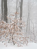


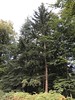
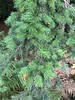
The above images may not be of the site on this page, but were taken nearby. They are loaded from Flickr so please click on them for image credits.
Click here to see more info for this site
Nearby sites
Click here to view sites on an interactive map of the areaKey: Red: member's photo, Blue: 3rd party photo, Yellow: other image, Green: no photo - please go there and take one, Grey: site destroyed
Download sites to:
KML (Google Earth)
GPX (GPS waypoints)
CSV (Garmin/Navman)
CSV (Excel)
To unlock full downloads you need to sign up as a Contributory Member. Otherwise downloads are limited to 50 sites.
Turn off the page maps and other distractions
Nearby sites listing. In the following links * = Image available
868m WNW 291° Alte Taufe* Natural Stone / Erratic / Other Natural Feature
10.3km ENE 73° Gehrden, Suerser Berg* Stone Circle
10.4km ENE 63° Ringwall Gehrdener Burgberg* Hillfort
12.0km E 96° Rästepahl Early Christian Sculptured Stone
12.6km NNW 333° Urnengräberfeld Hohnhorst* Barrow Cemetery
15.7km NE 56° Grabhügelfeld Benther Berg Barrow Cemetery
16.1km NE 56° Early Metalworking at the Benther Berg Ancient Mine, Quarry or other Industry
22.3km ENE 63° Anderlingen Steinkistengrab (Hannover)* Chambered Tomb
22.3km ENE 62° Niedersächsischen Landesmuseums Hannover* Museum
25.1km ENE 59° Das Rad* Turf Maze
25.3km NW 318° Dinosaurierpark Münchehagen Museum
25.9km NNW 342° Davidstein* Natural Stone / Erratic / Other Natural Feature
26.0km ENE 66° Kopperloch* Holy Well or Sacred Spring
26.1km NNW 340° Goliathstein* Natural Stone / Erratic / Other Natural Feature
26.1km ENE 66° Heiligers Brunnen* Holy Well or Sacred Spring
27.3km W 267° Summstein Bückeburg* Modern Stone Circle etc
29.0km ESE 122° Grabhügelfeld Osterholz Barrow Cemetery
29.7km NW 323° Düsselburg* Ancient Village or Settlement
30.0km SW 235° Evastein* Natural Stone / Erratic / Other Natural Feature
30.2km SW 231° Grabhügel am Gersiek Round Barrow(s)
30.4km ESE 120° Beusterburg Ringwall Causewayed Enclosure
30.6km ENE 65° Urnengräberfeld Misburg* Barrow Cemetery
31.6km NW 313° Opferstein Wasserstraße Holed Stone
31.7km NW 313° Marklo Quelle Opferstein Holy Well or Sacred Spring
31.9km SW 234° Grabhügel Almena Round Barrow(s)
View more nearby sites and additional images


 We would like to know more about this location. Please feel free to add a brief description and any relevant information in your own language.
 Wir möchten mehr über diese Stätte erfahren. Bitte zögern Sie nicht, eine kurze Beschreibung und relevante Informationen in Deutsch hinzuzufügen.
 Nous aimerions en savoir encore un peu sur les lieux. S'il vous plaît n'hesitez pas à ajouter une courte description et tous les renseignements pertinents dans votre propre langue.
 Quisieramos informarnos un poco más de las lugares. No dude en añadir una breve descripción y otros datos relevantes en su propio idioma.