


<< Our Photo Pages >> Glauberg Siedlung - Hillfort in Germany in Hesse
Submitted by AlexHunger on Monday, 24 October 2005 Page Views: 5189
Iron Age and Later PrehistorySite Name: Glauberg SiedlungCountry: Germany Land: Hesse Type: Hillfort
Nearest Town: Frankfurt Nearest Village: Glauberg
Latitude: 50.308510N Longitude: 9.008140E
Condition:
| 5 | Perfect |
| 4 | Almost Perfect |
| 3 | Reasonable but with some damage |
| 2 | Ruined but still recognisable as an ancient site |
| 1 | Pretty much destroyed, possibly visible as crop marks |
| 0 | No data. |
| -1 | Completely destroyed |
| 5 | Superb |
| 4 | Good |
| 3 | Ordinary |
| 2 | Not Good |
| 1 | Awful |
| 0 | No data. |
| 5 | Can be driven to, probably with disabled access |
| 4 | Short walk on a footpath |
| 3 | Requiring a bit more of a walk |
| 2 | A long walk |
| 1 | In the middle of nowhere, a nightmare to find |
| 0 | No data. |
| 5 | co-ordinates taken by GPS or official recorded co-ordinates |
| 4 | co-ordinates scaled from a detailed map |
| 3 | co-ordinates scaled from a bad map |
| 2 | co-ordinates of the nearest village |
| 1 | co-ordinates of the nearest town |
| 0 | no data |
Internal Links:
External Links:
")
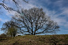
500 Meter long Celtic Hillforth dating to About 500 BCE. The inhabitants also set up the 2 tumuli and ditches in the valey below, where chieftain graves and statues were found. The hillfort was again reused in the middle ages, from which stone foundations remain.
You may be viewing yesterday's version of this page. To see the most up to date information please register for a free account.
")
Do not use the above information on other web sites or publications without permission of the contributor.
Nearby Images from Flickr


The above images may not be of the site on this page, but were taken nearby. They are loaded from Flickr so please click on them for image credits.
Click here to see more info for this site
Nearby sites
Click here to view sites on an interactive map of the areaKey: Red: member's photo, Blue: 3rd party photo, Yellow: other image, Green: no photo - please go there and take one, Grey: site destroyed
Download sites to:
KML (Google Earth)
GPX (GPS waypoints)
CSV (Garmin/Navman)
CSV (Excel)
To unlock full downloads you need to sign up as a Contributory Member. Otherwise downloads are limited to 50 sites.
Turn off the page maps and other distractions
Nearby sites listing. In the following links * = Image available
259m SSW 194° Keltenwelt am Glauberg* Museum
344m S 172° Glauberg Fürstengrabhügel* Round Barrow(s)
893m NW 317° Glauberg Museum* Museum
14.7km NNW 334° Kindstein* Standing Stone (Menhir)
15.6km W 266° Friedberg Siedlung Ancient Village or Settlement
16.0km SW 224° Schöneck-Kilianstädten* Ancient Village or Settlement
16.3km NNE 14° Dicker Stein Eichelsdorf Standing Stone (Menhir)
16.7km SSE 147° Pfortenstein* Standing Stone (Menhir)
23.3km NW 321° Heiliger Stein* Passage Grave
23.4km NW 317° Kräppelstein* Standing Stone (Menhir)
23.5km NW 323° Vorderwald Muschenheim* Barrow Cemetery
23.5km NW 321° Hügelgrab Heiliger Stein* Round Barrow(s)
24.0km W 263° Hünengrab Köppern Round Barrow(s)
24.6km WNW 292° Menhir Ober-Moerlen* Standing Stone (Menhir)
28.6km WNW 302° Butzbach Menhir* Standing Stone (Menhir)
30.0km WSW 255° Gluckenstein* Standing Stone (Menhir)
30.1km WNW 292° Hausberg Hillfort* Hillfort
31.6km W 263° Saalburg* Hillfort
32.3km SW 227° Frankfurt Archaelogisches Museum* Museum
32.3km SW 227° Frankfurt Museum für Vor-und Frühgeschichte Museum
32.8km WSW 249° Vortaunusmuseum Oberursel Museum
34.7km SW 220° Rainheeg Grabhügelgruppe Barrow Cemetery
34.8km WSW 248° Heidetränk Oppidum* Hillfort
34.9km SW 225° Eichlehen Grabhügelgruppe Barrow Cemetery
35.4km SW 219° Alter Hegwald Barrow Cemetery
View more nearby sites and additional images


 We would like to know more about this location. Please feel free to add a brief description and any relevant information in your own language.
 Wir möchten mehr über diese Stätte erfahren. Bitte zögern Sie nicht, eine kurze Beschreibung und relevante Informationen in Deutsch hinzuzufügen.
 Nous aimerions en savoir encore un peu sur les lieux. S'il vous plaît n'hesitez pas à ajouter une courte description et tous les renseignements pertinents dans votre propre langue.
 Quisieramos informarnos un poco más de las lugares. No dude en añadir una breve descripción y otros datos relevantes en su propio idioma.