<< Our Photo Pages >> Haselhoern Huegelgrab (1) - Round Barrow(s) in Germany in Lower Saxony, Bremen
Submitted by Martin_L on Thursday, 20 August 2009 Page Views: 2545
Neolithic and Bronze AgeSite Name: Haselhoern Huegelgrab (1) Alternative Name: Hügelgrab HaselhörnCountry: Germany Land: Lower Saxony, Bremen Type: Round Barrow(s)
Nearest Town: Bremerhaven Nearest Village: Flögeln
Latitude: 53.663200N Longitude: 8.777500E
Condition:
| 5 | Perfect |
| 4 | Almost Perfect |
| 3 | Reasonable but with some damage |
| 2 | Ruined but still recognisable as an ancient site |
| 1 | Pretty much destroyed, possibly visible as crop marks |
| 0 | No data. |
| -1 | Completely destroyed |
| 5 | Superb |
| 4 | Good |
| 3 | Ordinary |
| 2 | Not Good |
| 1 | Awful |
| 0 | No data. |
| 5 | Can be driven to, probably with disabled access |
| 4 | Short walk on a footpath |
| 3 | Requiring a bit more of a walk |
| 2 | A long walk |
| 1 | In the middle of nowhere, a nightmare to find |
| 0 | No data. |
| 5 | co-ordinates taken by GPS or official recorded co-ordinates |
| 4 | co-ordinates scaled from a detailed map |
| 3 | co-ordinates scaled from a bad map |
| 2 | co-ordinates of the nearest village |
| 1 | co-ordinates of the nearest town |
| 0 | no data |
Internal Links:
External Links:
I have visited· I would like to visit
Martin_L has visited here
 (PID:49542)")
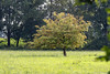
Round barrow, most probably dating back to early bronze age. Nicely situated in a group of trees inside some fields. The barrow was robbed, but nevertheless it is well worth a visit.
You may be viewing yesterday's version of this page. To see the most up to date information please register for a free account.
 (PID:91023)")
Do not use the above information on other web sites or publications without permission of the contributor.
Nearby Images from Flickr


The above images may not be of the site on this page, but were taken nearby. They are loaded from Flickr so please click on them for image credits.
Click here to see more info for this site
Nearby sites
Click here to view sites on an interactive map of the areaKey: Red: member's photo, Blue: 3rd party photo, Yellow: other image, Green: no photo - please go there and take one, Grey: site destroyed
Download sites to:
KML (Google Earth)
GPX (GPS waypoints)
CSV (Garmin/Navman)
CSV (Excel)
To unlock full downloads you need to sign up as a Contributory Member. Otherwise downloads are limited to 50 sites.
Turn off the page maps and other distractions
Nearby sites listing. In the following links * = Image available
478m WSW 240° Floegeln Steinkistengrab* Cist
663m SSW 202° Floegelner Holz Huegelgrab (2) Round Barrow(s)
789m SW 234° Floegelner Holz Huegelgrab (1) Round Barrow(s)
1.3km WNW 282° Stueh Huegelgrab (2) Round Barrow(s)
1.4km NW 309° Flögeln-Eekhöltjen* Ancient Village or Settlement
1.7km W 274° Stueh Huegelgrab (1) Round Barrow(s)
2.0km SSE 155° Floegeln Grabhuegelgruppe (Floegeln 3)* Barrow Cemetery
2.0km SSE 152° Floegeln Vorgeschichtspfad* Museum
2.0km SSE 155° Floegeln Steingrab 1* Passage Grave
2.0km SSE 155° Floegeln Steingrab 2* Passage Grave
3.5km NNW 347° Wanna Steingrab (15)* Passage Grave
3.5km NNW 340° Wanna Steingrab (13)* Passage Grave
4.1km NNW 342° Wanna Steingrab (6)* Chambered Tomb
4.1km N 0° Wanna Steingrab (17)* Passage Grave
4.1km NNW 346° Wanna Steingrab (7) Karlskirche* Chambered Tomb
4.2km N 359° Wanna Steingrab (16)* Passage Grave
4.4km N 8° Wanna Steingrab (12)* Chambered Tomb
4.8km NNE 18° Wanna Steingrab (11)* Chambered Tomb
5.0km NNE 18° Wanna Steingrab (10)* Chambered Tomb
5.1km N 10° Wanna Steingrab (9)* Chambered Tomb
5.1km N 10° Grabhügelgruppe Am Hohen Kopf* Barrow Cemetery
5.1km N 10° Wanna Steingrab (8)* Chambered Tomb
5.9km SE 134° Bederkesa Steinring* Rock Art
5.9km SE 133° Museum Burg Bederkesa* Museum
6.7km SW 214° Drangstedt Grab 4* Chambered Tomb
View more nearby sites and additional images


 We would like to know more about this location. Please feel free to add a brief description and any relevant information in your own language.
 Wir möchten mehr über diese Stätte erfahren. Bitte zögern Sie nicht, eine kurze Beschreibung und relevante Informationen in Deutsch hinzuzufügen.
 Nous aimerions en savoir encore un peu sur les lieux. S'il vous plaît n'hesitez pas à ajouter une courte description et tous les renseignements pertinents dans votre propre langue.
 Quisieramos informarnos un poco más de las lugares. No dude en añadir una breve descripción y otros datos relevantes en su propio idioma.