

<< Our Photo Pages >> Bundi - Ancient Village or Settlement in India
Submitted by motist on Sunday, 28 January 2007 Page Views: 9180
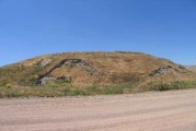
Multi-periodSite Name: BundiCountry: India Type: Ancient Village or Settlement
Nearest Town: Kota
Latitude: 25.441144N Longitude: 75.642408E
Condition:
| 5 | Perfect |
| 4 | Almost Perfect |
| 3 | Reasonable but with some damage |
| 2 | Ruined but still recognisable as an ancient site |
| 1 | Pretty much destroyed, possibly visible as crop marks |
| 0 | No data. |
| -1 | Completely destroyed |
| 5 | Superb |
| 4 | Good |
| 3 | Ordinary |
| 2 | Not Good |
| 1 | Awful |
| 0 | No data. |
| 5 | Can be driven to, probably with disabled access |
| 4 | Short walk on a footpath |
| 3 | Requiring a bit more of a walk |
| 2 | A long walk |
| 1 | In the middle of nowhere, a nightmare to find |
| 0 | No data. |
| 5 | co-ordinates taken by GPS or official recorded co-ordinates |
| 4 | co-ordinates scaled from a detailed map |
| 3 | co-ordinates scaled from a bad map |
| 2 | co-ordinates of the nearest village |
| 1 | co-ordinates of the nearest town |
| 0 | no data |
Internal Links:
External Links:
")
In early times, the city of Bundi and its surrounding areas was inhabited by some local tribes. Among the various tribes and clans, the Meenas were the most powerful and dominant. The city of Bundi is also believed to derive its name from the name of one of the prominent Meena chieftains, Bunda Meena. The Hada Rajputs are also an integral part of the history of this Rajasthan city. The Hadoti region, which is the main base of Bundi, derived its name from the Hada Rajputs. The Hada Rajputs are actually a branch of the Chauhan clan. They dominated the city from the 12th century and continued doing so for a long period of time. It was in 1193 that Mohammad Ghori defeated Prithviraj Chauhan in a fierce battle that raged between them. Some of the nobles of Prithviraj Chauhan fled to the nearby areas in the Chambal Valley. The valley area was inhabited by local tribes and clans and the nobles dominated these tribes and brought the area of Hadoti under their dominance. Later two states were formed - Kota and Bundi - on both sides of the River Chambal. With time, Bundi lost its significance to Kota. During the British rule, Bundi existed as an independent state. After 1947, the city was made a part of the state of Rajasthan. o-ordinates by GPS.
You may be viewing yesterday's version of this page. To see the most up to date information please register for a free account.
")
")
")
")
")
")
")
")
")
")
")
")
")
")
")
")
")
")
")
")
")
")
")
")
These are just the first 25 photos of Bundi. If you log in with a free user account you will be able to see our entire collection.
Do not use the above information on other web sites or publications without permission of the contributor.
Click here to see more info for this site
Nearby sites
Click here to view sites on an interactive map of the areaKey: Red: member's photo, Blue: 3rd party photo, Yellow: other image, Green: no photo - please go there and take one, Grey: site destroyed
Download sites to:
KML (Google Earth)
GPX (GPS waypoints)
CSV (Garmin/Navman)
CSV (Excel)
To unlock full downloads you need to sign up as a Contributory Member. Otherwise downloads are limited to 50 sites.
Turn off the page maps and other distractions
Nearby sites listing. In the following links * = Image available
117.4km WSW 239° Chittorgarh fort* Hillfort
121.5km SW 233° Udaipur* Ancient Temple
208.6km WSW 249° Eklingji Temple* Ancient Temple
209.2km WSW 248° Nagahyuda Jain Temple* Ancient Temple
215.7km WSW 244° Ahar Royal Cenotaphs* Ancient Village or Settlement
218.9km WSW 247° South Rajasthan folks & guardian stones* Ancient Temple
219.6km WSW 244° Udaipur guardian stones* Standing Stones
252.3km S 177° Ujjain* Ancient Temple
253.8km NNW 328° Sarasvati River Indus script Ancient Village or Settlement
271.0km W 264° Korta, Pali Taluka* Ancient Temple
304.0km SE 134° Vidisha, Madhya Pradesh* Ancient Temple
304.4km SE 135° Sanchi* Ancient Temple
304.9km SE 134° Bijamandal Temple at Vidisha* Ancient Temple
305.6km SE 134° Heliodorus pillar* Ancient Temple
341.9km WSW 251° Mount Abu* Ancient Temple
342.6km SE 144° Bhim Betka* Rock Art
357.0km SSW 194° Bagh Cave Temples* Ancient Temple
375.4km NNE 24° Qutab Minar Complex* Ancient Temple
410.7km NNE 16° Farmana Harappan burial site Ancient Village or Settlement
430.4km N 6° Rakhigarhi* Ancient Village or Settlement
473.5km SW 227° Lothal* Ancient Village or Settlement
489.1km ENE 76° Jajmau ka tila Ancient Village or Settlement
498.3km WNW 290° Jaisalmer Hero Stones* Standing Stones
499.6km WNW 290° Jaisalmer area* Sculptured Stone
504.4km WSW 238° Dhrangadhra* Standing Stone (Menhir)
View more nearby sites and additional images


 We would like to know more about this location. Please feel free to add a brief description and any relevant information in your own language.
 Wir möchten mehr über diese Stätte erfahren. Bitte zögern Sie nicht, eine kurze Beschreibung und relevante Informationen in Deutsch hinzuzufügen.
 Nous aimerions en savoir encore un peu sur les lieux. S'il vous plaît n'hesitez pas à ajouter une courte description et tous les renseignements pertinents dans votre propre langue.
 Quisieramos informarnos un poco más de las lugares. No dude en añadir una breve descripción y otros datos relevantes en su propio idioma.