<< Text Pages >> Burzahom Archaeological Site - Standing Stones in India
Submitted by Anonymous on Friday, 09 August 2019 Page Views: 1546
Neolithic and Bronze AgeSite Name: Burzahom Archaeological SiteCountry: India
NOTE: This site is 113.256 km away from the location you searched for.
Type: Standing Stones
Nearest Town: Srinagar Nearest Village: burzahom
Latitude: 34.169252N Longitude: 74.866970E
Condition:
| 5 | Perfect |
| 4 | Almost Perfect |
| 3 | Reasonable but with some damage |
| 2 | Ruined but still recognisable as an ancient site |
| 1 | Pretty much destroyed, possibly visible as crop marks |
| 0 | No data. |
| -1 | Completely destroyed |
| 5 | Superb |
| 4 | Good |
| 3 | Ordinary |
| 2 | Not Good |
| 1 | Awful |
| 0 | No data. |
| 5 | Can be driven to, probably with disabled access |
| 4 | Short walk on a footpath |
| 3 | Requiring a bit more of a walk |
| 2 | A long walk |
| 1 | In the middle of nowhere, a nightmare to find |
| 0 | No data. |
| 5 | co-ordinates taken by GPS or official recorded co-ordinates |
| 4 | co-ordinates scaled from a detailed map |
| 3 | co-ordinates scaled from a bad map |
| 2 | co-ordinates of the nearest village |
| 1 | co-ordinates of the nearest town |
| 0 | no data |
Internal Links:
External Links:
Standing Stones in India
The name Burzahom roughly translates as 'place [hom] of birch [burz]]' in Kashmiri. The site is located 5 km from the famous Mughal garden of Shalimar and 16 km north -east of Srinagar.
https://lostkashmirihistory.com/burzahom-that-was
You may be viewing yesterday's version of this page. To see the most up to date information please register for a free account.
Do not use the above information on other web sites or publications without permission of the contributor.
Nearby Images from Flickr
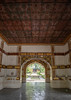
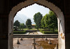
The above images may not be of the site on this page, but were taken nearby. They are loaded from Flickr so please click on them for image credits.
Click here to see more info for this site
Nearby sites
Click here to view sites on an interactive map of the areaKey: Red: member's photo, Blue: 3rd party photo, Yellow: other image, Green: no photo - please go there and take one, Grey: site destroyed
Download sites to:
KML (Google Earth)
GPX (GPS waypoints)
CSV (Garmin/Navman)
CSV (Excel)
To unlock full downloads you need to sign up as a Contributory Member. Otherwise downloads are limited to 50 sites.
Turn off the page maps and other distractions
Nearby sites listing. In the following links * = Image available
139.7km E 80° Mulbekh Maitreya rock sculpture Sculptured Stone
173.5km WSW 254° Threatened Rock Shelters in Islamabad* Cave or Rock Shelter
176.4km E 81° Dhomkar Rock Art* Rock Art
180.4km WSW 255° Margalla Buddhist Caves Cave or Rock Shelter
181.4km E 84° Khalsi Petroglyphs Rock Art
194.5km E 85° Nurla Petroglyphs Rock Art
194.6km WSW 257° Taxila Museum* Museum
201.4km NNW 344° Kargah Buddha* Rock Art
203.6km E 85° Hemis Shukpachan engraved stone* Rock Art
203.8km E 85° Hemis Shukpachan cup marked stone* Rock Art
203.8km E 85° Hemis Shukpachan Menhir* Standing Stone (Menhir)
203.9km E 85° Hemis Shukpachen Palace* Ancient Palace
210.3km E 87° Alchi petroglyphs* Rock Art
212.4km E 88° Alchi Gompa* Ancient Temple
213.6km E 88° Chilungtse altar stone Carving
232.9km W 273° Asota (Kalula) circle* Stone Circle
234.0km E 89° Taroo petroglyphs Rock Art
238.2km E 81° Camouflage Shield Stone* Rock Art
239.5km N 355° Hunza Valley Petroglyphs* Rock Art
242.0km E 97° Markha valley Ladakh, Shorten's (Stupa's)* Ancient Temple
242.2km ENE 78° Hundar Buddha sculptured stone* Rock Art
246.4km WNW 285° Swat Buddha Sculptured Stone
246.4km WNW 285° Ghalegay Caves Cave or Rock Shelter
247.0km WNW 284° Shingardar Stupa Ancient Temple
249.6km E 89° Maitreya Buddha and Avalokiteshvara rock carving* Sculptured Stone
View more nearby sites and additional images


 We would like to know more about this location. Please feel free to add a brief description and any relevant information in your own language.
 Wir möchten mehr über diese Stätte erfahren. Bitte zögern Sie nicht, eine kurze Beschreibung und relevante Informationen in Deutsch hinzuzufügen.
 Nous aimerions en savoir encore un peu sur les lieux. S'il vous plaît n'hesitez pas à ajouter une courte description et tous les renseignements pertinents dans votre propre langue.
 Quisieramos informarnos un poco más de las lugares. No dude en añadir una breve descripción y otros datos relevantes en su propio idioma.