<< Text Pages >> Forêt de Haguenau Necropolis - Barrow Cemetery in France in Alsace-Lorraine:Bas-Rhin (67)
Submitted by KaiHofmann on Tuesday, 27 August 2013 Page Views: 2603
Neolithic and Bronze AgeSite Name: Forêt de Haguenau NecropolisCountry: France
NOTE: This site is 9.454 km away from the location you searched for.
Département: Alsace-Lorraine:Bas-Rhin (67) Type: Barrow Cemetery
Nearest Town: Haguenau
Latitude: 48.851282N Longitude: 7.863962E
Condition:
| 5 | Perfect |
| 4 | Almost Perfect |
| 3 | Reasonable but with some damage |
| 2 | Ruined but still recognisable as an ancient site |
| 1 | Pretty much destroyed, possibly visible as crop marks |
| 0 | No data. |
| -1 | Completely destroyed |
| 5 | Superb |
| 4 | Good |
| 3 | Ordinary |
| 2 | Not Good |
| 1 | Awful |
| 0 | No data. |
| 5 | Can be driven to, probably with disabled access |
| 4 | Short walk on a footpath |
| 3 | Requiring a bit more of a walk |
| 2 | A long walk |
| 1 | In the middle of nowhere, a nightmare to find |
| 0 | No data. |
| 5 | co-ordinates taken by GPS or official recorded co-ordinates |
| 4 | co-ordinates scaled from a detailed map |
| 3 | co-ordinates scaled from a bad map |
| 2 | co-ordinates of the nearest village |
| 1 | co-ordinates of the nearest town |
| 0 | no data |
Be the first person to rate this site - see the 'Contribute!' box in the right hand menu.
Internal Links:
External Links:
Barrow Cemetery in Alsace:Bas-Rhin (67)
In a large "holy forest" (its old name) around Haguenau there are over 600 Iron Age burial mounds.
You may be viewing yesterday's version of this page. To see the most up to date information please register for a free account.
Do not use the above information on other web sites or publications without permission of the contributor.
Nearby Images from Flickr
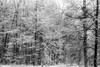
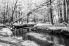
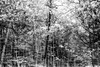

The above images may not be of the site on this page, but were taken nearby. They are loaded from Flickr so please click on them for image credits.
Click here to see more info for this site
Nearby sites
Click here to view sites on an interactive map of the areaKey: Red: member's photo, Blue: 3rd party photo, Yellow: other image, Green: no photo - please go there and take one, Grey: site destroyed
Download sites to:
KML (Google Earth)
GPX (GPS waypoints)
CSV (Garmin/Navman)
CSV (Excel)
To unlock full downloads you need to sign up as a Contributory Member. Otherwise downloads are limited to 50 sites.
Turn off the page maps and other distractions
Nearby sites listing. In the following links * = Image available
15.0km SE 140° Greffern Menhir I Standing Stone (Menhir)
15.0km SE 140° Greffern Menhir II Standing Stone (Menhir)
17.9km N 358° Climbronn Holy Well or Sacred Spring
18.1km ESE 111° Heiligenbuck Artificial Mound
18.9km NW 304° La Maison de l'Archéologie des Vosges du Nord Museum
20.7km NW 321° Le Grand Gres* Modern Stone Circle etc
20.8km NW 324° Steinkopf Polissoir* Polissoir
21.8km NW 304° Wasembourg temple* Ancient Temple
21.8km WNW 301° Hexenplaetzel* Ancient Temple
21.9km WNW 303° Le Jardin des Fées* Misc. Earthwork
22.0km WNW 302° Les Pierres à Cupules* Natural Stone / Erratic / Other Natural Feature
22.2km NW 306° Ziegenberg Camp Celtique* Ancient Village or Settlement
22.4km N 3° Löffelskreuz Ancient Cross
23.4km NW 309° La Liese* Rock Art
24.5km NW 317° L´Homme* Natural Stone / Erratic / Other Natural Feature
24.8km NW 313° Heidenkopf Standing Stone (Menhir)
25.0km NW 309° Hagelbusch* Standing Stone (Menhir)
25.1km NNW 333° Maimont Keltenring* Hillfort
25.2km NNW 333° Maimont Opferschale* Natural Stone / Erratic / Other Natural Feature
26.8km NW 316° Hirschfelsen* Natural Stone / Erratic / Other Natural Feature
27.2km N 10° Steinerner Tisch Rock Art
27.4km NW 304° Hausberg Philipsbourg Polissoir
27.8km NNE 33° Schaidter Hinkelstein* Standing Stone (Menhir)
28.9km NNW 326° Summstein Rösselsquelle Modern Stone Circle etc
29.9km NW 310° Rocher et Arche de l´Erbsenfelsen* Natural Stone / Erratic / Other Natural Feature
View more nearby sites and additional images


 We would like to know more about this location. Please feel free to add a brief description and any relevant information in your own language.
 Wir möchten mehr über diese Stätte erfahren. Bitte zögern Sie nicht, eine kurze Beschreibung und relevante Informationen in Deutsch hinzuzufügen.
 Nous aimerions en savoir encore un peu sur les lieux. S'il vous plaît n'hesitez pas à ajouter une courte description et tous les renseignements pertinents dans votre propre langue.
 Quisieramos informarnos un poco más de las lugares. No dude en añadir una breve descripción y otros datos relevantes en su propio idioma.