<< Our Photo Pages >> Musée des Merveilles - Museum in France in Provence:Alpes-Maritimes (06)
Submitted by KaiHofmann on Wednesday, 26 June 2013 Page Views: 1741
MuseumsSite Name: Musée des MerveillesCountry: France
NOTE: This site is 7.216 km away from the location you searched for.
Département: Provence:Alpes-Maritimes (06) Type: Museum
Nearest Town: Tende
Latitude: 44.090306N Longitude: 7.592650E
Condition:
| 5 | Perfect |
| 4 | Almost Perfect |
| 3 | Reasonable but with some damage |
| 2 | Ruined but still recognisable as an ancient site |
| 1 | Pretty much destroyed, possibly visible as crop marks |
| 0 | No data. |
| -1 | Completely destroyed |
| 5 | Superb |
| 4 | Good |
| 3 | Ordinary |
| 2 | Not Good |
| 1 | Awful |
| 0 | No data. |
| 5 | Can be driven to, probably with disabled access |
| 4 | Short walk on a footpath |
| 3 | Requiring a bit more of a walk |
| 2 | A long walk |
| 1 | In the middle of nowhere, a nightmare to find |
| 0 | No data. |
| 5 | co-ordinates taken by GPS or official recorded co-ordinates |
| 4 | co-ordinates scaled from a detailed map |
| 3 | co-ordinates scaled from a bad map |
| 2 | co-ordinates of the nearest village |
| 1 | co-ordinates of the nearest town |
| 0 | no data |
Internal Links:
External Links:
")
Museum with information about the petroglyphs of the Vallée des Merveilles.
You may be viewing yesterday's version of this page. To see the most up to date information please register for a free account.
")
Do not use the above information on other web sites or publications without permission of the contributor.
Nearby Images from Flickr

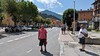
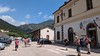
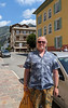

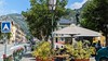
The above images may not be of the site on this page, but were taken nearby. They are loaded from Flickr so please click on them for image credits.
Click here to see more info for this site
Nearby sites
Click here to view sites on an interactive map of the areaKey: Red: member's photo, Blue: 3rd party photo, Yellow: other image, Green: no photo - please go there and take one, Grey: site destroyed
Download sites to:
KML (Google Earth)
GPX (GPS waypoints)
CSV (Garmin/Navman)
CSV (Excel)
To unlock full downloads you need to sign up as a Contributory Member. Otherwise downloads are limited to 50 sites.
Turn off the page maps and other distractions
Nearby sites listing. In the following links * = Image available
5.8km ESE 122° Notre-Dame-des-Fontaines* Holy Well or Sacred Spring
9.7km W 270° Gravures Rupestres de Fontanalba* Rock Art
12.4km W 263° Gravures Rupestres de Vallée des Merveilles* Rock Art
13.4km NE 44° Lago della Ratoira Menhir Standing Stone (Menhir)
19.7km N 3° Bisalta Menhir Standing Stone (Menhir)
20.4km ESE 118° Passo di Mezzaluna Menhir* Standing Stone (Menhir)
22.0km ESE 115° Sotto di St. Lorenzo Altar Rock Rock Art
25.3km SSW 210° Albarea Grotte Sepulcrale Cave or Rock Shelter
25.7km SW 226° Peire Cava Tumulus Artificial Mound
28.9km NE 35° Frabosa Sottana Barrows Round Barrow(s)
28.9km NE 35° Frabosa Sottana Menhirs Standing Stones
29.1km NE 34° Maudagna Valley engraved stone Rock Art
29.9km NE 37° Bassi Menhirs Standing Stones
30.1km NE 38° Bassi dolmen Burial Chamber or Dolmen
30.8km NE 36° St. Martino Cromlech Stone Circle
33.7km NE 47° Savin Menhir Standing Stone (Menhir)
34.4km ENE 62° Deversi Pietra delle Masche Cup Mark Stone Rock Art
34.4km S 188° Balzi Rossi* Cave or Rock Shelter
35.0km ENE 63° Deversi Engraved stone Rock Art
35.6km SSW 192° Musée de la Préhistoire régionale de Menton* Museum
37.6km SSW 195° Grotte du Vallonet Cave or Rock Shelter
37.6km SSW 194° Grotte du Repaire Cave or Rock Shelter
37.8km SSW 197° La Palmeraie Cave or Rock Shelter
38.8km NE 35° Briaglia menhir Standing Stone (Menhir)
40.8km W 274° Menhir de Tiecs Standing Stone (Menhir)
View more nearby sites and additional images


 We would like to know more about this location. Please feel free to add a brief description and any relevant information in your own language.
 Wir möchten mehr über diese Stätte erfahren. Bitte zögern Sie nicht, eine kurze Beschreibung und relevante Informationen in Deutsch hinzuzufügen.
 Nous aimerions en savoir encore un peu sur les lieux. S'il vous plaît n'hesitez pas à ajouter une courte description et tous les renseignements pertinents dans votre propre langue.
 Quisieramos informarnos un poco más de las lugares. No dude en añadir una breve descripción y otros datos relevantes en su propio idioma.