

<< Text Pages >> Schlossbann Biel-Büttenberg Schalenstein - Rock Art in Switzerland in Bern
Submitted by AlexHunger on Saturday, 18 February 2006 Page Views: 4854
Rock ArtSite Name: Schlossbann Biel-Büttenberg SchalensteinCountry: Switzerland
NOTE: This site is 0.501 km away from the location you searched for.
Canton: Bern Type: Rock Art
Nearest Town: Bern Nearest Village: Bern
Latitude: 46.943590N Longitude: 7.449030E
Condition:
| 5 | Perfect |
| 4 | Almost Perfect |
| 3 | Reasonable but with some damage |
| 2 | Ruined but still recognisable as an ancient site |
| 1 | Pretty much destroyed, possibly visible as crop marks |
| 0 | No data. |
| -1 | Completely destroyed |
| 5 | Superb |
| 4 | Good |
| 3 | Ordinary |
| 2 | Not Good |
| 1 | Awful |
| 0 | No data. |
| 5 | Can be driven to, probably with disabled access |
| 4 | Short walk on a footpath |
| 3 | Requiring a bit more of a walk |
| 2 | A long walk |
| 1 | In the middle of nowhere, a nightmare to find |
| 0 | No data. |
| 5 | co-ordinates taken by GPS or official recorded co-ordinates |
| 4 | co-ordinates scaled from a detailed map |
| 3 | co-ordinates scaled from a bad map |
| 2 | co-ordinates of the nearest village |
| 1 | co-ordinates of the nearest town |
| 0 | no data |
Internal Links:
External Links:
Cuphole stone in Bern
Stone measuring 1.56 Meters x 0.8 Meters x 1.35 Meters with 10 certain cupholes and 4 indistinkt ones removed from original location to the front of Historisches Museum.
Address: Helvetiaplatz 5, 3005
Phone: +41 31-3507711
You may be viewing yesterday's version of this page. To see the most up to date information please register for a free account.
Do not use the above information on other web sites or publications without permission of the contributor.
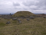
Nearby Images from Flickr


The above images may not be of the site on this page, but were taken nearby. They are loaded from Flickr so please click on them for image credits.
Click here to see more info for this site
Nearby sites
Click here to view sites on an interactive map of the areaKey: Red: member's photo, Blue: 3rd party photo, Yellow: other image, Green: no photo - please go there and take one, Grey: site destroyed
Download sites to:
KML (Google Earth)
GPX (GPS waypoints)
CSV (Garmin/Navman)
CSV (Excel)
To unlock full downloads you need to sign up as a Contributory Member. Otherwise downloads are limited to 50 sites.
Turn off the page maps and other distractions
Nearby sites listing. In the following links * = Image available
1m S 180° Utzigen ob Worb-Buchholz Schalenstein Rock Art
15.2km NNW 334° Grossaffoltern Schalenstein Rock Art
16.1km ESE 103° Lychleustein Möschberg-Oberthal* Modern Stone Circle etc
18.9km N 357° Hubelstein Biezwil* Natural Stone / Erratic / Other Natural Feature
19.5km N 357° Hubelstein Schalenstein Rock Art
20.9km N 5° Murlistein Rock Art
21.4km NNW 342° Dotzigeberg Schalenstein Rock Art
21.5km N 3° Fuchsenstein Schalenstein Rock Art
22.2km NNW 328° Roman temple district Petinesca* Ancient Temple
25.2km NNW 328° Längholz Heidenstein Natural Stone / Erratic / Other Natural Feature
25.2km NNW 328° Längholz Dachsenstein Rock Art
25.5km NNW 329° Längholz Schalenstein Rock Art
25.7km WNW 285° Findling (Schalenstein) Ins* Natural Stone / Erratic / Other Natural Feature
26.8km NW 324° Museum Schwab* Museum
26.8km NW 324° Luterhölzli Schalenstein Rock Art
26.8km NW 324° Brüggmöösli Schalenstein* Rock Art
27.0km N 350° Eichholz Schalenstein* Rock Art
27.1km N 5° Nennigkofen Schalenstein* Rock Art
27.2km W 274° Oppidum Mont Vully* Ancient Village or Settlement
27.4km NW 314° Druidenstein Rock Art
27.6km NW 313° Findling Holenstein* Natural Stone / Erratic / Other Natural Feature
28.4km W 274° Agassiz Stein* Natural Stone / Erratic / Other Natural Feature
29.4km WNW 291° Jolimont Grabhügelfeld Artificial Mound
29.6km WNW 291° Jolimont Schalensteine 2 Rock Art
29.6km WNW 291° Jolimont Schalensteine 3 Rock Art
View more nearby sites and additional images


 We would like to know more about this location. Please feel free to add a brief description and any relevant information in your own language.
 Wir möchten mehr über diese Stätte erfahren. Bitte zögern Sie nicht, eine kurze Beschreibung und relevante Informationen in Deutsch hinzuzufügen.
 Nous aimerions en savoir encore un peu sur les lieux. S'il vous plaît n'hesitez pas à ajouter une courte description et tous les renseignements pertinents dans votre propre langue.
 Quisieramos informarnos un poco más de las lugares. No dude en añadir una breve descripción y otros datos relevantes en su propio idioma.