<< Text Pages >> Les Pierres aux Fees - Rock Art in Switzerland in Wallis
Submitted by KaiHofmann on Wednesday, 02 February 2011 Page Views: 3073
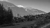
Rock ArtSite Name: Les Pierres aux Fees Alternative Name: Pierre aux Immoles, Pierre des Mayens BlancsCountry: Switzerland
NOTE: This site is 15.412 km away from the location you searched for.
Canton: Wallis Type: Rock Art
Nearest Town: Evolene Nearest Village: Villa
Latitude: 46.117210N Longitude: 7.505724E
Condition:
| 5 | Perfect |
| 4 | Almost Perfect |
| 3 | Reasonable but with some damage |
| 2 | Ruined but still recognisable as an ancient site |
| 1 | Pretty much destroyed, possibly visible as crop marks |
| 0 | No data. |
| -1 | Completely destroyed |
| 5 | Superb |
| 4 | Good |
| 3 | Ordinary |
| 2 | Not Good |
| 1 | Awful |
| 0 | No data. |
| 5 | Can be driven to, probably with disabled access |
| 4 | Short walk on a footpath |
| 3 | Requiring a bit more of a walk |
| 2 | A long walk |
| 1 | In the middle of nowhere, a nightmare to find |
| 0 | No data. |
| 5 | co-ordinates taken by GPS or official recorded co-ordinates |
| 4 | co-ordinates scaled from a detailed map |
| 3 | co-ordinates scaled from a bad map |
| 2 | co-ordinates of the nearest village |
| 1 | co-ordinates of the nearest town |
| 0 | no data |
Internal Links:
External Links:
Cup and Ring marks in Wallis
several rocks with cup-marks and lines.
You may be viewing yesterday's version of this page. To see the most up to date information please register for a free account.
Do not use the above information on other web sites or publications without permission of the contributor.
Nearby Images from Flickr

The above images may not be of the site on this page, but were taken nearby. They are loaded from Flickr so please click on them for image credits.
Click here to see more info for this site
Nearby sites
Click here to view sites on an interactive map of the areaKey: Red: member's photo, Blue: 3rd party photo, Yellow: other image, Green: no photo - please go there and take one, Grey: site destroyed
Download sites to:
KML (Google Earth)
GPX (GPS waypoints)
CSV (Garmin/Navman)
CSV (Excel)
To unlock full downloads you need to sign up as a Contributory Member. Otherwise downloads are limited to 50 sites.
Turn off the page maps and other distractions
Nearby sites listing. In the following links * = Image available
13.6km NNE 32° Pierre des Sauvages Rock Art
16.7km NNW 337° St-Léonard Menhirs Stone Row / Alignment
17.4km NW 320° Dolmen Don Bosco* Burial Chamber or Dolmen
17.4km NW 317° Chemin des Collines Menhirs* Stone Row / Alignment
17.5km NW 317° Sion Steinkistengrab* Burial Chamber or Dolmen
17.6km NNW 338° Crête-des-Barmes, St. Leonard Rock Art
20.6km SE 125° Heidenstein Ofenen Rock Art
28.1km ENE 74° Heidnische Tossu Modern Dolmen* Modern Stone Circle etc
31.8km NE 47° Heidnisch Biel Hillfort
41.9km WNW 298° Menhirs de Chessières* Standing Stones
42.1km S 190° Vollein Necropolis Barrow Cemetery
43.7km ENE 58° Naters Heidenstein Standing Stone (Menhir)
45.4km SSW 201° Saint Martin de Corleans Dolmen* Burial Chamber or Dolmen
61.3km E 83° Masso coppellato Alpe La Prasca* Sculptured Stone
61.6km SSE 151° Plan de Sorcières* Rock Art
64.0km ENE 68° Crampiolo* Sculptured Stone
64.7km ENE 68° Montorfano* Sculptured Stone
64.7km ENE 76° Sasso Coppellato* Sculptured Stone
65.7km ENE 77° Muro del Diavolo* Ancient Temple
68.4km SW 225° Cromlech del Piccolo San Bernardo* Stone Circle
68.4km SW 225° Col du Petit Saint-Bernard Cromlech* Stone Circle
69.1km E 88° Coimo's cup stone* Rock Art
70.1km SSE 164° The Path of the Souls Rock Art
70.3km NNW 336° Menhir La Roche* Standing Stone (Menhir)
74.0km ESE 112° Masso coppellato Bagnella Rock Art
View more nearby sites and additional images


 We would like to know more about this location. Please feel free to add a brief description and any relevant information in your own language.
 Wir möchten mehr über diese Stätte erfahren. Bitte zögern Sie nicht, eine kurze Beschreibung und relevante Informationen in Deutsch hinzuzufügen.
 Nous aimerions en savoir encore un peu sur les lieux. S'il vous plaît n'hesitez pas à ajouter une courte description et tous les renseignements pertinents dans votre propre langue.
 Quisieramos informarnos un poco más de las lugares. No dude en añadir una breve descripción y otros datos relevantes en su propio idioma.