<< Text Pages >> Vollein Necropolis - Barrow Cemetery in Italy in Valle D'Aosta
Submitted by AlexHunger on Tuesday, 04 April 2006 Page Views: 6956
Neolithic and Bronze AgeSite Name: Vollein NecropolisCountry: Italy
NOTE: This site is 1.485 km away from the location you searched for.
Region: Valle D'Aosta Type: Barrow Cemetery
Nearest Town: Torino Nearest Village: Quart
Latitude: 45.744240N Longitude: 7.411050E
Condition:
| 5 | Perfect |
| 4 | Almost Perfect |
| 3 | Reasonable but with some damage |
| 2 | Ruined but still recognisable as an ancient site |
| 1 | Pretty much destroyed, possibly visible as crop marks |
| 0 | No data. |
| -1 | Completely destroyed |
| 5 | Superb |
| 4 | Good |
| 3 | Ordinary |
| 2 | Not Good |
| 1 | Awful |
| 0 | No data. |
| 5 | Can be driven to, probably with disabled access |
| 4 | Short walk on a footpath |
| 3 | Requiring a bit more of a walk |
| 2 | A long walk |
| 1 | In the middle of nowhere, a nightmare to find |
| 0 | No data. |
| 5 | co-ordinates taken by GPS or official recorded co-ordinates |
| 4 | co-ordinates scaled from a detailed map |
| 3 | co-ordinates scaled from a bad map |
| 2 | co-ordinates of the nearest village |
| 1 | co-ordinates of the nearest town |
| 0 | no data |
Internal Links:
External Links:
Barrow Cemetery in Valle D'aosta
66 Late Bronze age stone tombs on plateau above the Valle D'Aosta, found in 1968.
IMPORTANT NOTE: Position of site unknown, co-ordinates given for nearest village.
You may be viewing yesterday's version of this page. To see the most up to date information please register for a free account.
Do not use the above information on other web sites or publications without permission of the contributor.
Nearby Images from Flickr
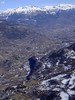
The above images may not be of the site on this page, but were taken nearby. They are loaded from Flickr so please click on them for image credits.
Click here to see more info for this site
Nearby sites
Click here to view sites on an interactive map of the areaKey: Red: member's photo, Blue: 3rd party photo, Yellow: other image, Green: no photo - please go there and take one, Grey: site destroyed
Download sites to:
KML (Google Earth)
GPX (GPS waypoints)
CSV (Garmin/Navman)
CSV (Excel)
To unlock full downloads you need to sign up as a Contributory Member. Otherwise downloads are limited to 50 sites.
Turn off the page maps and other distractions
Nearby sites listing. In the following links * = Image available
8.9km W 264° Saint Martin de Corleans Dolmen* Burial Chamber or Dolmen
36.8km SE 135° The Path of the Souls Rock Art
38.2km NE 39° Heidenstein Ofenen Rock Art
39.1km ESE 108° Plan de Sorcières* Rock Art
41.5km W 260° Cromlech del Piccolo San Bernardo* Stone Circle
41.5km W 260° Col du Petit Saint-Bernard Cromlech* Stone Circle
42.1km N 10° Les Pierres aux Fees Rock Art
43.9km SE 139° Lugnacco Menhir* Standing Stone (Menhir)
53.3km SW 214° Les Peintures du Rocher du Château* Rock Art
53.8km SW 232° Col des Ves* Standing Stone (Menhir)
54.4km N 355° Chemin des Collines Menhirs* Stone Row / Alignment
54.5km N 355° Sion Steinkistengrab* Burial Chamber or Dolmen
54.9km N 356° Dolmen Don Bosco* Burial Chamber or Dolmen
55.0km NNE 15° Pierre des Sauvages Rock Art
56.8km N 1° St-Léonard Menhirs Stone Row / Alignment
57.7km N 1° Crête-des-Barmes, St. Leonard Rock Art
59.5km S 172° Dreamland* Modern Stone Circle etc
60.0km NE 35° Heidnische Tossu Modern Dolmen* Modern Stone Circle etc
60.9km WSW 247° Dolmen de Nantfrozin Burial Chamber or Dolmen
61.5km SW 215° La Pierre des Saints Rock Art
61.8km SW 220° Pierre à Cupules dite Le Rocher aux Pieds Rock Art
61.8km SW 220° La Pierre aux Pieds Rock Art
62.7km SW 215° Pierre Gravée (Crosats) Rock Art
63.9km SW 217° Pierre Gravée (St Pierre) Rock Art
64.2km SE 140° Mazzè Menhir* Standing Stone (Menhir)
View more nearby sites and additional images


 We would like to know more about this location. Please feel free to add a brief description and any relevant information in your own language.
 Wir möchten mehr über diese Stätte erfahren. Bitte zögern Sie nicht, eine kurze Beschreibung und relevante Informationen in Deutsch hinzuzufügen.
 Nous aimerions en savoir encore un peu sur les lieux. S'il vous plaît n'hesitez pas à ajouter une courte description et tous les renseignements pertinents dans votre propre langue.
 Quisieramos informarnos un poco más de las lugares. No dude en añadir una breve descripción y otros datos relevantes en su propio idioma.