<< Our Photo Pages >> Grabhüglefeld Dill - Barrow Cemetery in Germany in Rhineland-Palatinate
Submitted by KaiHofmann on Friday, 08 December 2017 Page Views: 758
Neolithic and Bronze AgeSite Name: Grabhüglefeld DillCountry: Germany
NOTE: This site is 5.347 km away from the location you searched for.
Land: Rhineland-Palatinate Type: Barrow Cemetery
Nearest Town: Simmern Nearest Village: Dill
Latitude: 49.928893N Longitude: 7.353819E
Condition:
| 5 | Perfect |
| 4 | Almost Perfect |
| 3 | Reasonable but with some damage |
| 2 | Ruined but still recognisable as an ancient site |
| 1 | Pretty much destroyed, possibly visible as crop marks |
| 0 | No data. |
| -1 | Completely destroyed |
| 5 | Superb |
| 4 | Good |
| 3 | Ordinary |
| 2 | Not Good |
| 1 | Awful |
| 0 | No data. |
| 5 | Can be driven to, probably with disabled access |
| 4 | Short walk on a footpath |
| 3 | Requiring a bit more of a walk |
| 2 | A long walk |
| 1 | In the middle of nowhere, a nightmare to find |
| 0 | No data. |
| 5 | co-ordinates taken by GPS or official recorded co-ordinates |
| 4 | co-ordinates scaled from a detailed map |
| 3 | co-ordinates scaled from a bad map |
| 2 | co-ordinates of the nearest village |
| 1 | co-ordinates of the nearest town |
| 0 | no data |
Internal Links:
External Links:
")
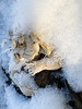
Iron-age burial mounds (around 40-50) of the 5th-4th century BCE. Some are still 3m tall.
You may be viewing yesterday's version of this page. To see the most up to date information please register for a free account.
")
")
Do not use the above information on other web sites or publications without permission of the contributor.
Nearby Images from Flickr

The above images may not be of the site on this page, but were taken nearby. They are loaded from Flickr so please click on them for image credits.
Click here to see more info for this site
Nearby sites
Click here to view sites on an interactive map of the areaKey: Red: member's photo, Blue: 3rd party photo, Yellow: other image, Green: no photo - please go there and take one, Grey: site destroyed
Download sites to:
KML (Google Earth)
GPX (GPS waypoints)
CSV (Garmin/Navman)
CSV (Excel)
To unlock full downloads you need to sign up as a Contributory Member. Otherwise downloads are limited to 50 sites.
Turn off the page maps and other distractions
Nearby sites listing. In the following links * = Image available
7.4km SSW 193° Rhaunen Koenigstein* Standing Stone (Menhir)
8.7km NE 39° Grabhügelfeld Biebern Barrow Cemetery
9.3km SSE 163° Keltensiedlung Altburg* Museum
11.0km SSE 151° Wehlenstein* Rock Outcrop
12.0km SW 222° Quellheiligtum Hochscheid* Holy Well or Sacred Spring
12.6km SSW 213° Hellertshausen Schimmerstein * Standing Stone (Menhir)
12.8km WSW 241° Grabhügelgruppe Hochscheid Barrow Cemetery
12.9km NNE 32° Grabhügelfeld Alterkülz Barrow Cemetery
13.1km WNW 291° Enkirch Viereckschanzen Misc. Earthwork
13.4km WNW 293° Fuerstinhuegelgrab Enkirch* Round Barrow(s)
13.5km WNW 291° Huneck Menhir Standing Stone (Menhir)
13.9km S 175° Hirtenboesch Grabhuegelfeld Barrow Cemetery
14.3km WSW 240° Wederath Hügelgräber III Round Barrow(s)
14.6km WSW 239° Menhir am Archäologiepark Belginum* Standing Stone (Menhir)
14.7km WSW 239° Menhirgruppe am Archäologiepark Belginum* Standing Stones
14.8km ESE 111° Alteburg Soonwald* Hillfort
15.0km SE 134° Brauweiler Grabhuegelfeld Barrow Cemetery
15.0km W 276° Campsteine* Standing Stones
15.0km W 276° Roemerstrasse Campsteine Ancient Trackway
15.2km NNE 21° Bell Huegelgraeber Barrow Cemetery
15.6km WSW 255° Bildstein Pilmeroth/Wederath Natural Stone / Erratic / Other Natural Feature
16.1km W 265° Pferdekopf* Natural Stone / Erratic / Other Natural Feature
16.6km S 170° Grabhügelfeld Perchwald Barrow Cemetery
16.8km WSW 241° Römergrab Wederath Round Barrow(s)
16.8km E 84° Reizenborn Quelle Holy Well or Sacred Spring
View more nearby sites and additional images


 We would like to know more about this location. Please feel free to add a brief description and any relevant information in your own language.
 Wir möchten mehr über diese Stätte erfahren. Bitte zögern Sie nicht, eine kurze Beschreibung und relevante Informationen in Deutsch hinzuzufügen.
 Nous aimerions en savoir encore un peu sur les lieux. S'il vous plaît n'hesitez pas à ajouter une courte description et tous les renseignements pertinents dans votre propre langue.
 Quisieramos informarnos un poco más de las lugares. No dude en añadir una breve descripción y otros datos relevantes en su propio idioma.