<< Our Photo Pages >> Hermeskappel - Ancient Trackway in France in Alsace-Lorraine:Moselle (57)
Submitted by KaiHofmann on Monday, 24 October 2011 Page Views: 2201
Multi-periodSite Name: HermeskappelCountry: France Département: Alsace-Lorraine:Moselle (57) Type: Ancient Trackway
Nearest Town: Sarregemuines Nearest Village: Hermeskappel
Latitude: 49.096432N Longitude: 7.164460E
Condition:
| 5 | Perfect |
| 4 | Almost Perfect |
| 3 | Reasonable but with some damage |
| 2 | Ruined but still recognisable as an ancient site |
| 1 | Pretty much destroyed, possibly visible as crop marks |
| 0 | No data. |
| -1 | Completely destroyed |
| 5 | Superb |
| 4 | Good |
| 3 | Ordinary |
| 2 | Not Good |
| 1 | Awful |
| 0 | No data. |
| 5 | Can be driven to, probably with disabled access |
| 4 | Short walk on a footpath |
| 3 | Requiring a bit more of a walk |
| 2 | A long walk |
| 1 | In the middle of nowhere, a nightmare to find |
| 0 | No data. |
| 5 | co-ordinates taken by GPS or official recorded co-ordinates |
| 4 | co-ordinates scaled from a detailed map |
| 3 | co-ordinates scaled from a bad map |
| 2 | co-ordinates of the nearest village |
| 1 | co-ordinates of the nearest town |
| 0 | no data |
Internal Links:
External Links:
")
An ancient Gallo-Roman trackway.
You may be viewing yesterday's version of this page. To see the most up to date information please register for a free account.
Do not use the above information on other web sites or publications without permission of the contributor.
Nearby Images from Flickr
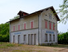
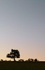
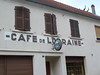
The above images may not be of the site on this page, but were taken nearby. They are loaded from Flickr so please click on them for image credits.
Click here to see more info for this site
Nearby sites
Click here to view sites on an interactive map of the areaKey: Red: member's photo, Blue: 3rd party photo, Yellow: other image, Green: no photo - please go there and take one, Grey: site destroyed
Download sites to:
KML (Google Earth)
GPX (GPS waypoints)
CSV (Garmin/Navman)
CSV (Excel)
To unlock full downloads you need to sign up as a Contributory Member. Otherwise downloads are limited to 50 sites.
Turn off the page maps and other distractions
Nearby sites listing. In the following links * = Image available
2.1km W 274° Grosswald Villa* Ancient Palace
3.3km NW 322° Kapellenwald Barrow Cemetery
3.8km NE 46° Brueckerberg Grabhuegelgruppe* Barrow Cemetery
4.4km NNE 28° Homerich* Natural Stone / Erratic / Other Natural Feature
4.5km NNE 17° Europaeischer Kulturpark* Museum
5.2km N 2° Reinheimer Berg Grabhuegel* Barrow Cemetery
5.4km NNE 27° Horres* Round Barrow(s)
6.8km N 3° Bebelsheim Grabhuegel* Barrow Cemetery
7.0km WNW 282° Musée de la Faïence Museum
9.3km NNW 346° Grabhuegel Ormesheim* Round Barrow(s)
9.6km E 86° Tumulus de Rimling Round Barrow(s)
11.0km NNE 18° Rubenheim Grabhuegelfeld* Barrow Cemetery
11.3km SE 136° Tumulus de Bining Round Barrow(s)
11.7km N 1° Huegelgraeber Sauerackerwald* Barrow Cemetery
12.0km NNE 32° Odilienquelle* Holy Well or Sacred Spring
12.1km NE 43° Böckweiler Hügelgrab* Round Barrow(s)
12.5km NE 38° Kirchheimerhof Grabhuegelfeld * Barrow Cemetery
12.8km ENE 74° Tumuli de Ormesviller Barrow Cemetery
12.8km N 359° Ommersheim Huegelgraeberfeld 2* Barrow Cemetery
12.9km N 3° Wetzstein Assweiler* Carving
13.1km N 0° Ommersheim Huegelgraeberfeld 1* Barrow Cemetery
13.2km ENE 60° Altheim Brenschelbach Grabhuegelfeld * Barrow Cemetery
13.3km NE 44° Lindenbrunnen* Holy Well or Sacred Spring
13.4km E 89° Nassenwald settlement Ancient Village or Settlement
15.2km NE 42° Gruenbachwald Graeberfeld* Barrow Cemetery
View more nearby sites and additional images


 We would like to know more about this location. Please feel free to add a brief description and any relevant information in your own language.
 Wir möchten mehr über diese Stätte erfahren. Bitte zögern Sie nicht, eine kurze Beschreibung und relevante Informationen in Deutsch hinzuzufügen.
 Nous aimerions en savoir encore un peu sur les lieux. S'il vous plaît n'hesitez pas à ajouter une courte description et tous les renseignements pertinents dans votre propre langue.
 Quisieramos informarnos un poco más de las lugares. No dude en añadir una breve descripción y otros datos relevantes en su propio idioma.