

<< Text Pages >> Gräberfeld Königsfeld - Barrow Cemetery in Germany in Rhineland-Palatinate
Submitted by KaiHofmann on Thursday, 16 November 2017 Page Views: 638
Neolithic and Bronze AgeSite Name: Gräberfeld KönigsfeldCountry: Germany
NOTE: This site is 2.18 km away from the location you searched for.
Land: Rhineland-Palatinate Type: Barrow Cemetery
Nearest Town: Hermeskeil Nearest Village: Rascheid
Latitude: 49.684137N Longitude: 6.930170E
Condition:
| 5 | Perfect |
| 4 | Almost Perfect |
| 3 | Reasonable but with some damage |
| 2 | Ruined but still recognisable as an ancient site |
| 1 | Pretty much destroyed, possibly visible as crop marks |
| 0 | No data. |
| -1 | Completely destroyed |
| 5 | Superb |
| 4 | Good |
| 3 | Ordinary |
| 2 | Not Good |
| 1 | Awful |
| 0 | No data. |
| 5 | Can be driven to, probably with disabled access |
| 4 | Short walk on a footpath |
| 3 | Requiring a bit more of a walk |
| 2 | A long walk |
| 1 | In the middle of nowhere, a nightmare to find |
| 0 | No data. |
| 5 | co-ordinates taken by GPS or official recorded co-ordinates |
| 4 | co-ordinates scaled from a detailed map |
| 3 | co-ordinates scaled from a bad map |
| 2 | co-ordinates of the nearest village |
| 1 | co-ordinates of the nearest town |
| 0 | no data |
Internal Links:
External Links:
Barrow Cemetery in Rhineland-Palatinate
An iron-age barrow cemetery (necropolis) of the 6th-3rd century CE with around 110 burial mounds.
You may be viewing yesterday's version of this page. To see the most up to date information please register for a free account.
Do not use the above information on other web sites or publications without permission of the contributor.
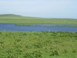
Nearby Images from Flickr
The above images may not be of the site on this page, but were taken nearby. They are loaded from Flickr so please click on them for image credits.
Click here to see more info for this site
Nearby sites
Click here to view sites on an interactive map of the areaKey: Red: member's photo, Blue: 3rd party photo, Yellow: other image, Green: no photo - please go there and take one, Grey: site destroyed
Download sites to:
KML (Google Earth)
GPX (GPS waypoints)
CSV (Garmin/Navman)
CSV (Excel)
To unlock full downloads you need to sign up as a Contributory Member. Otherwise downloads are limited to 50 sites.
Turn off the page maps and other distractions
Nearby sites listing. In the following links * = Image available
3.8km WNW 300° Graue Eltz* Natural Stone / Erratic / Other Natural Feature
5.4km N 349° Hoher Stein Beuren* Natural Stone / Erratic / Other Natural Feature
5.6km WNW 302° Hinkelstein von Beuren* Standing Stone (Menhir)
6.2km N 357° Posterather Wacken* Natural Stone / Erratic / Other Natural Feature
6.2km NNW 333° Strackheck Grabhuegelfeld Barrow Cemetery
7.5km WNW 303° Kühonner Hügelgräberfeld* Barrow Cemetery
7.6km NW 324° Grabstele Bescheid* Standing Stone (Menhir)
7.7km WNW 303° Menhir Farschweiler* Standing Stone (Menhir)
8.6km NNW 330° Stein von Bescheid* Standing Stone (Menhir)
8.6km N 4° Menhir Schönberg 1* Standing Stone (Menhir)
8.7km SE 142° Hunnenring* Hillfort
8.9km SE 141° Otzenhausen Quelle* Holy Well or Sacred Spring
9.1km N 0° Menhir Schönberg 2* Standing Stone (Menhir)
10.3km NW 314° Fell Bergheiligtum (hill sanctuary)* Ancient Temple
10.4km W 270° Hünengrab Drei Mörder* Chambered Tomb
10.4km ENE 72° Sigfrieds Quelle Erbeskopf Holy Well or Sacred Spring
10.8km WNW 301° Fürstengrab von Thomm* Round Barrow(s)
10.9km S 178° Schlittchen* Ancient Mine, Quarry or other Industry
11.0km NNW 348° Breitenstein Büdlich* Standing Stone (Menhir)
11.3km N 353° Büdlich Hinkelstein* Standing Stone (Menhir)
11.6km NNW 336° Stein von Büdlich Standing Stone (Menhir)
11.7km S 186° Oberloestern Monumentalgrabhuegel* Round Barrow(s)
11.8km S 182° Oberlöstern Menhir* Standing Stone (Menhir)
12.3km WNW 303° Hinkelstein von Thomm* Standing Stone (Menhir)
12.5km ENE 61° Summstein Erbeskopf Modern Stone Circle etc
View more nearby sites and additional images


 We would like to know more about this location. Please feel free to add a brief description and any relevant information in your own language.
 Wir möchten mehr über diese Stätte erfahren. Bitte zögern Sie nicht, eine kurze Beschreibung und relevante Informationen in Deutsch hinzuzufügen.
 Nous aimerions en savoir encore un peu sur les lieux. S'il vous plaît n'hesitez pas à ajouter une courte description et tous les renseignements pertinents dans votre propre langue.
 Quisieramos informarnos un poco más de las lugares. No dude en añadir una breve descripción y otros datos relevantes en su propio idioma.