


<< Text Pages >> Pierre qui Tourne (Les Grangettes) - Rock Art in France in Franche:Doubs (25)
Submitted by holger_rix on Friday, 08 April 2016 Page Views: 1343
Rock ArtSite Name: Pierre qui Tourne (Les Grangettes)Country: France
NOTE: This site is 21.551 km away from the location you searched for.
Département: Franche:Doubs (25) Type: Rock Art
Nearest Town: Pontarlier Nearest Village: Les Grangettes
Latitude: 46.838869N Longitude: 6.312944E
Condition:
| 5 | Perfect |
| 4 | Almost Perfect |
| 3 | Reasonable but with some damage |
| 2 | Ruined but still recognisable as an ancient site |
| 1 | Pretty much destroyed, possibly visible as crop marks |
| 0 | No data. |
| -1 | Completely destroyed |
| 5 | Superb |
| 4 | Good |
| 3 | Ordinary |
| 2 | Not Good |
| 1 | Awful |
| 0 | No data. |
| 5 | Can be driven to, probably with disabled access |
| 4 | Short walk on a footpath |
| 3 | Requiring a bit more of a walk |
| 2 | A long walk |
| 1 | In the middle of nowhere, a nightmare to find |
| 0 | No data. |
| 5 | co-ordinates taken by GPS or official recorded co-ordinates |
| 4 | co-ordinates scaled from a detailed map |
| 3 | co-ordinates scaled from a bad map |
| 2 | co-ordinates of the nearest village |
| 1 | co-ordinates of the nearest town |
| 0 | no data |
Be the first person to rate this site - see the 'Contribute!' box in the right hand menu.
Internal Links:
External Links:
Rock Art in Franche:Doubs (25)
Route du Lac à Friard, Les Grangettes, Pontarlier, Doubs
Source: T4T35.fr
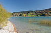
Picture:
www.panoramio.com
You may be viewing yesterday's version of this page. To see the most up to date information please register for a free account.
Do not use the above information on other web sites or publications without permission of the contributor.
Nearby Images from Flickr
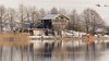
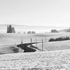
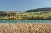
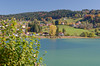
The above images may not be of the site on this page, but were taken nearby. They are loaded from Flickr so please click on them for image credits.
Click here to see more info for this site
Nearby sites
Click here to view sites on an interactive map of the areaKey: Red: member's photo, Blue: 3rd party photo, Yellow: other image, Green: no photo - please go there and take one, Grey: site destroyed
Download sites to:
KML (Google Earth)
GPX (GPS waypoints)
CSV (Garmin/Navman)
CSV (Excel)
To unlock full downloads you need to sign up as a Contributory Member. Otherwise downloads are limited to 50 sites.
Turn off the page maps and other distractions
Nearby sites listing. In the following links * = Image available
16.4km ESE 120° Pierre du Bon Château Rock Art
18.7km ESE 117° Rances Schalensteine Rock Art
22.0km SSE 156° La Praz Steinkreis* Stone Circle
22.7km SSE 160° Mont-la-Ville Schalenstein Rock Art
22.8km SSE 147° Pierre à Camille* Modern Stone Circle etc
23.6km ESE 101° Menhir de Crusilles-Dessus* Modern Stone Circle etc
25.5km E 95° Grandson Menhir* Standing Stone (Menhir)
26.9km ESE 104° Clendy Steinalleen* Stone Row / Alignment
27.0km E 90° Bonvillars Menhir* Standing Stone (Menhir)
28.7km E 88° Praz Berthoud (Onnens)* Burial Chamber or Dolmen
29.2km SW 223° Menhir de La Chevrerie Standing Stone (Menhir)
29.6km E 87° Pierres Longues de Corcelles* Standing Stones
32.2km E 83° Concise Schalenstein* Rock Art
33.9km E 82° Erratic Stone La Grande-Béroche* Natural Stone / Erratic / Other Natural Feature
34.1km E 81° Les Devens Menhir de St. Aubin* Standing Stone (Menhir)
35.4km ENE 77° Les Devens Menhir de Gorgier* Standing Stone (Menhir)
35.7km ENE 78° Pierres de Guégenou* Standing Stones
36.2km S 179° Pierre du Bois Cabrol Rock Art
36.3km S 179° Pierre à écuelles d'Outard Rock Art
37.7km S 171° Menhir de La Varnette* Standing Stone (Menhir)
37.7km S 171° Erratic Stone Corcelles-Cormondrèche* Natural Stone / Erratic / Other Natural Feature
37.8km ENE 75° Vauroux Menhir* Standing Stone (Menhir)
38.9km ENE 76° Menhir Bevaix/Treytel* Modern Stone Circle etc
39.0km WSW 257° Menhir dit la Dèesse Alésia Standing Stone (Menhir)
39.1km E 89° Pierre du Mariage* Natural Stone / Erratic / Other Natural Feature
View more nearby sites and additional images


 We would like to know more about this location. Please feel free to add a brief description and any relevant information in your own language.
 Wir möchten mehr über diese Stätte erfahren. Bitte zögern Sie nicht, eine kurze Beschreibung und relevante Informationen in Deutsch hinzuzufügen.
 Nous aimerions en savoir encore un peu sur les lieux. S'il vous plaît n'hesitez pas à ajouter une courte description et tous les renseignements pertinents dans votre propre langue.
 Quisieramos informarnos un poco más de las lugares. No dude en añadir una breve descripción y otros datos relevantes en su propio idioma.