

<< Text Pages >> Bonifatiusbron Holy Well - Holy Well or Sacred Spring in Netherlands in Friesland
Submitted by Hunengrab77 on Thursday, 06 July 2023 Page Views: 202
Springs and Holy WellsSite Name: Bonifatiusbron Holy WellCountry: Netherlands
NOTE: This site is 2.823 km away from the location you searched for.
Province: Friesland Type: Holy Well or Sacred Spring
Nearest Town: Dokkum
Latitude: 53.322220N Longitude: 6.002650E
Condition:
| 5 | Perfect |
| 4 | Almost Perfect |
| 3 | Reasonable but with some damage |
| 2 | Ruined but still recognisable as an ancient site |
| 1 | Pretty much destroyed, possibly visible as crop marks |
| 0 | No data. |
| -1 | Completely destroyed |
| 5 | Superb |
| 4 | Good |
| 3 | Ordinary |
| 2 | Not Good |
| 1 | Awful |
| 0 | No data. |
| 5 | Can be driven to, probably with disabled access |
| 4 | Short walk on a footpath |
| 3 | Requiring a bit more of a walk |
| 2 | A long walk |
| 1 | In the middle of nowhere, a nightmare to find |
| 0 | No data. |
| 5 | co-ordinates taken by GPS or official recorded co-ordinates |
| 4 | co-ordinates scaled from a detailed map |
| 3 | co-ordinates scaled from a bad map |
| 2 | co-ordinates of the nearest village |
| 1 | co-ordinates of the nearest town |
| 0 | no data |
Be the first person to rate this site - see the 'Contribute!' box in the right hand menu.
Internal Links:
External Links:
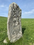
Holy Well or Sacred Spring in Friesland
The original mediaeval Well dedicated to Saint Boniface was located in the centre of Dokkum, at the Markt. During a catholic revival in the second half of the 19th Century the veneration was moved to another old well, orginally used by the local beer brewers. A miraculous healing of a child with wheeping cough took place in 1990, adding to continued popularity of this place of pilgrimage. The Holy Well is now part of a complex with park and chapel, built in the 1920s and 30s.
Article from the Dutch Meertens Institute.
You may be viewing yesterday's version of this page. To see the most up to date information please register for a free account.
Do not use the above information on other web sites or publications without permission of the contributor.
Nearby Images from Flickr

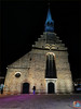
The above images may not be of the site on this page, but were taken nearby. They are loaded from Flickr so please click on them for image credits.
Click here to see more info for this site
Nearby sites
Click here to view sites on an interactive map of the areaKey: Red: member's photo, Blue: 3rd party photo, Yellow: other image, Green: no photo - please go there and take one, Grey: site destroyed
Download sites to:
KML (Google Earth)
GPX (GPS waypoints)
CSV (Garmin/Navman)
CSV (Excel)
To unlock full downloads you need to sign up as a Contributory Member. Otherwise downloads are limited to 50 sites.
Turn off the page maps and other distractions
Nearby sites listing. In the following links * = Image available
4.1km ENE 74° Dorpsterp Oostrum Ancient Village or Settlement
10.3km W 279° Terp Hegebeintum (45523) Ancient Village or Settlement
11.7km SE 129° Ijstijdenmuseum Museum
14.5km S 185° Poppestien* Natural Stone / Erratic / Other Natural Feature
26.3km SE 133° Zwerfsteen Mienscheer* Natural Stone / Erratic / Other Natural Feature
35.8km S 173° Museum Opsterlân Museum
36.0km SSE 148° Oosterwolde (45877) Ancient Village or Settlement
36.0km SSE 148° Donkerbroek (45873) Ancient Village or Settlement
36.0km SSE 148° Waskemeer (45872) Ancient Village or Settlement
36.4km SE 132° D1 Steenbergen* Passage Grave
36.4km SSE 146° Waskemeer (45871) Ancient Village or Settlement
36.5km SE 146° Waskemeer (45870) Ancient Village or Settlement
38.7km SSE 153° Donkerbroek (45875) Ancient Village or Settlement
39.7km SSE 162° Twijtel (45879) Ancient Village or Settlement
40.0km SSE 148° Oosterwolde (45874) Ancient Village or Settlement
41.7km SE 133° Norg Kerk Hunebed* Natural Stone / Erratic / Other Natural Feature
41.8km SE 135° D2 Westervelde* Passage Grave
42.6km SSE 156° Langedijke (45878) Ancient Village or Settlement
43.4km S 188° Zwerfsteen van Rottum* Natural Stone / Erratic / Other Natural Feature
43.6km ESE 117° Grafheuvel Eelde (45394) Round Barrow(s)
45.6km SE 129° D5 Zeijen* Passage Grave
46.2km ESE 123° Gebroken Cirkel* Modern Stone Circle etc
46.5km ESE 114° G4 Onner Es Chambered Tomb
47.1km SE 125° Zwerfsteen Vries* Natural Stone / Erratic / Other Natural Feature
47.3km ESE 116° G3 Glimmer Es* Chambered Tomb
View more nearby sites and additional images


 We would like to know more about this location. Please feel free to add a brief description and any relevant information in your own language.
 Wir möchten mehr über diese Stätte erfahren. Bitte zögern Sie nicht, eine kurze Beschreibung und relevante Informationen in Deutsch hinzuzufügen.
 Nous aimerions en savoir encore un peu sur les lieux. S'il vous plaît n'hesitez pas à ajouter une courte description et tous les renseignements pertinents dans votre propre langue.
 Quisieramos informarnos un poco más de las lugares. No dude en añadir una breve descripción y otros datos relevantes en su propio idioma.