

<< Our Photo Pages >> Archaeological Survey and Ethnoarchaeological Studies in Sefidkouh of Makran - Ancient Village or Settlement in Iran
Submitted by Andy B on Friday, 27 March 2020 Page Views: 860
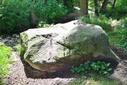
Neolithic and Bronze AgeSite Name: Archaeological Survey and Ethnoarchaeological Studies in Sefidkouh of Makran Alternative Name: SefidkuhCountry: Iran
NOTE: This site is 215.92 km away from the location you searched for.
Type: Ancient Village or Settlement
Nearest Town: Baluchistan
Latitude: 26.538308N Longitude: 59.501357E
Condition:
| 5 | Perfect |
| 4 | Almost Perfect |
| 3 | Reasonable but with some damage |
| 2 | Ruined but still recognisable as an ancient site |
| 1 | Pretty much destroyed, possibly visible as crop marks |
| 0 | No data. |
| -1 | Completely destroyed |
| 5 | Superb |
| 4 | Good |
| 3 | Ordinary |
| 2 | Not Good |
| 1 | Awful |
| 0 | No data. |
| 5 | Can be driven to, probably with disabled access |
| 4 | Short walk on a footpath |
| 3 | Requiring a bit more of a walk |
| 2 | A long walk |
| 1 | In the middle of nowhere, a nightmare to find |
| 0 | No data. |
| 5 | co-ordinates taken by GPS or official recorded co-ordinates |
| 4 | co-ordinates scaled from a detailed map |
| 3 | co-ordinates scaled from a bad map |
| 2 | co-ordinates of the nearest village |
| 1 | co-ordinates of the nearest town |
| 0 | no data |
Internal Links:
External Links:
")
In this first season of survey, specific archaeological and anthropological evidence was obtained from lesser-known Sefidokouh communities; among the most notable of these is the discovery of circular architectural evidence, still visible to this day in the Sefidokouh area, and also evidence of pottery suspected to belong from the Chalcolithic era, along with a specific pottery type known as Londo.
Based on the archaeological findings of Pakistan's Baluchistan, some scholars, believe this type of pottery belongs to the second and third centuries BC, but this date may be different in the Baluchistan of Iran.
The results of the absolute chronology tests should soon open a new window in our field. Londo pottery is one of Balochistan's index potteries and can be found in the early layers of the Tepe Yahya of Kerman, the Kaftary site in Fars, and all over western Pakistan including the area of Jahawalan, Budi Buti and Las Bella, the Domb Kouh site, Hezar mardi in Bampur and the Give Castle area in South Khorasan.
Londo pottery is the second largest pottery group in the Persian Gulf, the Oman Sea and the Makran region, which testifies to the trade between the people of the region.
The survey team of Makran Sefidkouh area has been looking for evidence of the presence of ancient sites in this impassable area. Our Ethnoarchaeological project focused on identifying, surveying and recording communities residing in the Sefidokouh highlands, the settlement continuity pattern of these people and to identify and record the villages under study.
In addition to the findings in this season of the survey, new evidence of the importance of oval, circular, and stacked camps which is very important, also emerged.
Due to the discovery of glass bracelets, pottery fragments and anthropological evidence alongside the identified a circular grave specimen, with the examples found in neighbouring areas such as Pakistan and Oman (areas such as Haif, Umm al-Anar and Jalan) in the prehistoric time period, it is probable that the Makran region, and especially Sefidkuh, was dominated by semi-nomadic communities and was one of the important areas of trade between the southern marginal communities of the Persian Gulf and the high-lying communities of Baluchistan and Sistan and neighbouring areas.
We have identified twelve locations with evidence of pre-historic (Epipaleolithic, Neolithic, Chalcolithic) settlement, where life continues today. These 12 current settlements are located in the mountainous area of Sefidkuh. The names of the villages are: Baragdan, Kuchkodam, Koddap, Tangsam, Kopidap, Javanja, Torkeguash, Dangar, Kupchu, Sorkhkalut Patgan and Siyahdan.
In this survey evidence of historical and Islamic cemeteries was also found, it is probable that due to the strategic importance of the region, it has long been the home of semi-sedentary nomadic people, and these communities still reside in the area.
We are still unable to accurately identify the ancient communities living in the Sefidkouh heights and it is necessary to conduct targeted studies in the long-term, in collaboration with the Institute of Archaeology, the Institute of Anthropology and interdisciplinary experts, alongside the study of contemporary modern societies living in the region. I will have more news of our findings soon.
Hossein Vahedi is head of the archaeology expedition, which is conducted by permission of the Research Institute and Collaboration of Shahrekord University. Source: Release from the Public Relations Institute of Cultural Heritage and Tourism.
You may be viewing yesterday's version of this page. To see the most up to date information please register for a free account.
")
")
")
")
")
Do not use the above information on other web sites or publications without permission of the contributor.
Click here to see more info for this site
Nearby sites
Click here to view sites on an interactive map of the areaKey: Red: member's photo, Blue: 3rd party photo, Yellow: other image, Green: no photo - please go there and take one, Grey: site destroyed
Download sites to:
KML (Google Earth)
GPX (GPS waypoints)
CSV (Garmin/Navman)
CSV (Excel)
To unlock full downloads you need to sign up as a Contributory Member. Otherwise downloads are limited to 50 sites.
Turn off the page maps and other distractions
Nearby sites listing. In the following links * = Image available
293.8km NW 324° Jiroft Ancient Site Ancient Village or Settlement
326.2km W 264° Khasab Fort Museum* Museum
329.6km W 264° Tawi Petroglyphs* Rock Art
339.1km WSW 253° Dibba Tomb Chambered Tomb
352.7km WSW 258° Shimal Tomb Chambered Tomb
361.4km WSW 258° Ras Al Khaimah Tombs* Chambered Tomb
396.2km WSW 247° Mleiha Fort Stone Fort or Dun
397.0km WSW 248° Mleiha Archaeological Centre* Museum
397.0km WSW 248° Mleiha Umm an-Nar tomb* Chambered Tomb
397.9km WSW 247° Jebel Faya tomb 1* Chambered Tomb
397.9km WSW 247° Jebel Faya tomb 2 Chambered Tomb
398.0km WSW 247° Jebel Faya tomb 3 Chambered Tomb
398.0km WSW 248° FAY-NE-15* Ancient Village or Settlement
398.1km WSW 248° Wadi Caves* Cave or Rock Shelter
398.3km WSW 247° Jebel Faya Rock Shelter Cave or Rock Shelter
405.4km WSW 256° Akab Ritual Site and Settlement Ancient Village or Settlement
407.9km WSW 246° Al-Buhais 18 Ancient Village or Settlement
410.0km WSW 255° Umm al-Quwain 2* Ancient Village or Settlement
411.6km WSW 254° Tell Abraq* Stone Fort or Dun
415.9km WSW 254° Mowaihat Chambered Cairn
430.5km WSW 253° Sharjah Archaeological Museum* Museum
443.7km WSW 252° Dubai Museum* Museum
448.2km WSW 237° Al Hili Archaeological park* Museum
449.3km S 176° Ras Al Had* Ancient Village or Settlement
449.5km SW 215° Qubur Juhhal Beehive Tombs* Chambered Tomb
View more nearby sites and additional images


 We would like to know more about this location. Please feel free to add a brief description and any relevant information in your own language.
 Wir möchten mehr über diese Stätte erfahren. Bitte zögern Sie nicht, eine kurze Beschreibung und relevante Informationen in Deutsch hinzuzufügen.
 Nous aimerions en savoir encore un peu sur les lieux. S'il vous plaît n'hesitez pas à ajouter une courte description et tous les renseignements pertinents dans votre propre langue.
 Quisieramos informarnos un poco más de las lugares. No dude en añadir una breve descripción y otros datos relevantes en su propio idioma.