<< Text Pages >> Nosy Mangabe Graves - Rock Cut Tomb in Madagascar
Submitted by KaiHofmann on Sunday, 27 January 2019 Page Views: 3787
Multi-periodSite Name: Nosy Mangabe GravesCountry: Madagascar
NOTE: This site is 212.581 km away from the location you searched for.
Type: Rock Cut Tomb
Nearest Town: Maroantsetra Nearest Village: Nosy Mangabe
Latitude: 15.495S Longitude: 49.768056E
Condition:
| 5 | Perfect |
| 4 | Almost Perfect |
| 3 | Reasonable but with some damage |
| 2 | Ruined but still recognisable as an ancient site |
| 1 | Pretty much destroyed, possibly visible as crop marks |
| 0 | No data. |
| -1 | Completely destroyed |
| 5 | Superb |
| 4 | Good |
| 3 | Ordinary |
| 2 | Not Good |
| 1 | Awful |
| 0 | No data. |
| 5 | Can be driven to, probably with disabled access |
| 4 | Short walk on a footpath |
| 3 | Requiring a bit more of a walk |
| 2 | A long walk |
| 1 | In the middle of nowhere, a nightmare to find |
| 0 | No data. |
| 5 | co-ordinates taken by GPS or official recorded co-ordinates |
| 4 | co-ordinates scaled from a detailed map |
| 3 | co-ordinates scaled from a bad map |
| 2 | co-ordinates of the nearest village |
| 1 | co-ordinates of the nearest town |
| 0 | no data |
Internal Links:
External Links:
Rock Cut Tomb in Madagascar
On the small island of Nosy Mangabe in the northeastern part of Madagascar a group of ancient stone coffins are to find in a cave at the western hillside of the highest mountain. They are possible of the 8th century CE as there are some other remains of settlements of the 8th cenutry CE.
This is a link to the coffins
You may be viewing yesterday's version of this page. To see the most up to date information please register for a free account.
Do not use the above information on other web sites or publications without permission of the contributor.
Nearby Images from Flickr
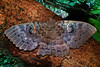
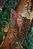
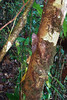
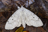


The above images may not be of the site on this page, but were taken nearby. They are loaded from Flickr so please click on them for image credits.
Click here to see more info for this site
Nearby sites
Click here to view sites on an interactive map of the areaKey: Red: member's photo, Blue: 3rd party photo, Yellow: other image, Green: no photo - please go there and take one, Grey: site destroyed
Download sites to:
KML (Google Earth)
GPX (GPS waypoints)
CSV (Garmin/Navman)
CSV (Excel)
To unlock full downloads you need to sign up as a Contributory Member. Otherwise downloads are limited to 50 sites.
Turn off the page maps and other distractions
Nearby sites listing. In the following links * = Image available
810.6km SW 216° Makay Massif Paintings Rock Art
1669.4km W 273° Chongoni Rock Art Rock Art
1757.2km WNW 297° Isimila* Ancient Village or Settlement
1844.1km WNW 303° Dodoma Stones* Natural Stone / Erratic / Other Natural Feature
2061.1km WSW 252° Great Zimbabwe* Ancient Village or Settlement
2092.1km WNW 284° Mwela rock paintings Rock Art
2170.2km NW 309° Gong Rock* Rock Art
2209.2km NW 321° Lewa Rock Gongs Rock Art
2239.9km SW 232° Border Cave* Cave or Rock Shelter
2261.2km NW 317° Hyrax Hill Ancient Village or Settlement
2273.3km WSW 237° Bantu stone circles* Standing Stones
2277.4km SW 235° Lion Cavern Ngwenya Ancient Mine, Quarry or other Industry
2279.3km WSW 248° Machete I Rock Art
2313.4km WSW 253° World's View Matobo National Park* Natural Stone / Erratic / Other Natural Feature
2315.2km WSW 253° Inanke Cave Cave or Rock Shelter
2324.7km WSW 253° Bambata Cave* Cave or Rock Shelter
2407.1km NW 313° Ukula Rock Paintings Rock Art
2431.7km WSW 244° Palala River Bluffs San Rock Paintings* Rock Art
2454.7km NW 317° Orchard Cave, Kenya* Cave or Rock Shelter
2462.4km NW 321° Namoratunga Rock Engravings Rock Art
2466.5km SW 228° Sibudu Cave* Cave or Rock Shelter
2490.3km NW 322° Lokori Stone Pillars Standing Stone (Menhir)
2510.8km W 264° Sikaunda petroglyphs Rock Art
2513.9km WSW 240° African Window* Museum
2532.8km NW 316° Kakoro Rock art Rock Art
View more nearby sites and additional images


 We would like to know more about this location. Please feel free to add a brief description and any relevant information in your own language.
 Wir möchten mehr über diese Stätte erfahren. Bitte zögern Sie nicht, eine kurze Beschreibung und relevante Informationen in Deutsch hinzuzufügen.
 Nous aimerions en savoir encore un peu sur les lieux. S'il vous plaît n'hesitez pas à ajouter une courte description et tous les renseignements pertinents dans votre propre langue.
 Quisieramos informarnos un poco más de las lugares. No dude en añadir una breve descripción y otros datos relevantes en su propio idioma.