<< Our Photo Pages >> Hundehaugene - Standing Stone (Menhir) in Norway in Rogaland
Submitted by kenntha88 on Saturday, 03 October 2015 Page Views: 990
Neolithic and Bronze AgeSite Name: HundehaugeneCountry: Norway
NOTE: This site is 7.666 km away from the location you searched for.
Fylke: Rogaland Type: Standing Stone (Menhir)
Nearest Town: Haugesund Nearest Village: Vikadal
Latitude: 59.500792N Longitude: 5.906771E
Condition:
| 5 | Perfect |
| 4 | Almost Perfect |
| 3 | Reasonable but with some damage |
| 2 | Ruined but still recognisable as an ancient site |
| 1 | Pretty much destroyed, possibly visible as crop marks |
| 0 | No data. |
| -1 | Completely destroyed |
| 5 | Superb |
| 4 | Good |
| 3 | Ordinary |
| 2 | Not Good |
| 1 | Awful |
| 0 | No data. |
| 5 | Can be driven to, probably with disabled access |
| 4 | Short walk on a footpath |
| 3 | Requiring a bit more of a walk |
| 2 | A long walk |
| 1 | In the middle of nowhere, a nightmare to find |
| 0 | No data. |
| 5 | co-ordinates taken by GPS or official recorded co-ordinates |
| 4 | co-ordinates scaled from a detailed map |
| 3 | co-ordinates scaled from a bad map |
| 2 | co-ordinates of the nearest village |
| 1 | co-ordinates of the nearest town |
| 0 | no data |
Internal Links:
External Links:
")
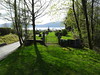
The site consists of three small round barrows and one standing stone. The stone is located in a small garden next to a camping site and inside a horse fence. The barrows are called Hundehaugane from the word hund (dog) from a local tale about a dog being buried here.
The smaller round barrows are very difficult to see because they are covered in high grass and some smaller trees. The standing stone is located next to a pine tree. It is on top of a small hill that could possibly be another smaller barrow.
The stone is around 1,80 metres in height, 30cm wide and around 20cm thick. It is tilting slightly to one side.
You may be viewing yesterday's version of this page. To see the most up to date information please register for a free account.
")
")
")
Do not use the above information on other web sites or publications without permission of the contributor.
Nearby Images from Flickr


The above images may not be of the site on this page, but were taken nearby. They are loaded from Flickr so please click on them for image credits.
Click here to see more info for this site
Nearby sites
Click here to view sites on an interactive map of the areaKey: Red: member's photo, Blue: 3rd party photo, Yellow: other image, Green: no photo - please go there and take one, Grey: site destroyed
Download sites to:
KML (Google Earth)
GPX (GPS waypoints)
CSV (Garmin/Navman)
CSV (Excel)
To unlock full downloads you need to sign up as a Contributory Member. Otherwise downloads are limited to 50 sites.
Turn off the page maps and other distractions
Nearby sites listing. In the following links * = Image available
6.9km NW 326° Østabøstødl - Rabbadn* Barrow Cemetery
18.2km N 5° Gjerde standing stone* Standing Stone (Menhir)
18.4km WSW 248° Bautasteinene på Erland* Standing Stones
19.4km N 10° Kyrkjehaugen* Standing Stone (Menhir)
19.6km NNE 16° Grindheim stone cross* Ancient Cross
19.6km NNE 16° Grindheim Runestone* Carving
19.6km N 10° Helgaberget Helleristninger* Rock Art
25.8km NW 320° Bjoavågen* Carving
26.3km WSW 254° Grinde Bautarsteinar, Tysvær* Standing Stones
26.6km NW 321° Utbjoa* Cairn
27.2km NNE 30° Bruteigsteinen* Rock Art
29.4km E 97° Ritland barrow cemetery* Barrow Cemetery
29.4km E 98° Neset* Ancient Village or Settlement
31.8km SW 223° Resastaven* Standing Stone (Menhir)
34.5km NNW 341° Sjo* Barrow Cemetery
34.6km NNW 341° Moa Moa* Standing Stone (Menhir)
37.1km WSW 248° De Fem Dårlige Jomfruer* Stone Circle
37.3km SSE 165° Midtre Fister* Barrow Cemetery
37.5km WSW 258° Haraldshaugen Barrow* Round Barrow(s)
37.6km WSW 250° Storhaugen* Round Barrow(s)
37.8km SSE 161° Store Bjelland* Standing Stone (Menhir)
38.1km WSW 249° Kjørkhaug* Round Barrow(s)
38.3km WSW 245° Flagghaugen* Round Barrow(s)
38.4km WSW 245° Sewing Needle of The Virgin Mary* Standing Stone (Menhir)
38.4km WSW 245° Kuhaugen og Kongshaugen* Round Barrow(s)
View more nearby sites and additional images


 We would like to know more about this location. Please feel free to add a brief description and any relevant information in your own language.
 Wir möchten mehr über diese Stätte erfahren. Bitte zögern Sie nicht, eine kurze Beschreibung und relevante Informationen in Deutsch hinzuzufügen.
 Nous aimerions en savoir encore un peu sur les lieux. S'il vous plaît n'hesitez pas à ajouter une courte description et tous les renseignements pertinents dans votre propre langue.
 Quisieramos informarnos un poco más de las lugares. No dude en añadir una breve descripción y otros datos relevantes en su propio idioma.