

<< Text Pages >> Mont Guerin Camp Prehistorique - Ancient Village or Settlement in France in Franche:Jura (39)
Submitted by AlexHunger on Tuesday, 17 May 2005 Page Views: 3083
Multi-periodSite Name: Mont Guerin Camp PrehistoriqueCountry: France
NOTE: This site is 2.303 km away from the location you searched for.
Département: Franche:Jura (39) Type: Ancient Village or Settlement
Nearest Town: Dijon Nearest Village: Moissey
Latitude: 47.205620N Longitude: 5.522550E
Condition:
| 5 | Perfect |
| 4 | Almost Perfect |
| 3 | Reasonable but with some damage |
| 2 | Ruined but still recognisable as an ancient site |
| 1 | Pretty much destroyed, possibly visible as crop marks |
| 0 | No data. |
| -1 | Completely destroyed |
| 5 | Superb |
| 4 | Good |
| 3 | Ordinary |
| 2 | Not Good |
| 1 | Awful |
| 0 | No data. |
| 5 | Can be driven to, probably with disabled access |
| 4 | Short walk on a footpath |
| 3 | Requiring a bit more of a walk |
| 2 | A long walk |
| 1 | In the middle of nowhere, a nightmare to find |
| 0 | No data. |
| 5 | co-ordinates taken by GPS or official recorded co-ordinates |
| 4 | co-ordinates scaled from a detailed map |
| 3 | co-ordinates scaled from a bad map |
| 2 | co-ordinates of the nearest village |
| 1 | co-ordinates of the nearest town |
| 0 | no data |
Be the first person to rate this site - see the 'Contribute!' box in the right hand menu.
Internal Links:
External Links:
Ancient Settlement in Jura
IMPORTANT NOTE: Positional co-ordinates scaled from a detailed map source. 900 Meters north of town
You may be viewing yesterday's version of this page. To see the most up to date information please register for a free account.
Do not use the above information on other web sites or publications without permission of the contributor.
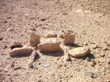
Nearby Images from Flickr
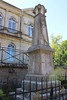

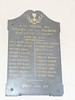
The above images may not be of the site on this page, but were taken nearby. They are loaded from Flickr so please click on them for image credits.
Click here to see more info for this site
Nearby sites
Click here to view sites on an interactive map of the areaKey: Red: member's photo, Blue: 3rd party photo, Yellow: other image, Green: no photo - please go there and take one, Grey: site destroyed
Download sites to:
KML (Google Earth)
GPX (GPS waypoints)
CSV (Garmin/Navman)
CSV (Excel)
To unlock full downloads you need to sign up as a Contributory Member. Otherwise downloads are limited to 50 sites.
Turn off the page maps and other distractions
Nearby sites listing. In the following links * = Image available
2.9km SE 136° Grotte de l'Ermitage* Cave or Rock Shelter
11.2km SSW 205° Monnieres 3 Burial Chamber or Dolmen
11.3km SSW 204° Monnieres 2 Burial Chamber or Dolmen
11.3km SSW 204° Monnieres 1 Burial Chamber or Dolmen
41.7km W 276° Combe des Cent-Marches Burial Chamber or Dolmen
46.4km W 280° Ciste du Mont-Afrique Burial Chamber or Dolmen
50.9km W 266° Collonges Ciste Burial Chamber or Dolmen
51.5km WNW 284° Sur-les-Roches Burial Chamber or Dolmen
52.6km W 270° Dolmen du Bois-de-Monfarbeau 1* Burial Chamber or Dolmen
52.7km W 270° Dolmen du Bois-de-Monfarbeau 2* Burial Chamber or Dolmen
53.8km NE 53° Dolmen de Lanjoutot Burial Chamber or Dolmen
54.4km SSE 156° Menhir dit la Dèesse Alésia Standing Stone (Menhir)
55.0km NE 52° Dolmen de Courboux Burial Chamber or Dolmen
55.4km W 269° Dolmen du Poiset Burial Chamber or Dolmen
56.4km NE 37° Traves burial chamber Burial Chamber or Dolmen
57.5km NE 37° La Pierre Percée (Traves) Standing Stone (Menhir)
58.2km NE 38° Dolmen dit la Pierre-Percée Burial Chamber or Dolmen
58.4km NE 50° Echenoz-le-Sec burial chamber Burial Chamber or Dolmen
58.9km S 177° Lons-le-Saunier Musée d'Archéologie Museum
59.5km NNE 14° Camp des Romains Ancient Village or Settlement
60.0km WSW 254° Croconnet Tumulus Chambered Cairn
61.0km WNW 295° Ciste du Val-Courbe Burial Chamber or Dolmen
61.3km WSW 250° Dolmen dit la Pierre-Brûlée* Burial Chamber or Dolmen
61.3km WSW 248° Dolmen de Pierrefitte (Volnay) Burial Chamber or Dolmen
62.6km WSW 252° Tombeaux du Single Burial Chamber or Dolmen
View more nearby sites and additional images


 We would like to know more about this location. Please feel free to add a brief description and any relevant information in your own language.
 Wir möchten mehr über diese Stätte erfahren. Bitte zögern Sie nicht, eine kurze Beschreibung und relevante Informationen in Deutsch hinzuzufügen.
 Nous aimerions en savoir encore un peu sur les lieux. S'il vous plaît n'hesitez pas à ajouter une courte description et tous les renseignements pertinents dans votre propre langue.
 Quisieramos informarnos un poco más de las lugares. No dude en añadir una breve descripción y otros datos relevantes en su propio idioma.