 with our Megalithic Portal iPhone app")


<< Our Photo Pages >> Grafheuvels Heesakker, Overpelt - Barrow Cemetery in Belgium
Submitted by Shunt on Sunday, 22 June 2008 Page Views: 3694
Neolithic and Bronze AgeSite Name: Grafheuvels Heesakker, OverpeltCountry: Belgium
NOTE: This site is 1.964 km away from the location you searched for.
Type: Barrow Cemetery
Nearest Town: Overpelt Nearest Village: Herent
Latitude: 51.194705N Longitude: 5.435982E
Condition:
| 5 | Perfect |
| 4 | Almost Perfect |
| 3 | Reasonable but with some damage |
| 2 | Ruined but still recognisable as an ancient site |
| 1 | Pretty much destroyed, possibly visible as crop marks |
| 0 | No data. |
| -1 | Completely destroyed |
| 5 | Superb |
| 4 | Good |
| 3 | Ordinary |
| 2 | Not Good |
| 1 | Awful |
| 0 | No data. |
| 5 | Can be driven to, probably with disabled access |
| 4 | Short walk on a footpath |
| 3 | Requiring a bit more of a walk |
| 2 | A long walk |
| 1 | In the middle of nowhere, a nightmare to find |
| 0 | No data. |
| 5 | co-ordinates taken by GPS or official recorded co-ordinates |
| 4 | co-ordinates scaled from a detailed map |
| 3 | co-ordinates scaled from a bad map |
| 2 | co-ordinates of the nearest village |
| 1 | co-ordinates of the nearest town |
| 0 | no data |
Internal Links:
External Links:
")
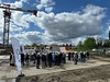
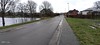
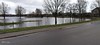
I found out about this ancient site when I used Google Earth when I was searching for something else. I saw a street called 'Urnenveldstraat'. "Urnenveld" means Urn Field, so I thought there had to be something there.
There's a park near this site where a sign post shows various paths and one went around the urn field.
Unfortunately it's hard to reach and its condition isn't very good.
You may be viewing yesterday's version of this page. To see the most up to date information please register for a free account.
Do not use the above information on other web sites or publications without permission of the contributor.
Nearby Images from Flickr

The above images may not be of the site on this page, but were taken nearby. They are loaded from Flickr so please click on them for image credits.
Click here to see more info for this site
Nearby sites
Click here to view sites on an interactive map of the areaKey: Red: member's photo, Blue: 3rd party photo, Yellow: other image, Green: no photo - please go there and take one, Grey: site destroyed
Download sites to:
KML (Google Earth)
GPX (GPS waypoints)
CSV (Garmin/Navman)
CSV (Excel)
To unlock full downloads you need to sign up as a Contributory Member. Otherwise downloads are limited to 50 sites.
Turn off the page maps and other distractions
Nearby sites listing. In the following links * = Image available
2.5km NE 43° Grafheuvels Kolis* Barrow Cemetery
3.5km W 276° Hunneberg Overpelt* Barrow Cemetery
4.8km S 179° Molhem* Barrow Cemetery
8.3km NE 35° Grafheuvels Grote Haart* Barrow Cemetery
9.1km NE 35° Grafheuvels Haarterheide* Barrow Cemetery
13.2km SE 142° Archeologisch park, Grafheuvels Wijshagen* Barrow Cemetery
15.5km N 354° Valentinusput (Westerhoven) Holy Well or Sacred Spring
15.5km ENE 68° Boshoverheide Grafheuvels* Barrow Cemetery
15.7km SSE 155° Heksenberg Meeuwen* Artificial Mound
16.1km NW 314° Grafheuvel Weebosch (45211) Round Barrow(s)
16.2km NNW 339° Grafheuvel Eerselsedijk* Barrow Cemetery
16.4km WNW 291° Steen der Zeven Heerlijkheden* Marker Stone
17.5km NNW 342° Grafheuvel Riethoven (45942) Round Barrow(s)
18.0km WNW 284° Stenencirkel op de Maat* Modern Stone Circle etc
18.8km NNW 344° Grafheuvels Riethoven (45940) Round Barrow(s)
21.4km NNE 19° Grafheuvel Heeze (46003) Round Barrow(s)
21.5km N 349° Sprankel Barrow Cemetery* Barrow Cemetery
21.5km NNE 13° Grafheuvel Ekenrooi (46183) Round Barrow(s)
21.9km NNW 346° Grafheuvel Steensel (525030)* Round Barrow(s)
22.1km S 183° Holsteen* Polissoir
24.5km NNW 347° Grafheuvels Knegsel* Barrow Cemetery
25.6km NNW 346° Urnenveld Toterfout (46128) Cist
25.6km NNW 345° Grafheuvels #1-3 Toterfout (46129) Barrow Cemetery
25.7km NNW 343° Grafheuvels Half Mijl - Toterfout* Barrow Cemetery
25.7km NNW 344° Grafheuvels Toterfout* Barrow Cemetery
View more nearby sites and additional images


 We would like to know more about this location. Please feel free to add a brief description and any relevant information in your own language.
 Wir möchten mehr über diese Stätte erfahren. Bitte zögern Sie nicht, eine kurze Beschreibung und relevante Informationen in Deutsch hinzuzufügen.
 Nous aimerions en savoir encore un peu sur les lieux. S'il vous plaît n'hesitez pas à ajouter une courte description et tous les renseignements pertinents dans votre propre langue.
 Quisieramos informarnos un poco más de las lugares. No dude en añadir una breve descripción y otros datos relevantes en su propio idioma.