<< Our Photo Pages >> Pyramid island Anzer - Artificial Mound in Russia
Submitted by AlexAssa on Tuesday, 10 November 2015 Page Views: 2771
Multi-periodSite Name: Pyramid island AnzerCountry: Russia
NOTE: This site is 525.016 km away from the location you searched for.
Type: Artificial Mound
Nearest Town: Arkhangelsk Nearest Village: Anzer Island (Solovetsky)
Latitude: 65.132757N Longitude: 36.116208E
Condition:
| 5 | Perfect |
| 4 | Almost Perfect |
| 3 | Reasonable but with some damage |
| 2 | Ruined but still recognisable as an ancient site |
| 1 | Pretty much destroyed, possibly visible as crop marks |
| 0 | No data. |
| -1 | Completely destroyed |
| 5 | Superb |
| 4 | Good |
| 3 | Ordinary |
| 2 | Not Good |
| 1 | Awful |
| 0 | No data. |
| 5 | Can be driven to, probably with disabled access |
| 4 | Short walk on a footpath |
| 3 | Requiring a bit more of a walk |
| 2 | A long walk |
| 1 | In the middle of nowhere, a nightmare to find |
| 0 | No data. |
| 5 | co-ordinates taken by GPS or official recorded co-ordinates |
| 4 | co-ordinates scaled from a detailed map |
| 3 | co-ordinates scaled from a bad map |
| 2 | co-ordinates of the nearest village |
| 1 | co-ordinates of the nearest town |
| 0 | no data |
Internal Links:
External Links:
")
You may be viewing yesterday's version of this page. To see the most up to date information please register for a free account.
Do not use the above information on other web sites or publications without permission of the contributor.
Nearby Images from Flickr
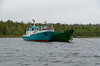
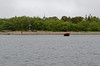
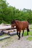
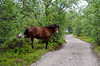


The above images may not be of the site on this page, but were taken nearby. They are loaded from Flickr so please click on them for image credits.
Click here to see more info for this site
Nearby sites
Click here to view sites on an interactive map of the areaKey: Red: member's photo, Blue: 3rd party photo, Yellow: other image, Green: no photo - please go there and take one, Grey: site destroyed
Download sites to:
KML (Google Earth)
GPX (GPS waypoints)
CSV (Garmin/Navman)
CSV (Excel)
To unlock full downloads you need to sign up as a Contributory Member. Otherwise downloads are limited to 50 sites.
Turn off the page maps and other distractions
Nearby sites listing. In the following links * = Image available
28.1km SW 230° Labyrinth Big Zayatsky Island* Turf Maze
46.4km WSW 246° Oleshin Island* Turf Maze
78.7km NW 315° Ostrov Bol'shoy Rob'yak* Standing Stones
102.9km SW 226° Zalavruga* Rock Art
174.0km NW 321° Seyd of Chupskaya Guba* Natural Stone / Erratic / Other Natural Feature
175.2km W 270° Vottovaara Mountain* Natural Stone / Erratic / Other Natural Feature
189.7km NNW 336° Umba ancient labyrinth* Turf Maze
229.5km NNW 337° Lake Kanozero* Carving
274.6km NW 325° Kandalaksha* Turf Maze
352.1km S 188° Oleny Ostrov burial* Ancient Village or Settlement
352.2km S 188° Olene-ostrovsky burial ground* Ancient Village or Settlement
375.7km SSW 194° Solomennoe Stone Circle (modern)* Modern Stone Circle etc
383.8km S 181° Lake Onega Rock Art* Rock Art
443.9km NNW 344° Crow Stone complex* Stone Circle
465.8km SW 226° Pirunpöytä* Rock Art
468.4km W 278° Kierikki Keskus Ancient Village or Settlement
468.9km W 272° Jättiläissaari Giant's Church Stone Fort or Dun
480.8km W 269° Hautakangas Giant's Church (Tyrnävä) Stone Fort or Dun
481.3km W 276° Rajakangas Giant's Church* Stone Fort or Dun
482.9km W 269° Metelinkangas Giant's Church Stone Fort or Dun
483.2km W 275° Laivakangas NE Giant's Church Stone Fort or Dun
484.0km W 278° Metelinkirkko, Huhinmaa Giant's Church Stone Fort or Dun
484.2km W 276° Mäntyselkä Giant's Church Stone Fort or Dun
484.2km W 274° Linnasaari Giant's Church Stone Fort or Dun
484.6km NNW 344° Seids Ura-Guba* Natural Stone / Erratic / Other Natural Feature
View more nearby sites and additional images


 We would like to know more about this location. Please feel free to add a brief description and any relevant information in your own language.
 Wir möchten mehr über diese Stätte erfahren. Bitte zögern Sie nicht, eine kurze Beschreibung und relevante Informationen in Deutsch hinzuzufügen.
 Nous aimerions en savoir encore un peu sur les lieux. S'il vous plaît n'hesitez pas à ajouter une courte description et tous les renseignements pertinents dans votre propre langue.
 Quisieramos informarnos un poco más de las lugares. No dude en añadir una breve descripción y otros datos relevantes en su propio idioma.