<< Other Photo Pages >> Tejisi Menhir - Standing Stone (Menhir) in Georgia
Submitted by davidmorgan on Wednesday, 09 December 2015 Page Views: 3034
Neolithic and Bronze AgeSite Name: Tejisi MenhirCountry: Georgia Type: Standing Stone (Menhir)
Nearest Town: Tbilisi Nearest Village: Tejisi
Latitude: 41.691977N Longitude: 44.088546E
Condition:
| 5 | Perfect |
| 4 | Almost Perfect |
| 3 | Reasonable but with some damage |
| 2 | Ruined but still recognisable as an ancient site |
| 1 | Pretty much destroyed, possibly visible as crop marks |
| 0 | No data. |
| -1 | Completely destroyed |
| 5 | Superb |
| 4 | Good |
| 3 | Ordinary |
| 2 | Not Good |
| 1 | Awful |
| 0 | No data. |
| 5 | Can be driven to, probably with disabled access |
| 4 | Short walk on a footpath |
| 3 | Requiring a bit more of a walk |
| 2 | A long walk |
| 1 | In the middle of nowhere, a nightmare to find |
| 0 | No data. |
| 5 | co-ordinates taken by GPS or official recorded co-ordinates |
| 4 | co-ordinates scaled from a detailed map |
| 3 | co-ordinates scaled from a bad map |
| 2 | co-ordinates of the nearest village |
| 1 | co-ordinates of the nearest town |
| 0 | no data |
Internal Links:
External Links:
")
A 5 metre tall menhir in St Nicholas Church.
You may be viewing yesterday's version of this page. To see the most up to date information please register for a free account.
Do not use the above information on other web sites or publications without permission of the contributor.
Nearby Images from Flickr
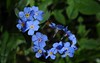

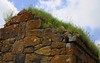
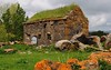
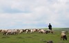

The above images may not be of the site on this page, but were taken nearby. They are loaded from Flickr so please click on them for image credits.
Click here to see more info for this site
Nearby sites
Click here to view sites on an interactive map of the areaKey: Red: member's photo, Blue: 3rd party photo, Yellow: other image, Green: no photo - please go there and take one, Grey: site destroyed
Download sites to:
KML (Google Earth)
GPX (GPS waypoints)
CSV (Garmin/Navman)
CSV (Excel)
To unlock full downloads you need to sign up as a Contributory Member. Otherwise downloads are limited to 50 sites.
Turn off the page maps and other distractions
Nearby sites listing. In the following links * = Image available
25.2km SSE 152° Mamulos Pantiani* Ancient Village or Settlement
26.7km SW 219° Chikiani Menhir Standing Stone (Menhir)
48.9km SW 224° Abuli Fortress* Ancient Village or Settlement
63.2km SW 235° Kat Kar Menhir Standing Stone (Menhir)
69.6km ESE 119° Gadachrili Gora* Ancient Village or Settlement
90.4km S 174° Gogaran Iron Age mausoleum Burial Chamber or Dolmen
97.9km NW 313° Chiatura Ancient Temple
110.3km S 174° Gegharot* Ancient Village or Settlement
116.0km S 188° Vardakar settlement Ancient Village or Settlement
118.1km SE 138° Anapat Cave Rock Art
130.1km ESE 119° Yastytepe Ancient Village or Settlement
148.8km SSW 199° Alem Rock Art* Rock Art
148.9km S 181° Kakavadzor temple Ancient Temple
149.9km SSE 151° Lchashen Bronze-Age complex Ancient Village or Settlement
156.1km S 174° Agarak Rock Cut Tomb
157.2km S 174° Agarak 2 Ancient Village or Settlement
157.8km S 175° Voskehat settlement Ancient Village or Settlement
157.9km S 180° Shamiram settlement Ancient Village or Settlement
158.9km E 85° Ananauri 3 Great Kurgan* Round Barrow(s)
160.5km S 174° Voskevaz Vishap Standing Stone (Menhir)
163.0km SSE 148° Berdunk Urartian Fortress Promontory Fort / Cliff Castle
166.3km SSE 167° Karmir Berd Rock Art
167.4km SSE 163° Aramus Ancient Village or Settlement
171.0km NNE 29° Dattykh hillfort* Hillfort
171.1km SE 124° Tatarly Stone Age settlement Ancient Village or Settlement
View more nearby sites and additional images


 We would like to know more about this location. Please feel free to add a brief description and any relevant information in your own language.
 Wir möchten mehr über diese Stätte erfahren. Bitte zögern Sie nicht, eine kurze Beschreibung und relevante Informationen in Deutsch hinzuzufügen.
 Nous aimerions en savoir encore un peu sur les lieux. S'il vous plaît n'hesitez pas à ajouter une courte description et tous les renseignements pertinents dans votre propre langue.
 Quisieramos informarnos un poco más de las lugares. No dude en añadir una breve descripción y otros datos relevantes en su propio idioma.