


<< Other Photo Pages >> Oppidum du Camp de César (Laudun-l'Ardoise) - Ancient Village or Settlement in France in Languedoc:Gard (30)
Submitted by holger_rix on Monday, 25 April 2016 Page Views: 1461
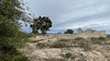
Multi-periodSite Name: Oppidum du Camp de César (Laudun-l'Ardoise)Country: France
NOTE: This site is 1.606 km away from the location you searched for.
Département: Languedoc:Gard (30) Type: Ancient Village or Settlement
Nearest Village: Laudun-l'Ardoise
Latitude: 44.119990N Longitude: 4.654350E
Condition:
| 5 | Perfect |
| 4 | Almost Perfect |
| 3 | Reasonable but with some damage |
| 2 | Ruined but still recognisable as an ancient site |
| 1 | Pretty much destroyed, possibly visible as crop marks |
| 0 | No data. |
| -1 | Completely destroyed |
| 5 | Superb |
| 4 | Good |
| 3 | Ordinary |
| 2 | Not Good |
| 1 | Awful |
| 0 | No data. |
| 5 | Can be driven to, probably with disabled access |
| 4 | Short walk on a footpath |
| 3 | Requiring a bit more of a walk |
| 2 | A long walk |
| 1 | In the middle of nowhere, a nightmare to find |
| 0 | No data. |
| 5 | co-ordinates taken by GPS or official recorded co-ordinates |
| 4 | co-ordinates scaled from a detailed map |
| 3 | co-ordinates scaled from a bad map |
| 2 | co-ordinates of the nearest village |
| 1 | co-ordinates of the nearest town |
| 0 | no data |
Be the first person to rate this site - see the 'Contribute!' box in the right hand menu.
Internal Links:
External Links:
 (PID:147888)")
Chemin du Camp de César, Passage du Loup, Laudun-l'Ardoise, Nimes, Gard, Languedoc-Roussillon-Midi-Pyrénées
Source: T4T35.fr
You may be viewing yesterday's version of this page. To see the most up to date information please register for a free account.
 (PID:147889)")
Do not use the above information on other web sites or publications without permission of the contributor.
Nearby Images from Flickr


The above images may not be of the site on this page, but were taken nearby. They are loaded from Flickr so please click on them for image credits.
Click here to see more info for this site
Nearby sites
Click here to view sites on an interactive map of the areaKey: Red: member's photo, Blue: 3rd party photo, Yellow: other image, Green: no photo - please go there and take one, Grey: site destroyed
Download sites to:
KML (Google Earth)
GPX (GPS waypoints)
CSV (Garmin/Navman)
CSV (Excel)
To unlock full downloads you need to sign up as a Contributory Member. Otherwise downloads are limited to 50 sites.
Turn off the page maps and other distractions
Nearby sites listing. In the following links * = Image available
5.6km NNW 332° Musée Archeologique (Bagnols)* Museum
8.5km W 267° Menhir de la Peira Pecolada Standing Stone (Menhir)
8.7km W 267° Dolmen de la Peira Pecolada Burial Chamber or Dolmen
8.9km WSW 238° Oppidum de Gaujac* Ancient Village or Settlement
10.1km WSW 247° Dolmen du Pin Burial Chamber or Dolmen
10.2km NW 323° Dolmen de Coste-Rigaude Burial Chamber or Dolmen
11.1km WSW 246° Dolmen du Traves de l'Avent Burial Chamber or Dolmen
11.2km NE 54° La Sabliere Cave or Rock Shelter
12.4km E 82° Roman Theatre of Orange* Ancient Palace
12.5km NNW 348° Pierre des Druides (St Alexandre)* Standing Stone (Menhir)
13.8km W 268° Dolmen de Diole Burial Chamber or Dolmen
14.5km W 274° Pierre Plantée de St-Marcel Standing Stone (Menhir)
15.2km W 268° Dolmen de Coucouveze* Burial Chamber or Dolmen
20.8km SW 223° Pont Aqueduc de Bordnègre* Ancient Mine, Quarry or other Industry
20.9km SSW 208° Le Pont Roupt* Ancient Mine, Quarry or other Industry
21.3km SSW 206° Abri de la Salpetriere* Cave or Rock Shelter
21.4km SSW 206° Le Pont du Gard* Ancient Mine, Quarry or other Industry
21.8km NW 320° Issirac 2 Burial Chamber or Dolmen
21.8km NNW 339° Pié de Mounié Burial Chamber or Dolmen
21.8km NW 321° Issirac 1 Burial Chamber or Dolmen
22.3km WNW 291° Pierre Plantée (Lèque)* Standing Stone (Menhir)
22.5km SSW 210° Grotte de la Balauzière Cave or Rock Shelter
22.8km NNW 341° Dolmen du Quartier de Feuillet Burial Chamber or Dolmen
23.1km NNW 329° La Bartre Burial Chamber or Dolmen
23.4km SW 217° Grotte des Colonnes Cave or Rock Shelter
View more nearby sites and additional images


 We would like to know more about this location. Please feel free to add a brief description and any relevant information in your own language.
 Wir möchten mehr über diese Stätte erfahren. Bitte zögern Sie nicht, eine kurze Beschreibung und relevante Informationen in Deutsch hinzuzufügen.
 Nous aimerions en savoir encore un peu sur les lieux. S'il vous plaît n'hesitez pas à ajouter une courte description et tous les renseignements pertinents dans votre propre langue.
 Quisieramos informarnos un poco más de las lugares. No dude en añadir una breve descripción y otros datos relevantes en su propio idioma.