 with our Megalithic Portal iPhone app")


<< Image Pages >> Plattesteen - Natural Stone / Erratic / Other Natural Feature in Belgium in Bruxelles - Brussel
Submitted by Alta-Falisa on Saturday, 03 May 2014 Page Views: 6955
Natural PlacesSite Name: PlattesteenCountry: Belgium
NOTE: This site is 8.533 km away from the location you searched for.
Province: Bruxelles - Brussel Type: Natural Stone / Erratic / Other Natural Feature
Nearest Town: Bang in the middle of Brussels
Latitude: 50.846452N Longitude: 4.349065E
Condition:
| 5 | Perfect |
| 4 | Almost Perfect |
| 3 | Reasonable but with some damage |
| 2 | Ruined but still recognisable as an ancient site |
| 1 | Pretty much destroyed, possibly visible as crop marks |
| 0 | No data. |
| -1 | Completely destroyed |
| 5 | Superb |
| 4 | Good |
| 3 | Ordinary |
| 2 | Not Good |
| 1 | Awful |
| 0 | No data. |
| 5 | Can be driven to, probably with disabled access |
| 4 | Short walk on a footpath |
| 3 | Requiring a bit more of a walk |
| 2 | A long walk |
| 1 | In the middle of nowhere, a nightmare to find |
| 0 | No data. |
| 5 | co-ordinates taken by GPS or official recorded co-ordinates |
| 4 | co-ordinates scaled from a detailed map |
| 3 | co-ordinates scaled from a bad map |
| 2 | co-ordinates of the nearest village |
| 1 | co-ordinates of the nearest town |
| 0 | no data |
Internal Links:
External Links:
")
Plattesteen is Dutch for "flat stone", or slab. It is now the name of a street.
Although Brussels is strictly bilingual, it has been felt superfluous to translate, from Dutch to French, a name probably older than the city herself.
Nearby flows the River Senne, now vaulted and invisible. In the 12th century, a bridge (le Pont du Miroir) was constructed, gone since long. One may assume that, before the construction of that bridge, a slab was used as a marker to indicate the place where the river could be forded.
Also nearby stood a stopover on the Camiño de Santiago de Compostella : first a modest chapel (mentioned since the 12th century), later enlarged and named Notre-Dame-du-Bon-Secours (Our Lady of Refuge), still upright !
Was this slab the remnant of a dolmen ?
Anybody who has visited Brussels has probably been on the Grand'Place and from there to the "Manneken Pis". The street Plattesteen lies just in-between.
You may be viewing yesterday's version of this page. To see the most up to date information please register for a free account.
")
Do not use the above information on other web sites or publications without permission of the contributor.
Nearby Images from Flickr


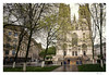


The above images may not be of the site on this page, but were taken nearby. They are loaded from Flickr so please click on them for image credits.
Click here to see more info for this site
Nearby sites
Click here to view sites on an interactive map of the areaKey: Red: member's photo, Blue: 3rd party photo, Yellow: other image, Green: no photo - please go there and take one, Grey: site destroyed
Download sites to:
KML (Google Earth)
GPX (GPS waypoints)
CSV (Garmin/Navman)
CSV (Excel)
To unlock full downloads you need to sign up as a Contributory Member. Otherwise downloads are limited to 50 sites.
Turn off the page maps and other distractions
Nearby sites listing. In the following links * = Image available
1.1km SSE 149° Palais d'Egmont / Egmontpaleis* Modern Stone Circle etc
1.5km SSW 194° Pilgrim's Menhir* Standing Stone (Menhir)
2.2km ESE 120° Musée des Sciences naturelles* Museum
3.1km ESE 105° Musée du Cinquantenaire - Jubelparkmuseum* Museum
7.6km ESE 119° Rouge-Cloître* Modern Stone Circle etc
9.3km SSE 155° Monument aux Forestiers* Modern Stone Circle etc
10.7km SE 144° Arboretum van Groenendal* Modern Stone Circle etc
12.0km E 98° Africa Museum, Tervuren* Museum
12.9km E 101° Dolmen of Duisburg* Polissoir
16.4km NNE 23° Alvensten* Ancient Cross
26.1km SSW 200° Table des Sorcières* Natural Stone / Erratic / Other Natural Feature
27.1km NW 320° Vleeshuismuseum* Museum
27.5km S 184° Musée communal de Nivelles* Museum
28.8km SE 144° Pierre qui Tourne de Beaurieux* Burial Chamber or Dolmen
32.5km SE 124° Cheval de Godde* Standing Stone (Menhir)
38.9km ESE 119° The Tumulus of Glimes Round Barrow(s)
39.2km E 99° Geosite Goudberg* Museum
39.4km ESE 101° Steen van Hoegaarden* Standing Stone (Menhir)
39.4km SE 127° La Grosse Borne (Perwez)* Marker Stone
40.2km W 276° Provincial Archeological Museum* Museum
42.7km S 191° Musée Royal de Mariemont* Museum
42.7km E 98° Leeuwensteen* Standing Stone (Menhir)
45.4km SSE 153° Polissoirs de Velaine sur Sambre* Polissoir
45.4km SSE 153° La Pierre qui Tourne (Velaine-sur-Sambre)* Standing Stone (Menhir)
46.2km SSE 151° Espace de l'Homme de Spy* Museum
View more nearby sites and additional images


 We would like to know more about this location. Please feel free to add a brief description and any relevant information in your own language.
 Wir möchten mehr über diese Stätte erfahren. Bitte zögern Sie nicht, eine kurze Beschreibung und relevante Informationen in Deutsch hinzuzufügen.
 Nous aimerions en savoir encore un peu sur les lieux. S'il vous plaît n'hesitez pas à ajouter une courte description et tous les renseignements pertinents dans votre propre langue.
 Quisieramos informarnos un poco más de las lugares. No dude en añadir una breve descripción y otros datos relevantes en su propio idioma.