<< Our Photo Pages >> Dolmen des Baumes - Burial Chamber or Dolmen in France in Rhone:Ardèche (07)
Submitted by TheCaptain on Friday, 06 May 2011 Page Views: 3527
Neolithic and Bronze AgeSite Name: Dolmen des BaumesCountry: France
NOTE: This site is 7.589 km away from the location you searched for.
Département: Rhone:Ardèche (07) Type: Burial Chamber or Dolmen
Nearest Town: Le Puy-en-Velay Nearest Village: Borée
Latitude: 44.901900N Longitude: 4.273430E
Condition:
| 5 | Perfect |
| 4 | Almost Perfect |
| 3 | Reasonable but with some damage |
| 2 | Ruined but still recognisable as an ancient site |
| 1 | Pretty much destroyed, possibly visible as crop marks |
| 0 | No data. |
| -1 | Completely destroyed |
| 5 | Superb |
| 4 | Good |
| 3 | Ordinary |
| 2 | Not Good |
| 1 | Awful |
| 0 | No data. |
| 5 | Can be driven to, probably with disabled access |
| 4 | Short walk on a footpath |
| 3 | Requiring a bit more of a walk |
| 2 | A long walk |
| 1 | In the middle of nowhere, a nightmare to find |
| 0 | No data. |
| 5 | co-ordinates taken by GPS or official recorded co-ordinates |
| 4 | co-ordinates scaled from a detailed map |
| 3 | co-ordinates scaled from a bad map |
| 2 | co-ordinates of the nearest village |
| 1 | co-ordinates of the nearest town |
| 0 | no data |
Be the first person to rate this site - see the 'Contribute!' box in the right hand menu.
Internal Links:
External Links:
I have visited· I would like to visit
ShamrockStone has visited here
")
You may be viewing yesterday's version of this page. To see the most up to date information please register for a free account.
Do not use the above information on other web sites or publications without permission of the contributor.
Nearby Images from Flickr
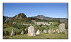
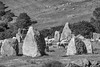
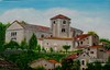


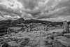
The above images may not be of the site on this page, but were taken nearby. They are loaded from Flickr so please click on them for image credits.
Click here to see more info for this site
Nearby sites
Click here to view sites on an interactive map of the areaKey: Red: member's photo, Blue: 3rd party photo, Yellow: other image, Green: no photo - please go there and take one, Grey: site destroyed
Download sites to:
KML (Google Earth)
GPX (GPS waypoints)
CSV (Garmin/Navman)
CSV (Excel)
To unlock full downloads you need to sign up as a Contributory Member. Otherwise downloads are limited to 50 sites.
Turn off the page maps and other distractions
Nearby sites listing. In the following links * = Image available
2.2km WSW 255° L'Ère du Tchier de Borée* Modern Stone Circle etc
13.2km N 358° Dolmen des Pennes* Burial Chamber or Dolmen
15.0km NE 37° Lichessol Statue-menhir Standing Stone (Menhir)
18.1km N 355° Dolmen de Vacheresses Burial Chamber or Dolmen
18.2km NNW 338° Chièze Menhir* Standing Stone (Menhir)
21.8km NW 323° Pierre à Cupules de Monedeyre Rock Art
22.1km NNW 345° Saint-Jeurés Menhir* Standing Stone (Menhir)
23.3km N 359° Croix-Menhir de Mendigoules* Standing Stone (Menhir)
26.3km W 263° Camp Celtique d’Antoune Ancient Village or Settlement
29.5km W 280° Dolmen de Collandre Burial Chamber or Dolmen
31.4km SSE 150° Menhir de Chante Epine Standing Stone (Menhir)
32.4km SSE 154° Dolmen des Faysses Burial Chamber or Dolmen
32.5km SSE 151° Dolmen du Devès de Serre Burial Chamber or Dolmen
33.9km NNW 343° Roche à Cupules des Barris Standing Stones
34.5km WNW 298° La Pierre-des-Fievres* Burial Chamber or Dolmen
34.9km WNW 298° Dolmen de Saint-Michel d'Aiguilhe* Burial Chamber or Dolmen
35.1km SSE 160° Jastres Oppidium North Hillfort
35.5km SSE 160° Jastres Oppidium South Hillfort
36.2km ENE 68° Dolmen de Chabot Burial Chamber or Dolmen
36.2km SSE 158° Dolmen de Mias 2 Burial Chamber or Dolmen
36.3km SSE 157° Dolmen de Mias 1* Burial Chamber or Dolmen
36.8km SSE 157° Dolmen des Quatre Pierres 1* Burial Chamber or Dolmen
36.9km SSE 157° Dolmen des Quatre Pierres 2 Burial Chamber or Dolmen
36.9km SE 137° Menhir de Chalès Standing Stone (Menhir)
36.9km SSE 157° Dolmen des Quatre Pierres 3* Burial Chamber or Dolmen
View more nearby sites and additional images


 We would like to know more about this location. Please feel free to add a brief description and any relevant information in your own language.
 Wir möchten mehr über diese Stätte erfahren. Bitte zögern Sie nicht, eine kurze Beschreibung und relevante Informationen in Deutsch hinzuzufügen.
 Nous aimerions en savoir encore un peu sur les lieux. S'il vous plaît n'hesitez pas à ajouter une courte description et tous les renseignements pertinents dans votre propre langue.
 Quisieramos informarnos un poco más de las lugares. No dude en añadir una breve descripción y otros datos relevantes en su propio idioma.