<< Our Photo Pages >> Oppidum d'Ambrussum - Ancient Village or Settlement in France in Languedoc:Hérault (34)
Submitted by TheCaptain on Thursday, 10 February 2005 Page Views: 4349
Multi-periodSite Name: Oppidum d'AmbrussumCountry: France
NOTE: This site is 5.889 km away from the location you searched for.
Département: Languedoc:Hérault (34) Type: Ancient Village or Settlement
Nearest Town: Montpelier Nearest Village: Villetelle
Latitude: 43.715900N Longitude: 4.149400E
Condition:
| 5 | Perfect |
| 4 | Almost Perfect |
| 3 | Reasonable but with some damage |
| 2 | Ruined but still recognisable as an ancient site |
| 1 | Pretty much destroyed, possibly visible as crop marks |
| 0 | No data. |
| -1 | Completely destroyed |
| 5 | Superb |
| 4 | Good |
| 3 | Ordinary |
| 2 | Not Good |
| 1 | Awful |
| 0 | No data. |
| 5 | Can be driven to, probably with disabled access |
| 4 | Short walk on a footpath |
| 3 | Requiring a bit more of a walk |
| 2 | A long walk |
| 1 | In the middle of nowhere, a nightmare to find |
| 0 | No data. |
| 5 | co-ordinates taken by GPS or official recorded co-ordinates |
| 4 | co-ordinates scaled from a detailed map |
| 3 | co-ordinates scaled from a bad map |
| 2 | co-ordinates of the nearest village |
| 1 | co-ordinates of the nearest town |
| 0 | no data |
Internal Links:
External Links:
I have visited· I would like to visit
regina has visited here
")
IMPORTANT NOTE: Position of site unknown, co-ordinates given for nearest village
You may be viewing yesterday's version of this page. To see the most up to date information please register for a free account.
")
")
")
Do not use the above information on other web sites or publications without permission of the contributor.
Nearby Images from Flickr


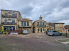


The above images may not be of the site on this page, but were taken nearby. They are loaded from Flickr so please click on them for image credits.
Click here to see more info for this site
Nearby sites
Click here to view sites on an interactive map of the areaKey: Red: member's photo, Blue: 3rd party photo, Yellow: other image, Green: no photo - please go there and take one, Grey: site destroyed
Download sites to:
KML (Google Earth)
GPX (GPS waypoints)
CSV (Garmin/Navman)
CSV (Excel)
To unlock full downloads you need to sign up as a Contributory Member. Otherwise downloads are limited to 50 sites.
Turn off the page maps and other distractions
Nearby sites listing. In the following links * = Image available
3.7km N 353° Colline de Moulin Menhir* Standing Stone (Menhir)
5.2km NNE 14° Pierre Plantée (Congénies)* Standing Stone (Menhir)
5.6km NNW 335° Mas Neuf menhir Standing Stone (Menhir)
8.0km NNE 12° Canteperdritz* Ancient Village or Settlement
9.8km W 279° Beaulieu (Languedoc)* Standing Stone (Menhir)
10.8km NNW 339° Fontbouisse* Ancient Village or Settlement
10.8km NE 35° Oppidum de Nages* Ancient Village or Settlement
11.9km NE 37° Castels Oppidum Ancient Village or Settlement
13.2km NNE 14° Oppidum de Mauressip Ancient Village or Settlement
15.9km NW 314° Oppidum du Castellet (Bois de Paris)* Ancient Village or Settlement
16.0km NW 315° Grotte citerne du Bois de Paris Cave or Rock Shelter
19.8km NNW 333° Menhir de Deroc* Standing Stone (Menhir)
19.9km WNW 285° Dolmen de Sainte-Croix* Burial Chamber or Dolmen
21.5km NE 52° Saint-Théodorit menhir-statue* Sculptured Stone
21.8km NE 52° Musée Archéologique de Nîmes* Museum
23.3km WSW 250° Vidals statue-menhir* Sculptured Stone
23.5km NW 309° Dolmen du Mas de Vedel* Burial Chamber or Dolmen
24.3km WNW 293° Valflaunès school sites* Modern Stone Circle etc
24.7km WNW 294° Menhir near Valflaunes* Standing Stone (Menhir)
25.4km WNW 284° Village Préhistorique de Lébous* Ancient Village or Settlement
25.5km SW 230° Site archéologique Lattara - Musée Henri Prades Museum
25.6km WNW 298° Dolmen de Viastre* Burial Chamber or Dolmen
25.7km WNW 297° Oppidum Roc des Mattes* Ancient Village or Settlement
26.1km NW 311° Menhir du Ranc* Standing Stone (Menhir)
26.2km NW 312° Dolmen du Ranq* Burial Chamber or Dolmen
View more nearby sites and additional images


 We would like to know more about this location. Please feel free to add a brief description and any relevant information in your own language.
 Wir möchten mehr über diese Stätte erfahren. Bitte zögern Sie nicht, eine kurze Beschreibung und relevante Informationen in Deutsch hinzuzufügen.
 Nous aimerions en savoir encore un peu sur les lieux. S'il vous plaît n'hesitez pas à ajouter une courte description et tous les renseignements pertinents dans votre propre langue.
 Quisieramos informarnos un poco más de las lugares. No dude en añadir una breve descripción y otros datos relevantes en su propio idioma.