<< Text Pages >> Konya Museum - Museum in Turkey
Submitted by AlexHunger on Wednesday, 15 February 2006 Page Views: 2943
MuseumsSite Name: Konya MuseumCountry: Turkey Type: Museum
Nearest Town: Konya
Latitude: 37.867973N Longitude: 32.493499E
Condition:
| 5 | Perfect |
| 4 | Almost Perfect |
| 3 | Reasonable but with some damage |
| 2 | Ruined but still recognisable as an ancient site |
| 1 | Pretty much destroyed, possibly visible as crop marks |
| 0 | No data. |
| -1 | Completely destroyed |
| 5 | Superb |
| 4 | Good |
| 3 | Ordinary |
| 2 | Not Good |
| 1 | Awful |
| 0 | No data. |
| 5 | Can be driven to, probably with disabled access |
| 4 | Short walk on a footpath |
| 3 | Requiring a bit more of a walk |
| 2 | A long walk |
| 1 | In the middle of nowhere, a nightmare to find |
| 0 | No data. |
| 5 | co-ordinates taken by GPS or official recorded co-ordinates |
| 4 | co-ordinates scaled from a detailed map |
| 3 | co-ordinates scaled from a bad map |
| 2 | co-ordinates of the nearest village |
| 1 | co-ordinates of the nearest town |
| 0 | no data |
Internal Links:
External Links:
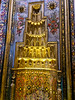
Museum in Konya, Turkey
Mostly ethnographic museum with perhaps some antiquities.
You may be viewing yesterday's version of this page. To see the most up to date information please register for a free account.
Do not use the above information on other web sites or publications without permission of the contributor.
Nearby Images from Flickr


The above images may not be of the site on this page, but were taken nearby. They are loaded from Flickr so please click on them for image credits.
Click here to see more info for this site
Nearby sites
Click here to view sites on an interactive map of the areaKey: Red: member's photo, Blue: 3rd party photo, Yellow: other image, Green: no photo - please go there and take one, Grey: site destroyed
Download sites to:
KML (Google Earth)
GPX (GPS waypoints)
CSV (Garmin/Navman)
CSV (Excel)
To unlock full downloads you need to sign up as a Contributory Member. Otherwise downloads are limited to 50 sites.
Turn off the page maps and other distractions
Nearby sites listing. In the following links * = Image available
554m NNW 341° Konya* Ancient Village or Settlement
10.1km WNW 292° Gevale Castle Hillfort
26.6km ESE 123° Abditol Höyük* Ancient Village or Settlement
35.1km ESE 111° Boncuklu Höyük* Ancient Village or Settlement
37.0km SE 127° Çatalhöyük* Ancient Village or Settlement
43.1km ENE 76° Bozdag Roman Dam* Ancient Mine, Quarry or other Industry
52.7km S 190° Karahoyuk (Akoren) Ancient Village or Settlement
54.4km ESE 120° Turkmen Karahoyuk* Ancient Village or Settlement
55.3km ENE 78° Savatra* Ancient Village or Settlement
57.4km WSW 246° Fasillar* Carving
72.1km W 266° Eflatun Pinar* Holy Well or Sacred Spring
79.2km NW 326° Yalburt* Carving
97.4km WNW 283° Arakli Mound Ancient Village or Settlement
99.9km SE 132° Can Hasan* Ancient Village or Settlement
120.8km WNW 293° Temple of Men Askaenos* Ancient Temple
123.8km W 268° Sanctuary of Eurymedon* Cave or Rock Shelter
124.1km WNW 293° Pisidian Antioch* Ancient Village or Settlement
132.0km ENE 62° Acemhöyük* Ancient Village or Settlement
133.6km SW 224° Etenna Ancient Village or Settlement
136.8km WSW 257° Adada (Pisidia)* Ancient Village or Settlement
139.9km WSW 240° Selge* Ancient Village or Settlement
142.2km ENE 67° Aksaray Museum* Museum
142.5km SW 219° Seleukeia Lyrbe* Ancient Village or Settlement
154.1km E 98° Eregli Kara Hoyuk Ancient Village or Settlement
155.0km WSW 243° Pednelissos* Ancient Village or Settlement
View more nearby sites and additional images


 We would like to know more about this location. Please feel free to add a brief description and any relevant information in your own language.
 Wir möchten mehr über diese Stätte erfahren. Bitte zögern Sie nicht, eine kurze Beschreibung und relevante Informationen in Deutsch hinzuzufügen.
 Nous aimerions en savoir encore un peu sur les lieux. S'il vous plaît n'hesitez pas à ajouter une courte description et tous les renseignements pertinents dans votre propre langue.
 Quisieramos informarnos un poco más de las lugares. No dude en añadir una breve descripción y otros datos relevantes en su propio idioma.