<< Our Photo Pages >> Yuzhnoukrainsk Cromlech - Chambered Cairn in Ukraine
Submitted by davidmorgan on Monday, 28 February 2022 Page Views: 5389
Neolithic and Bronze AgeSite Name: Yuzhnoukrainsk Cromlech Alternative Name: Южнобужский кромлех, Ûžnobužskij cromlech, YuzhnobuzhskyyCountry: Ukraine
NOTE: This site is 29.899 km away from the location you searched for.
Type: Chambered Cairn
Nearest Town: Yuzhnoukrainsk
Latitude: 47.853553N Longitude: 31.146632E
Condition:
| 5 | Perfect |
| 4 | Almost Perfect |
| 3 | Reasonable but with some damage |
| 2 | Ruined but still recognisable as an ancient site |
| 1 | Pretty much destroyed, possibly visible as crop marks |
| 0 | No data. |
| -1 | Completely destroyed |
| 5 | Superb |
| 4 | Good |
| 3 | Ordinary |
| 2 | Not Good |
| 1 | Awful |
| 0 | No data. |
| 5 | Can be driven to, probably with disabled access |
| 4 | Short walk on a footpath |
| 3 | Requiring a bit more of a walk |
| 2 | A long walk |
| 1 | In the middle of nowhere, a nightmare to find |
| 0 | No data. |
| 5 | co-ordinates taken by GPS or official recorded co-ordinates |
| 4 | co-ordinates scaled from a detailed map |
| 3 | co-ordinates scaled from a bad map |
| 2 | co-ordinates of the nearest village |
| 1 | co-ordinates of the nearest town |
| 0 | no data |
Internal Links:
External Links:
")
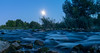
Photo submitted by bohuxyn on Twitter. See links to more photos in the comments below.
Information from dorugo.ua
Note: In solidarity with Ukraine
You may be viewing yesterday's version of this page. To see the most up to date information please register for a free account.
")
")
Do not use the above information on other web sites or publications without permission of the contributor.
Nearby Images from Flickr
The above images may not be of the site on this page, but were taken nearby. They are loaded from Flickr so please click on them for image credits.
Click here to see more info for this site
Nearby sites
Click here to view sites on an interactive map of the areaKey: Red: member's photo, Blue: 3rd party photo, Yellow: other image, Green: no photo - please go there and take one, Grey: site destroyed
Download sites to:
KML (Google Earth)
GPX (GPS waypoints)
CSV (Garmin/Navman)
CSV (Excel)
To unlock full downloads you need to sign up as a Contributory Member. Otherwise downloads are limited to 50 sites.
Turn off the page maps and other distractions
Nearby sites listing. In the following links * = Image available
38.2km NW 318° Mohyla-Hostra Burial Mound Round Barrow(s)
38.4km NW 311° Mohyla Blyzniuky Burial Mound Round Barrow(s)
110.6km NE 48° Stone Babas on Dvortsova Street* Carving
141.6km SSE 156° Olbia Ancient Village or Settlement
145.8km SSW 193° Kuyalnik Temple Ancient Temple
158.7km SSE 152° Kherson Cliffs* Natural Stone / Erratic / Other Natural Feature
184.1km ENE 72° Bohdaniv Kurgan Burial Mound Round Barrow(s)
186.8km E 80° Mohyla Baba* Round Barrow(s)
193.4km SSW 198° Tira (Ukraine) Ancient Village or Settlement
197.3km WSW 243° National Museum of History of Moldova* Museum
198.9km N 6° Mezhyrich Ancient Village or Settlement
224.0km E 94° Tolstaja Mogila Burial Mound Round Barrow(s)
236.0km E 93° Chertomlyk Kurgan Round Barrow(s)
238.8km E 100° Mamay-Hora* Round Barrow(s)
246.5km ESE 103° Znamenskoye Round Barrow(s)
264.9km ESE 111° Kozel Burial Mound Round Barrow(s)
269.4km SW 236° Upper Trajan's Wall Misc. Earthwork
270.5km ESE 113° Oguz Burial Mound Round Barrow(s)
284.5km W 270° Buteşti, Moldova* Cave or Rock Shelter
290.5km N 352° Museum of Historical Treasures of Ukraine* Museum
292.7km ENE 78° Sursʹkyy Kromlekh* Round Barrow(s)
293.3km N 351° Kyiv History Museum* Museum
296.1km E 89° Dolmens Scythian Camp* Burial Chamber or Dolmen
298.2km ENE 76° Dmytro Yavornytsky National Historical Museum of Dnipro* Museum
301.3km E 89° Zaporizhzhya Regional Museum* Museum
View more nearby sites and additional images


 We would like to know more about this location. Please feel free to add a brief description and any relevant information in your own language.
 Wir möchten mehr über diese Stätte erfahren. Bitte zögern Sie nicht, eine kurze Beschreibung und relevante Informationen in Deutsch hinzuzufügen.
 Nous aimerions en savoir encore un peu sur les lieux. S'il vous plaît n'hesitez pas à ajouter une courte description et tous les renseignements pertinents dans votre propre langue.
 Quisieramos informarnos un poco más de las lugares. No dude en añadir una breve descripción y otros datos relevantes en su propio idioma.