<< Our Photo Pages >> Coeur Ballant - Natural Stone / Erratic / Other Natural Feature in France in Auvergne:Puy-de-Dôme (63)
Submitted by TheCaptain on Wednesday, 08 September 2010 Page Views: 2475
Natural PlacesSite Name: Coeur Ballant Alternative Name: Roche Romaine, Le coeur BalantCountry: France
NOTE: This site is 2.627 km away from the location you searched for.
Département: Auvergne:Puy-de-Dôme (63) Type: Natural Stone / Erratic / Other Natural Feature
Nearest Town: Clermont-Ferrand Nearest Village: Combronde
Latitude: 45.993766N Longitude: 3.050409E
Condition:
| 5 | Perfect |
| 4 | Almost Perfect |
| 3 | Reasonable but with some damage |
| 2 | Ruined but still recognisable as an ancient site |
| 1 | Pretty much destroyed, possibly visible as crop marks |
| 0 | No data. |
| -1 | Completely destroyed |
| 5 | Superb |
| 4 | Good |
| 3 | Ordinary |
| 2 | Not Good |
| 1 | Awful |
| 0 | No data. |
| 5 | Can be driven to, probably with disabled access |
| 4 | Short walk on a footpath |
| 3 | Requiring a bit more of a walk |
| 2 | A long walk |
| 1 | In the middle of nowhere, a nightmare to find |
| 0 | No data. |
| 5 | co-ordinates taken by GPS or official recorded co-ordinates |
| 4 | co-ordinates scaled from a detailed map |
| 3 | co-ordinates scaled from a bad map |
| 2 | co-ordinates of the nearest village |
| 1 | co-ordinates of the nearest town |
| 0 | no data |
Be the first person to rate this site - see the 'Contribute!' box in the right hand menu.
Internal Links:
External Links:
I have visited· I would like to visit
alchemille visited on 19th Apr 2016 - their rating: Cond: 5 Amb: 5 Access: 4 Le Coeur Ballant or the Dancing heart is found in the wood near the village of Les Ballages, near Combronde in the Puy de Dôme, region of Auvergne. France
")
"This stone is one of those rocking stones still on its bedrock platform, and it wobbles with the help of a log, otherwise it is too heavy. It is also beautifully eroded in the shape of a heart."
Location Source: T4T35.fr
You may be viewing yesterday's version of this page. To see the most up to date information please register for a free account.
Do not use the above information on other web sites or publications without permission of the contributor.
Nearby Images from Flickr


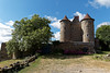
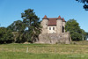
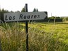
The above images may not be of the site on this page, but were taken nearby. They are loaded from Flickr so please click on them for image credits.
Click here to see more info for this site
Nearby sites
Click here to view sites on an interactive map of the areaKey: Red: member's photo, Blue: 3rd party photo, Yellow: other image, Green: no photo - please go there and take one, Grey: site destroyed
Download sites to:
KML (Google Earth)
GPX (GPS waypoints)
CSV (Garmin/Navman)
CSV (Excel)
To unlock full downloads you need to sign up as a Contributory Member. Otherwise downloads are limited to 50 sites.
Turn off the page maps and other distractions
Nearby sites listing. In the following links * = Image available
6.9km SE 139° Pierre du Tombeau* Standing Stone (Menhir)
8.9km WNW 299° Blot-l'Église menhir Standing Stone (Menhir)
9.6km S 174° St-Hyppolyte burial chamber Burial Chamber or Dolmen
11.3km SE 134° Pessat-Villeneuve menhir* Standing Stone (Menhir)
12.5km N 351° Table de Péraclos* Rock Outcrop
13.5km SSE 154° Stade de la Varenne Menhir* Standing Stone (Menhir)
14.7km ENE 60° Pierre Sanglante Rock Art
16.9km NNE 27° Menhir de Bègues Standing Stone (Menhir)
19.8km WNW 301° Menhirs of Barbouly* Stone Row / Alignment
20.4km NW 314° Brosses menhir* Standing Stone (Menhir)
21.2km S 176° Oppidum des Côtes de Clermont Ancient Village or Settlement
23.8km SSE 164° Menhir de Brézet Standing Stone (Menhir)
24.1km S 183° Menhir de Villars * Standing Stone (Menhir)
24.7km SSE 162° Menhir du Puy de la Poix* Standing Stone (Menhir)
24.8km SW 227° Pierrefit Standing Stone (Menhir)
25.1km SSE 162° Menhir de la Grande Borne* Standing Stone (Menhir)
25.6km SSE 167° Orthostat de la Sarre Burial Chamber or Dolmen
25.6km SSW 195° Temple de Mercure* Ancient Temple
27.0km SSE 167° Pierre Piquée du Pont d'Aubières* Standing Stone (Menhir)
28.0km S 171° Pierre Piquée d'Aubière, Rue Pourliat* Marker Stone
28.8km S 184° Thedes Menhir* Standing Stone (Menhir)
29.7km SSE 149° Oppidum du Puy du Mur Ancient Village or Settlement
29.9km S 181° Menhir de Berzet* Standing Stone (Menhir)
30.1km S 187° Menhir de Chatrat* Standing Stone (Menhir)
30.8km S 170° Plateau de Gergovie* Ancient Village or Settlement
View more nearby sites and additional images


 We would like to know more about this location. Please feel free to add a brief description and any relevant information in your own language.
 Wir möchten mehr über diese Stätte erfahren. Bitte zögern Sie nicht, eine kurze Beschreibung und relevante Informationen in Deutsch hinzuzufügen.
 Nous aimerions en savoir encore un peu sur les lieux. S'il vous plaît n'hesitez pas à ajouter une courte description et tous les renseignements pertinents dans votre propre langue.
 Quisieramos informarnos un poco más de las lugares. No dude en añadir una breve descripción y otros datos relevantes en su propio idioma.