<< Text Pages >> Bathonea - Ancient Village or Settlement in Turkey
Submitted by davidmorgan on Thursday, 11 December 2014 Page Views: 1975
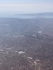
Multi-periodSite Name: BathoneaCountry: Turkey
NOTE: This site is 3.249 km away from the location you searched for.
Type: Ancient Village or Settlement
Nearest Town: Istanbul
Latitude: 41.033131N Longitude: 28.734153E
Condition:
| 5 | Perfect |
| 4 | Almost Perfect |
| 3 | Reasonable but with some damage |
| 2 | Ruined but still recognisable as an ancient site |
| 1 | Pretty much destroyed, possibly visible as crop marks |
| 0 | No data. |
| -1 | Completely destroyed |
| 5 | Superb |
| 4 | Good |
| 3 | Ordinary |
| 2 | Not Good |
| 1 | Awful |
| 0 | No data. |
| 5 | Can be driven to, probably with disabled access |
| 4 | Short walk on a footpath |
| 3 | Requiring a bit more of a walk |
| 2 | A long walk |
| 1 | In the middle of nowhere, a nightmare to find |
| 0 | No data. |
| 5 | co-ordinates taken by GPS or official recorded co-ordinates |
| 4 | co-ordinates scaled from a detailed map |
| 3 | co-ordinates scaled from a bad map |
| 2 | co-ordinates of the nearest village |
| 1 | co-ordinates of the nearest town |
| 0 | no data |
Internal Links:
External Links:
Ancient Village or Settlement in Istanbul, Turkey
A "long lost" Hellenistic/Roman town, rediscovered in 2009. Recent excavations have revealed artefacts dating back to 2000 BCE.
You may be viewing yesterday's version of this page. To see the most up to date information please register for a free account.
Do not use the above information on other web sites or publications without permission of the contributor.
Nearby Images from Flickr

The above images may not be of the site on this page, but were taken nearby. They are loaded from Flickr so please click on them for image credits.
Click here to see more info for this site
Nearby sites
Click here to view sites on an interactive map of the areaKey: Red: member's photo, Blue: 3rd party photo, Yellow: other image, Green: no photo - please go there and take one, Grey: site destroyed
Download sites to:
KML (Google Earth)
GPX (GPS waypoints)
CSV (Garmin/Navman)
CSV (Excel)
To unlock full downloads you need to sign up as a Contributory Member. Otherwise downloads are limited to 50 sites.
Turn off the page maps and other distractions
Nearby sites listing. In the following links * = Image available
19.0km E 100° Yenikapi Ancient Village or Settlement
19.1km E 98° Istanbul University Archaeological Museum Museum
20.1km E 98° Column of Constantine* Standing Stone (Menhir)
20.4km E 98° Spiral Column* Carving
20.5km E 98° Istanbul Amenhotep III Obelisk* Standing Stone (Menhir)
20.6km E 98° The Basilica Cistern, Istanbul* Ancient Mine, Quarry or other Industry
20.8km E 97° Istanbul Archaeological Museum* Museum
55.6km W 280° Çantaköy* Round Barrow(s)
87.7km W 268° Heraion-Teikhos* Ancient Village or Settlement
95.5km S 178° Aktopraklik Hoyuk Ancient Village or Settlement
96.1km S 183° Apollonia ad Rhyndacum* Ancient Village or Settlement
102.2km SW 226° Cyzicus Ancient Village or Settlement
102.7km W 267° Tekirdag Museum of Archaeology* Museum
103.3km SE 126° Dört Tepeler Chambered Tomb
108.3km SE 128° Berberkayasi Rock Cut Tomb
112.3km SE 139° Barcin Tumulus Ancient Village or Settlement
115.6km SSW 210° Daskyleion* Ancient Village or Settlement
144.8km SE 133° Bilecik* Ancient Village or Settlement
146.2km NNW 330° Ancient Tsarevo Ancient Village or Settlement
147.3km WNW 302° Asagipinar* Ancient Village or Settlement
156.1km WSW 244° Parion Ancient Village or Settlement
163.3km NNW 331° Beglik Tash* Natural Stone / Erratic / Other Natural Feature
163.7km NNW 330° Perla Dolmen 1* Burial Chamber or Dolmen
168.1km SSE 161° Deliklitaş Sculptured Stone
175.0km NW 313° Dolmen Belevren 2* Burial Chamber or Dolmen
View more nearby sites and additional images


 We would like to know more about this location. Please feel free to add a brief description and any relevant information in your own language.
 Wir möchten mehr über diese Stätte erfahren. Bitte zögern Sie nicht, eine kurze Beschreibung und relevante Informationen in Deutsch hinzuzufügen.
 Nous aimerions en savoir encore un peu sur les lieux. S'il vous plaît n'hesitez pas à ajouter une courte description et tous les renseignements pertinents dans votre propre langue.
 Quisieramos informarnos un poco más de las lugares. No dude en añadir una breve descripción y otros datos relevantes en su propio idioma.