<< Our Photo Pages >> Antandros house - Ancient Village or Settlement in Turkey
Submitted by Armand on Sunday, 23 December 2018 Page Views: 690
Multi-periodSite Name: Antandros house Alternative Name: AntandrusCountry: Turkey
NOTE: This site is 19.637 km away from the location you searched for.
Type: Ancient Village or Settlement
Nearest Town: Altınoluk Nearest Village: Avcılar
Latitude: 39.570000N Longitude: 26.796200E
Condition:
| 5 | Perfect |
| 4 | Almost Perfect |
| 3 | Reasonable but with some damage |
| 2 | Ruined but still recognisable as an ancient site |
| 1 | Pretty much destroyed, possibly visible as crop marks |
| 0 | No data. |
| -1 | Completely destroyed |
| 5 | Superb |
| 4 | Good |
| 3 | Ordinary |
| 2 | Not Good |
| 1 | Awful |
| 0 | No data. |
| 5 | Can be driven to, probably with disabled access |
| 4 | Short walk on a footpath |
| 3 | Requiring a bit more of a walk |
| 2 | A long walk |
| 1 | In the middle of nowhere, a nightmare to find |
| 0 | No data. |
| 5 | co-ordinates taken by GPS or official recorded co-ordinates |
| 4 | co-ordinates scaled from a detailed map |
| 3 | co-ordinates scaled from a bad map |
| 2 | co-ordinates of the nearest village |
| 1 | co-ordinates of the nearest town |
| 0 | no data |
Internal Links:
External Links:
")
You may be viewing yesterday's version of this page. To see the most up to date information please register for a free account.
")
")
")
")
Do not use the above information on other web sites or publications without permission of the contributor.
Nearby Images from Flickr
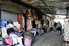
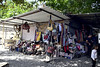
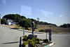


The above images may not be of the site on this page, but were taken nearby. They are loaded from Flickr so please click on them for image credits.
Click here to see more info for this site
Nearby sites
Click here to view sites on an interactive map of the areaKey: Red: member's photo, Blue: 3rd party photo, Yellow: other image, Green: no photo - please go there and take one, Grey: site destroyed
Download sites to:
KML (Google Earth)
GPX (GPS waypoints)
CSV (Garmin/Navman)
CSV (Excel)
To unlock full downloads you need to sign up as a Contributory Member. Otherwise downloads are limited to 50 sites.
Turn off the page maps and other distractions
Nearby sites listing. In the following links * = Image available
810m WNW 283° Antandros Ancient Village or Settlement
1.5km W 276° Antandros necropolis* Ancient Village or Settlement
40.4km WSW 258° Assos Temple of Athena* Ancient Temple
47.9km WNW 291° Neandria Ancient Village or Settlement
49.5km WNW 292° Koçali* Ancient Mine, Quarry or other Industry
50.5km SSW 210° Thermi (Lesbos)* Ancient Village or Settlement
53.4km W 270° Tuzla* Ancient Temple
57.6km SE 130° Allianoi Ancient Village or Settlement
58.2km WNW 291° Alexandria Troas* Ancient Village or Settlement
58.3km W 267° Chrysa Temple of Sminthian Apollo* Ancient Temple
59.0km SE 145° Pergamon* Ancient Village or Settlement
59.2km SW 234° Klopedi Temples Ancient Temple
59.2km SW 226° Messon Temple of Zeus Ancient Temple
59.3km SSE 148° Asklepieion* Ancient Temple
60.1km SSE 147° Bergama Archaeological Museum Museum
61.5km SSE 147° Bergama Tumulus* Round Barrow(s)
64.1km NW 312° Troy.* Ancient Village or Settlement
71.6km S 170° Candarli Necropolis Chambered Tomb
88.9km SSE 157° Aigai.* Ancient Village or Settlement
90.9km S 172° Kyme* Ancient Village or Settlement
96.9km NNE 14° Parion Ancient Village or Settlement
100.1km S 182° Phokaia* Ancient Village or Settlement
101.2km S 179° Tas Kule* Rock Cut Tomb
101.3km S 181° Seytan Hamami Rock Cut Tomb
102.3km SSE 169° Larissa (Aeolis) Ancient Village or Settlement
View more nearby sites and additional images


 We would like to know more about this location. Please feel free to add a brief description and any relevant information in your own language.
 Wir möchten mehr über diese Stätte erfahren. Bitte zögern Sie nicht, eine kurze Beschreibung und relevante Informationen in Deutsch hinzuzufügen.
 Nous aimerions en savoir encore un peu sur les lieux. S'il vous plaît n'hesitez pas à ajouter une courte description et tous les renseignements pertinents dans votre propre langue.
 Quisieramos informarnos un poco más de las lugares. No dude en añadir una breve descripción y otros datos relevantes en su propio idioma.