

<< Other Photo Pages >> Zasliai Footprint Stone - Rock Art in Lithuania
Submitted by KaiHofmann on Thursday, 29 March 2012 Page Views: 4170
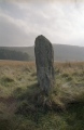
Rock ArtSite Name: Zasliai Footprint Stone Alternative Name: Laukagalio akmuo su žmogaus pėdaCountry: Lithuania
NOTE: This site is 14.728 km away from the location you searched for.
Type: Rock Art
Nearest Town: Elektrenai Nearest Village: Zasliai
Latitude: 54.901693N Longitude: 24.704583E
Condition:
| 5 | Perfect |
| 4 | Almost Perfect |
| 3 | Reasonable but with some damage |
| 2 | Ruined but still recognisable as an ancient site |
| 1 | Pretty much destroyed, possibly visible as crop marks |
| 0 | No data. |
| -1 | Completely destroyed |
| 5 | Superb |
| 4 | Good |
| 3 | Ordinary |
| 2 | Not Good |
| 1 | Awful |
| 0 | No data. |
| 5 | Can be driven to, probably with disabled access |
| 4 | Short walk on a footpath |
| 3 | Requiring a bit more of a walk |
| 2 | A long walk |
| 1 | In the middle of nowhere, a nightmare to find |
| 0 | No data. |
| 5 | co-ordinates taken by GPS or official recorded co-ordinates |
| 4 | co-ordinates scaled from a detailed map |
| 3 | co-ordinates scaled from a bad map |
| 2 | co-ordinates of the nearest village |
| 1 | co-ordinates of the nearest town |
| 0 | no data |
Internal Links:
External Links:
")
Cup-marked stone with a footprint on its surface.
You may be viewing yesterday's version of this page. To see the most up to date information please register for a free account.
Do not use the above information on other web sites or publications without permission of the contributor.
Nearby Images from Flickr
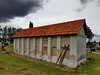
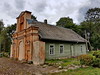
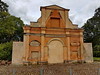
The above images may not be of the site on this page, but were taken nearby. They are loaded from Flickr so please click on them for image credits.
Click here to see more info for this site
Nearby sites
Click here to view sites on an interactive map of the areaKey: Red: member's photo, Blue: 3rd party photo, Yellow: other image, Green: no photo - please go there and take one, Grey: site destroyed
Download sites to:
KML (Google Earth)
GPX (GPS waypoints)
CSV (Garmin/Navman)
CSV (Excel)
To unlock full downloads you need to sign up as a Contributory Member. Otherwise downloads are limited to 50 sites.
Turn off the page maps and other distractions
Nearby sites listing. In the following links * = Image available
1.4km NW 306° Laukagalio akmuo su dubenėliais* Rock Art
18.9km SSW 213° Girelių akmuo* Natural Stone / Erratic / Other Natural Feature
27.3km NNW 345° Juozapavos akmuo* Natural Stone / Erratic / Other Natural Feature
38.9km N 6° Ukmergės piliakalnis* Artificial Mound
52.9km W 270° Santakos parkas* Modern Stone Circle etc
53.8km E 91° Nemenčinės Bilith* Modern Stone Circle etc
57.1km SE 136° Marijampolio akmuo* Natural Stone / Erratic / Other Natural Feature
68.6km NNE 19° Puntuko akmuo* Natural Stone / Erratic / Other Natural Feature
69.9km WNW 292° Karalgirio akmuo* Natural Stone / Erratic / Other Natural Feature
73.1km NW 315° Dotnuvo akmuo* Modern Stone Circle etc
75.8km WSW 240° Šakališkių piliakalnis* Artificial Mound
77.3km NE 34° Kilėviškių akmuo su dubeniu* Holed Stone
77.4km NE 34° Zarasų akmuo su dubeniu* Holed Stone
77.8km WSW 238° Gudelių akmuo* Natural Stone / Erratic / Other Natural Feature
78.4km SSW 194° Perlojos akmuo* Marker Stone
79.1km S 175° Kalesninkų akmuo* Standing Stone (Menhir)
79.5km SSE 167° Mantviliškų akmuo* Natural Stone / Erratic / Other Natural Feature
80.6km SW 235° Riečių piliakalnis* Artificial Mound
82.7km SSW 212° Didysis Dzūkijos akmuo* Natural Stone / Erratic / Other Natural Feature
88.0km WSW 239° Varnupių piliakalnis* Artificial Mound
88.2km WSW 239° Varnupių akmuo* Natural Stone / Erratic / Other Natural Feature
88.2km SW 234° Bambininkų piliakalnis* Artificial Mound
92.0km WSW 242° Padovinio piliakalnis* Artificial Mound
99.8km ENE 71° Šventos akmuo* Natural Stone / Erratic / Other Natural Feature
100.4km ENE 69° Bajorų akmuo* Natural Stone / Erratic / Other Natural Feature
View more nearby sites and additional images
Were Ancient Fossil Bone Marks Made by Stone Tools or Biting Animals? >>


 We would like to know more about this location. Please feel free to add a brief description and any relevant information in your own language.
 Wir möchten mehr über diese Stätte erfahren. Bitte zögern Sie nicht, eine kurze Beschreibung und relevante Informationen in Deutsch hinzuzufügen.
 Nous aimerions en savoir encore un peu sur les lieux. S'il vous plaît n'hesitez pas à ajouter une courte description et tous les renseignements pertinents dans votre propre langue.
 Quisieramos informarnos un poco más de las lugares. No dude en añadir una breve descripción y otros datos relevantes en su propio idioma.