<< Our Photo Pages >> Lithuanian Millenium Stone - Modern Stone Circle etc in Lithuania
Submitted by Alta-Falisa on Tuesday, 05 April 2016 Page Views: 2439
Modern SitesSite Name: Lithuanian Millenium StoneCountry: Lithuania
NOTE: This site is 4.796 km away from the location you searched for.
Type: Modern Stone Circle etc
Nearest Town: Kaunas Nearest Village: Kataučizna
Latitude: 54.762100N Longitude: 22.870200E
Condition:
| 5 | Perfect |
| 4 | Almost Perfect |
| 3 | Reasonable but with some damage |
| 2 | Ruined but still recognisable as an ancient site |
| 1 | Pretty much destroyed, possibly visible as crop marks |
| 0 | No data. |
| -1 | Completely destroyed |
| 5 | Superb |
| 4 | Good |
| 3 | Ordinary |
| 2 | Not Good |
| 1 | Awful |
| 0 | No data. |
| 5 | Can be driven to, probably with disabled access |
| 4 | Short walk on a footpath |
| 3 | Requiring a bit more of a walk |
| 2 | A long walk |
| 1 | In the middle of nowhere, a nightmare to find |
| 0 | No data. |
| 5 | co-ordinates taken by GPS or official recorded co-ordinates |
| 4 | co-ordinates scaled from a detailed map |
| 3 | co-ordinates scaled from a bad map |
| 2 | co-ordinates of the nearest village |
| 1 | co-ordinates of the nearest town |
| 0 | no data |
Internal Links:
External Links:
")
Commemorating the 1000th anniversary of the the first written mention of Lithuania, in a medieval German manuscript : the Annals of Quedlinburg, in March 1009.
A most unexpected monument, in a thinly populated area in the South-West, near the border with Kaliningrad Oblast.
You may be viewing yesterday's version of this page. To see the most up to date information please register for a free account.
")
")
Do not use the above information on other web sites or publications without permission of the contributor.
Nearby Images from Flickr
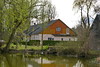
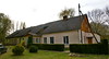
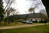


The above images may not be of the site on this page, but were taken nearby. They are loaded from Flickr so please click on them for image credits.
Click here to see more info for this site
Nearby sites
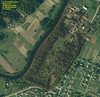
Click here to view sites on an interactive map of the areaKey: Red: member's photo, Blue: 3rd party photo, Yellow: other image, Green: no photo - please go there and take one, Grey: site destroyed
Download sites to:
KML (Google Earth)
GPX (GPS waypoints)
CSV (Garmin/Navman)
CSV (Excel)
To unlock full downloads you need to sign up as a Contributory Member. Otherwise downloads are limited to 50 sites.
Turn off the page maps and other distractions
Nearby sites listing. In the following links * = Image available
15.6km SSE 154° Vilkaviškio krašto akmuo* Marker Stone
34.2km SSW 198° Vištyčio akmuo* Natural Stone / Erratic / Other Natural Feature
46.4km SE 127° Padovinio piliakalnis* Artificial Mound
52.4km SE 125° Varnupių piliakalnis* Artificial Mound
52.4km SE 125° Varnupių akmuo* Natural Stone / Erratic / Other Natural Feature
57.5km ESE 113° Šakališkių piliakalnis* Artificial Mound
58.3km ESE 116° Gudelių akmuo* Natural Stone / Erratic / Other Natural Feature
58.7km S 179° Grodzisko Szurpiły* Hillfort
60.1km SE 128° Bambininkų piliakalnis* Artificial Mound
61.5km ESE 121° Riečių piliakalnis* Artificial Mound
61.9km S 175° Kurhan Wołownia Round Barrow(s)
62.3km SSW 199° Grodzisko Gulberek* Hillfort
65.2km NW 304° Rambyno kalno akmuo* Marker Stone
65.7km S 176° Kurhany Prudziszki (2) Barrow Cemetery
66.2km NW 326° Tauragė's 500th Anniversary Stone* Modern Stone Circle etc
66.3km ENE 76° Santakos parkas* Modern Stone Circle etc
66.6km S 177° Kurhany Prudziszki (1) Barrow Cemetery
66.8km NE 51° Karalgirio akmuo* Natural Stone / Erratic / Other Natural Feature
69.0km S 174° Grodzisko Osinki Hillfort
85.1km SSE 157° Grodzisko Posejnele Hillfort
85.1km SSW 206° Kurhan Dybowo Round Barrow(s)
86.9km SSW 213° Borki Stone Cirlce (2)* Stone Circle
87.1km SSW 214° Borki Stone Circle (1)* Stone Circle
87.4km N 355° Kriaučiaus akmuo* Natural Stone / Erratic / Other Natural Feature
87.7km SSW 212° Borki Cup-Marked Stone* Rock Art
View more nearby sites and additional images


 We would like to know more about this location. Please feel free to add a brief description and any relevant information in your own language.
 Wir möchten mehr über diese Stätte erfahren. Bitte zögern Sie nicht, eine kurze Beschreibung und relevante Informationen in Deutsch hinzuzufügen.
 Nous aimerions en savoir encore un peu sur les lieux. S'il vous plaît n'hesitez pas à ajouter une courte description et tous les renseignements pertinents dans votre propre langue.
 Quisieramos informarnos un poco más de las lugares. No dude en añadir una breve descripción y otros datos relevantes en su propio idioma.