<< Text Pages >> Grodzisko Posejnele - Hillfort in Poland in Podlaskie
Submitted by SolarMegalith on Thursday, 21 April 2011 Page Views: 3261
Iron Age and Later PrehistorySite Name: Grodzisko PosejneleCountry: Poland
NOTE: This site is 3.203 km away from the location you searched for.
Voivodeship: Podlaskie Type: Hillfort
Latitude: 54.054816N Longitude: 23.371361E
Condition:
| 5 | Perfect |
| 4 | Almost Perfect |
| 3 | Reasonable but with some damage |
| 2 | Ruined but still recognisable as an ancient site |
| 1 | Pretty much destroyed, possibly visible as crop marks |
| 0 | No data. |
| -1 | Completely destroyed |
| 5 | Superb |
| 4 | Good |
| 3 | Ordinary |
| 2 | Not Good |
| 1 | Awful |
| 0 | No data. |
| 5 | Can be driven to, probably with disabled access |
| 4 | Short walk on a footpath |
| 3 | Requiring a bit more of a walk |
| 2 | A long walk |
| 1 | In the middle of nowhere, a nightmare to find |
| 0 | No data. |
| 5 | co-ordinates taken by GPS or official recorded co-ordinates |
| 4 | co-ordinates scaled from a detailed map |
| 3 | co-ordinates scaled from a bad map |
| 2 | co-ordinates of the nearest village |
| 1 | co-ordinates of the nearest town |
| 0 | no data |
Internal Links:
External Links:
Hillfort in Podlaskie
Remains of an Iron Age fortified settlement dated for 300-200 BC and a well-preserved early medieval hillfort of the Yotvingians.
Read More at Suwalszczyzna.com.pl.
You may be viewing yesterday's version of this page. To see the most up to date information please register for a free account.
Do not use the above information on other web sites or publications without permission of the contributor.
Nearby Images from Flickr
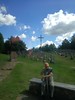
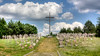
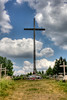
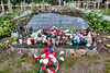
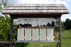
The above images may not be of the site on this page, but were taken nearby. They are loaded from Flickr so please click on them for image credits.
Click here to see more info for this site
Nearby sites
Click here to view sites on an interactive map of the areaKey: Red: member's photo, Blue: 3rd party photo, Yellow: other image, Green: no photo - please go there and take one, Grey: site destroyed
Download sites to:
KML (Google Earth)
GPX (GPS waypoints)
CSV (Garmin/Navman)
CSV (Excel)
To unlock full downloads you need to sign up as a Contributory Member. Otherwise downloads are limited to 50 sites.
Turn off the page maps and other distractions
Nearby sites listing. In the following links * = Image available
27.4km WNW 292° Grodzisko Osinki Hillfort
30.7km WNW 295° Kurhany Prudziszki (2) Barrow Cemetery
31.4km WNW 293° Kurhany Prudziszki (1) Barrow Cemetery
32.3km WNW 302° Kurhan Wołownia Round Barrow(s)
37.2km ESE 102° Velnio akmuo* Natural Stone / Erratic / Other Natural Feature
37.4km WNW 302° Grodzisko Szurpiły* Hillfort
44.2km NNE 20° Bambininkų piliakalnis* Artificial Mound
48.7km ENE 60° Didysis Dzūkijos akmuo* Natural Stone / Erratic / Other Natural Feature
49.3km NNE 12° Varnupių akmuo* Natural Stone / Erratic / Other Natural Feature
49.5km NNE 12° Varnupių piliakalnis* Artificial Mound
50.8km N 5° Padovinio piliakalnis* Artificial Mound
51.3km NNE 24° Riečių piliakalnis* Artificial Mound
56.3km NNE 21° Gudelių akmuo* Natural Stone / Erratic / Other Natural Feature
56.9km WNW 291° Grodzisko Gulberek* Hillfort
59.2km NNE 20° Šakališkių piliakalnis* Artificial Mound
63.3km NW 317° Vištyčio akmuo* Natural Stone / Erratic / Other Natural Feature
69.5km W 272° Kurhan Dybowo Round Barrow(s)
69.5km NNW 339° Vilkaviškio krašto akmuo* Marker Stone
70.2km ENE 75° Perlojos akmuo* Marker Stone
74.0km S 176° Grodzisko Miejskie Nowiny Hillfort
79.4km W 273° Borecka Forest Alignment* Stone Row / Alignment
79.8km W 274° Borki Cup-Marked Stone* Rock Art
80.5km W 275° Borki Stone Cirlce (2)* Stone Circle
81.0km W 275° Borki Stone Circle (1)* Stone Circle
81.1km WSW 245° Grodzisko Bajtkowo Hillfort
View more nearby sites and additional images


 We would like to know more about this location. Please feel free to add a brief description and any relevant information in your own language.
 Wir möchten mehr über diese Stätte erfahren. Bitte zögern Sie nicht, eine kurze Beschreibung und relevante Informationen in Deutsch hinzuzufügen.
 Nous aimerions en savoir encore un peu sur les lieux. S'il vous plaît n'hesitez pas à ajouter une courte description et tous les renseignements pertinents dans votre propre langue.
 Quisieramos informarnos un poco más de las lugares. No dude en añadir una breve descripción y otros datos relevantes en su propio idioma.