<< Text Pages >> Grodzisko Susiec - Hillfort in Poland in Lubelskie
Submitted by SolarMegalith on Saturday, 27 October 2018 Page Views: 731
Iron Age and Later PrehistorySite Name: Grodzisko SusiecCountry: Poland
NOTE: This site is 24.852 km away from the location you searched for.
Voivodeship: Lubelskie Type: Hillfort
Nearest Town: Józefin
Latitude: 50.394403N Longitude: 23.170681E
Condition:
| 5 | Perfect |
| 4 | Almost Perfect |
| 3 | Reasonable but with some damage |
| 2 | Ruined but still recognisable as an ancient site |
| 1 | Pretty much destroyed, possibly visible as crop marks |
| 0 | No data. |
| -1 | Completely destroyed |
| 5 | Superb |
| 4 | Good |
| 3 | Ordinary |
| 2 | Not Good |
| 1 | Awful |
| 0 | No data. |
| 5 | Can be driven to, probably with disabled access |
| 4 | Short walk on a footpath |
| 3 | Requiring a bit more of a walk |
| 2 | A long walk |
| 1 | In the middle of nowhere, a nightmare to find |
| 0 | No data. |
| 5 | co-ordinates taken by GPS or official recorded co-ordinates |
| 4 | co-ordinates scaled from a detailed map |
| 3 | co-ordinates scaled from a bad map |
| 2 | co-ordinates of the nearest village |
| 1 | co-ordinates of the nearest town |
| 0 | no data |
Internal Links:
External Links:
Hillfort in Lubelskie
An elongated summit of the Kościółek hill is occupied by earthwork remains of an early medieval hillfort. The excavations conducted at this site revealed traces of occupation dating back to the 8th-9th century (Tribal period).
You may be viewing yesterday's version of this page. To see the most up to date information please register for a free account.
Do not use the above information on other web sites or publications without permission of the contributor.
Nearby Images from Flickr
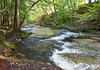
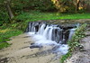
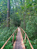
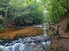
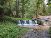
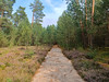
The above images may not be of the site on this page, but were taken nearby. They are loaded from Flickr so please click on them for image credits.
Click here to see more info for this site
Nearby sites
Click here to view sites on an interactive map of the areaKey: Red: member's photo, Blue: 3rd party photo, Yellow: other image, Green: no photo - please go there and take one, Grey: site destroyed
Download sites to:
KML (Google Earth)
GPX (GPS waypoints)
CSV (Garmin/Navman)
CSV (Excel)
To unlock full downloads you need to sign up as a Contributory Member. Otherwise downloads are limited to 50 sites.
Turn off the page maps and other distractions
Nearby sites listing. In the following links * = Image available
28.8km ENE 76° Kurhany Nedeżów Barrow Cemetery
32.1km N 359° Kurhany Hubale Barrow Cemetery
55.8km SSW 195° Kopiec Gaje Round Barrow(s)
57.6km N 8° Kurhan Wiszenki Round Barrow(s)
60.7km NNE 33° Grodzisko Skibice Hillfort
61.4km NNE 26° Kurhany Majdan Nowy Barrow Cemetery
64.8km NNE 17° Grodzisko Horodysko* Hillfort
71.9km SW 215° Grodzisko Tuligłowy* Hillfort
73.0km NE 55° Kurhany Ślipcze Barrow Cemetery
73.1km NNE 31° Kurhany Putnowice Wielkie Barrow Cemetery
75.0km NE 49° Kurhan Husynne Round Barrow(s)
75.5km SW 215° Kurhan Średnia 1* Round Barrow(s)
75.6km SW 216° Kurhan Średnia 2* Round Barrow(s)
75.6km SW 216° Kurhan Średnia 3* Round Barrow(s)
75.8km NNE 12° Kurhan Stare Depułtycze* Round Barrow(s)
75.8km SW 216° Kurhan Średnia 4* Round Barrow(s)
76.2km SW 216° Kurhan Średnia 5* Round Barrow(s)
76.6km NNE 14° Kurhan Depułtycze Królewskie* Round Barrow(s)
82.2km NNE 17° Kurhan Strupin Mały Round Barrow(s)
83.2km N 353° Grodzisko Ewopole Hillfort
83.2km NNE 16° Kurhany Chełm-Borek Barrow Cemetery
84.1km N 359° Grodzisko Kanie* Hillfort
86.9km SSW 203° Grodzisko Aksmanice Hillfort
88.6km SSW 206° Grodzisko Kopyśno Hillfort
91.0km NNE 26° Kurhan Barbarówka Round Barrow(s)
View more nearby sites and additional images


 We would like to know more about this location. Please feel free to add a brief description and any relevant information in your own language.
 Wir möchten mehr über diese Stätte erfahren. Bitte zögern Sie nicht, eine kurze Beschreibung und relevante Informationen in Deutsch hinzuzufügen.
 Nous aimerions en savoir encore un peu sur les lieux. S'il vous plaît n'hesitez pas à ajouter une courte description et tous les renseignements pertinents dans votre propre langue.
 Quisieramos informarnos un poco más de las lugares. No dude en añadir una breve descripción y otros datos relevantes en su propio idioma.