<< Our Photo Pages >> Merikarvia King's grave - Cairn in Finland
Submitted by AlexHunger on Tuesday, 22 July 2008 Page Views: 7017
Neolithic and Bronze AgeSite Name: Merikarvia King's graveCountry: Finland Type: Cairn
Nearest Town: Pori Nearest Village: Merikarvia
Latitude: 61.857546N Longitude: 21.475058E
Condition:
| 5 | Perfect |
| 4 | Almost Perfect |
| 3 | Reasonable but with some damage |
| 2 | Ruined but still recognisable as an ancient site |
| 1 | Pretty much destroyed, possibly visible as crop marks |
| 0 | No data. |
| -1 | Completely destroyed |
| 5 | Superb |
| 4 | Good |
| 3 | Ordinary |
| 2 | Not Good |
| 1 | Awful |
| 0 | No data. |
| 5 | Can be driven to, probably with disabled access |
| 4 | Short walk on a footpath |
| 3 | Requiring a bit more of a walk |
| 2 | A long walk |
| 1 | In the middle of nowhere, a nightmare to find |
| 0 | No data. |
| 5 | co-ordinates taken by GPS or official recorded co-ordinates |
| 4 | co-ordinates scaled from a detailed map |
| 3 | co-ordinates scaled from a bad map |
| 2 | co-ordinates of the nearest village |
| 1 | co-ordinates of the nearest town |
| 0 | no data |
Internal Links:
External Links:
")
It possibly has connections to the barrows at Samallahdenmaki which look to be less than 100km due south.
You may be viewing yesterday's version of this page. To see the most up to date information please register for a free account.
")
")
Do not use the above information on other web sites or publications without permission of the contributor.
Nearby Images from Flickr

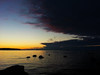


The above images may not be of the site on this page, but were taken nearby. They are loaded from Flickr so please click on them for image credits.
Click here to see more info for this site
Nearby sites
Click here to view sites on an interactive map of the areaKey: Red: member's photo, Blue: 3rd party photo, Yellow: other image, Green: no photo - please go there and take one, Grey: site destroyed
Download sites to:
KML (Google Earth)
GPX (GPS waypoints)
CSV (Garmin/Navman)
CSV (Excel)
To unlock full downloads you need to sign up as a Contributory Member. Otherwise downloads are limited to 50 sites.
Turn off the page maps and other distractions
Nearby sites listing. In the following links * = Image available
50.6km NNE 12° Susiluola* Cave or Rock Shelter
81.3km SE 145° Kokemaki* Barrow Cemetery
86.3km SSE 167° Sammallahdenmäki Barrow Cemetery
95.3km NE 50° The Devil's Nest (Pirunpesä)* Natural Stone / Erratic / Other Natural Feature
103.2km NNE 23° Hiivanaasenkivi* Artificial Mound
103.2km NNE 23° Hiivanaanen* Artificial Mound
110.0km S 174° Laitila* Barrow Cemetery
130.6km NNE 21° Levänluhta Holy Well or Sacred Spring
135.1km NNE 14° Tervajoki* Barrow Cemetery
136.6km NNE 14° Vahakyro* Barrow Cemetery
143.4km ESE 113° Järvensuo I* Ancient Village or Settlement
143.6km SSE 167° Isotalo, Nousiainen* Cairn
148.1km NNE 19° Höjsalträsk Giant's Church Stone Fort or Dun
153.1km NNE 19° Tavoma 1 Giant's Church Stone Fort or Dun
155.3km ESE 117° Rapola* Hillfort
156.9km SSE 166° Altar Raisio* NOT SET
160.0km SSE 162° Old Castle of Lieto* Hillfort
173.2km NNE 26° Korkeamäki Giant's Church* Stone Fort or Dun
184.0km ESE 120° Kauriala Uhrikivi Rock Art
184.2km SSE 150° Puonti* Cairn
185.8km ESE 113° Hovin Manor Stone Rock Art
187.4km SSW 208° Myran* Artificial Mound
187.7km SSW 208° Smidbacka* Artificial Mound
191.5km SSW 203° Borgboda Hillfort* Hillfort
191.8km SSW 204° Johannisberg (Kvarnbo)* Artificial Mound
View more nearby sites and additional images

")
 We would like to know more about this location. Please feel free to add a brief description and any relevant information in your own language.
 Wir möchten mehr über diese Stätte erfahren. Bitte zögern Sie nicht, eine kurze Beschreibung und relevante Informationen in Deutsch hinzuzufügen.
 Nous aimerions en savoir encore un peu sur les lieux. S'il vous plaît n'hesitez pas à ajouter une courte description et tous les renseignements pertinents dans votre propre langue.
 Quisieramos informarnos un poco más de las lugares. No dude en añadir una breve descripción y otros datos relevantes en su propio idioma.